Serre-Thibaud from Montgenèvre

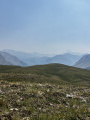
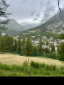
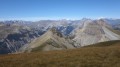
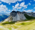
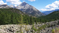
This route, starting from Montgenèvre, will take you to the mountain pastures of Col des Fonds and along a beautiful ridge, reaching a highest point of 2,549 m after a pleasant climb through the forest.

Details

102680813
Creation:
Last update:
Last review:
  • Walking
    Activity: Walking
  • ↔
    Distance: 7.36 mi
  • ◔
    Average duration: 5h 15 
  • ▲
    Difficulty: Moderate

  • ⚐
    Back to start: Yes
  • ↗
    Ascent: + 2,172 ft
  • ↘
    Descent: - 2,172 ft

  • ▲
    Highest point: 8,261 ft
  • ▼
    Lowest point: 6,089 ft

Photos

Description of the walk

Park near the Obélisque car park.

(S/E) Take the path down towards the road below, follow this road until you come to a path leading uphill on your left.

(1) Take the wide, gently sloping path heading off to the left.

(2) At the Bergerie crossroads, take the path leading uphill to the left, which will eventually lead to flatter ground.

(3) Set off along the wide path leading up towards the Crête du Serre-Thibaud.

(4) Take the path along the ridge on your left, pass the Rocher Rouge chairlift and continue your ascent to reach the summit of Serre Thibaud.

(5) Follow the same route back in the opposite direction to return to the Obélisque car park (S/E)

Waypoints

  1. S/E : mi 0 - alt. 6,089 ft - Obélisque car park
  2. 1 : mi 0.46 - alt. 6,165 ft - Start: Vallon des Baïsses
  3. 2 : mi 1.69 - alt. 6,719 ft - Bergerie crossroads
  4. 3 : mi 2.19 - alt. 7,231 ft - Vallon des Baïsses – Séparation
  5. 4 : mi 3.24 - alt. 8,031 ft - Rocher Rouge
  6. 5 : mi 3.68 - alt. 8,261 ft - Serre Thibaud (2549 m)
  7. S/E : mi 7.36 - alt. 6,089 ft - Obélisque car park

Other walks in the area

For more walks, use our search engine .

The GPS track and description are the property of this route's author. Please do not copy them without permission.