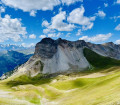
The Pointe des Rochers Charniers

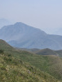
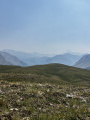
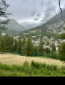
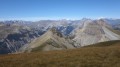
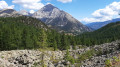
Behind the famous and very popular Mont Chaberton lies a magnificent, little-known but equally impressive ridge. This route takes you there after a pleasant climb through the forest and mountain pastures of the Col des Fonds, before descending via the Italian side of the ridge.

Please note: this route is reserved for experienced walkers accustomed to long hikes, as it includes some very steep and stony sections. I strongly recommend bringing walking poles to make the ascent and descent of the ridge easier.

Details

104037242
Creation:
Last update:
Last review:
  • Walking
    Activity: Walking
  • ↔
    Distance: 11.50 mi
  • ◔
    Duration according to the author: 8 hrs 
  • ▲
    Difficulty: Very difficult

  • ⚐
    Back to start: Yes
  • ↗
    Ascent: + 4,879 ft
  • ↘
    Descent: - 4,872 ft

  • ▲
    Highest point: 10,007 ft
  • ▼
    Lowest point: 6,079 ft

Photos

Description of the walk

Park near the obelisk car park.

(S/E) Take the path that slopes gently down towards a road on the right. Walk carefully along this road to reach the start of the path leading to the Col du Chaberton.

(1) Keep to the left to reach the Rocher Rouge area. Follow the path, which is signposted numerous times with signs for the Col des Fonds. You’ll come to a junction above the Cabane des Baïsses.

(2) Turn left and follow theGR®5 to reach the mountain pastures of the Col des Fonds. The path is signposted several times in this direction.

(3) At the pass, carry on straight ahead to reach the Col des Frères Mineurs via a gentle, gradual climb.

(4) Once at the pass, continue along the path, turning slightly to the right and skirting the rocks on your right.

(5) Begin your ascent towards the ridge by climbing the slope to your right.
Caution:the ascent is over very rocky and stony terrain. Watch your footing carefully and stick to sections where the boulders are stable. Where possible, avoid areas of fine scree and gravel, which may be less stable. The exact point at which you reach the ridge is irrelevant, as the route then continues to the right.

(6) Once you reach the ridge, turn right to head for the Pointe des Rochers Charniers. Depending on where you join the ridge, you may need to go round a rocky outcrop on the right to continue towards the summit.

(7) From the summit, descend south-eastwards towards the Clôt des Morts. Take care: the descent is over very stony ground, on a fairly steep scree slope. Choose the most stable routes and adapt your progress to the terrain.

(8) Once you reach the flat section, join the marked path and descend to a Y-junction.

(9) Turn right to climb to the Col du Chaberton via a wide, fairly stony path.

(10) Head back down towards Montgenèvre, following a yellow-marked path to the junction above the Cabane des Baïsses.

(2)Finish your route on the opposite side by following the same route back as on the way out to reach Montgenèvre (S/E).

Waypoints

  1. S/E : mi 0 - alt. 6,083 ft - Montgenèvre
  2. 1 : mi 0.42 - alt. 6,135 ft - The Vallon des Baïsses
  3. 2 : mi 1.78 - alt. 6,759 ft - Junction - Cabane des Baïsses
  4. 3 : mi 3.12 - alt. 7,920 ft - Col des Fonds
  5. 4 : mi 4 - alt. 8,465 ft - Col des Frères Mineurs
  6. 5 : mi 4.5 - alt. 8,537 ft - Below the ridge
  7. 6 : mi 5.24 - alt. 9,833 ft - Donkey’s Step
  8. 7 : mi 5.6 - alt. 9,993 ft - Pointe des Rochers Charniers
  9. 8 : mi 6.16 - alt. 8,825 ft - Le Clôt des Morts
  10. 9 : mi 7.08 - alt. 8,012 ft - Junction
  11. 10 : mi 7.94 - alt. 8,786 ft - Col du Chaberton
  12. S/E : mi 11.5 - alt. 6,079 ft - Montgenèvre

Notes

Caution: several stony and difficult sections; the ascent and descent along the ridge are very stony and slippery in places.
The descent from the Col du Chaberton is less steep, but still quite stony, with large boulders in places that could cause you to stumble, especially towards the end of the hike.

Worth a visit

- La Pointe des Rochers Charniers
- La Ruine des Sept Fontaines
- Les Roches de Marapa
- The Col du Chaberton

Always be cautious and plan ahead when you're outdoors. Visorando and the author of this route cannot be held responsible for any accidents occurring on this route.

The GR® and PR® markings are the intellectual property of the Fédération Française de Randonnée Pédestre.

Other walks in the area

For more walks, use our search engine .

The GPS track and description are the property of this route's author. Please do not copy them without permission.