Cresta Nera, starting from Montgenèvre

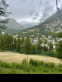
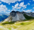
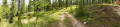
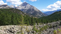
This very long route starting from Montgenèvre first passes through a beautiful forest before reaching the Col du Chaberton. After a short descent, the route continues through a second wooded area before reaching the Cresta Nera.

Details

103922624
Creation:
Last update:
Last review:
  • Walking
    Activity: Walking
  • ↔
    Distance: 12.63 mi
  • ◔
    Duration according to the author: 10 hrs 
  • ▲
    Difficulty: Very difficult

  • ⚐
    Back to start: Yes
  • ↗
    Ascent: + 5,098 ft
  • ↘
    Descent: - 5,112 ft

  • ▲
    Highest point: 8,819 ft
  • ▼
    Lowest point: 6,089 ft

Description of the walk

Park near the car park by the obelisk.

(S/E) Take the path that descends slightly towards a road on the right. Walk carefully along this road (Rue des Baisses) to reach the start of the path towards the Col du Chaberton.

(1) Keep to the left to reach the Rocher Rouge area. Follow the path, which is signposted several times with signs for the Col du Chaberton.

(2) At the junction, take the yellow-marked path climbing to the right to reach the Col du Chaberton. The climb is steep in places and very stony. Take particular care on this section.

(3) Once at the pass, take the wide path zigzagging downwards at a Y-junction.

(4) Take the path on your right leading down towards Cresta Nera. Keep to the right at the next junction.

(5) Cross the French-Italian border.

(6) Take the wide track on the right to join another, narrower path through the forest to complete your ascent to Cresta Nera.

(7) Once at the summit, begin your return journey to Montgenèvre (S/E) by following the same route back as on the way up.

Waypoints

  1. S/E : mi 0 - alt. 6,106 ft - Montgenèvre – Obelisk car park
  2. 1 : mi 0.44 - alt. 6,135 ft - The Vallon des Baïsses
  3. 2 : mi 1.86 - alt. 6,781 ft - Cabane des Gets – Crossroads
  4. 3 : mi 3.57 - alt. 8,799 ft - Col du Chaberton
  5. 4 : mi 4 - alt. 8,455 ft - Y-junction
  6. 5 : mi 4.78 - alt. 7,536 ft - French-Italian border
  7. 6 : mi 5.13 - alt. 6,926 ft - Trail
  8. 7 : mi 6.31 - alt. 7,362 ft - Cresta Nera
  9. S/E : mi 12.63 - alt. 6,106 ft - Montgenèvre – Obelisk car park

Notes

Between (3) and (2), take extreme care whilst descending the Col du Chaberton; the path is very stony, so you could easily trip.

Other walks in the area

For more walks, use our search engine .

The GPS track and description are the property of this route's author. Please do not copy them without permission.