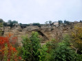
The rock of Embrun, its ramparts, gardens, canals and the Durance river.

Another way to discover Embrun. Walk on the rock from the viewpoint, then under the rock with its gardens and canals, a short detour to discover the Durance before completing the circular route in Embrun via the cathedral, the Maison des Chanonges, and the Tour Brune.

Details

n°1871306
Creation:
Last update:
Last review:
  • Walking
    Activity: Walking
  • ↔
    Distance: 2.68 mi
  • ◔
    Average duration: 1h 30 
  • ▲
    Difficulty: Easy

  • ⚐
    Back to start: Yes
  • ↗
    Ascent: + 344 ft
  • ↘
    Descent: - 348 ft

  • ▲
    Highest point: 2,861 ft
  • ▼
    Lowest point: 2,582 ft

Photos

Description of the walk

(S/E) Set off from the Archbishop’s Garden. When you reach the viewpoint and look out over the valley, turn left to walk along the edge of the rock. The plain is on your right. Leave the garden via the Promenade de l’Archevêché. You’ll reach a car park via an opening in a wall; continue along the edge of the Roc, leaving the Salle de la Poudrière and the Jardin du Roc on your left. Go through the gate in the rampart, which leads to a wooden bridge, and walk alongside the football stadium. Carry on past the first building and then the care home. At this point, the cliff face is less steep

(1) At the junction, turn right onto the path that descends towards Le Chaffal. Follow this path to the tarmac road to Saint-André, which you follow to the right until just past the transformer. Then take a small road on the right which leads you beneath the Roc. Ignore the dirt track on the left leading to the football ground and continue straight on towards the small gardens and canals.
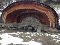
This path runs alongside the Roc and you can make out the route you’ve taken since setting off: the ramparts, then the viewpoint with its overhanging stone arch.

(2) When you are directly opposite the starting point, take a fairly wide, motorable dirt track on the left that heads towards some houses. Follow this track until you reach the small tarmac road running alongside the Durance. Take this Route de la Digue on the right, following the Durance.

(3) Just before a small bridge painted green, take the first tarmac track on the right which follows a small canal coming from Embrun. Continue along this track, keeping the canal on your left (the Chaffal, also known as the Torrent des Moulineaux), even when the track becomes unpaved. This track begins to climb with the Roc on your right, then turns into a tarmac path that climbs steeply to reach the car park of the Leader Price shop .

(4) Right at the start of the car park, there is a wooden staircase which is also used by aGR®® trail; follow this to the right. Walk alongside a wire fence with the Embrun Hospital on your right. At the junction, take Rue Pierre et Marie Curie on the left. At the stop sign, turn right into Rue Émile Guigues heading towards Notre-Dame du-Réal Cathedral.

(5) Walk round the cathedral on the left-hand side. On your left, you’ll see the Maison des Chanonges and then the Tour Brune.

Return to the Archbishop’s Garden, our starting point (S/E).

Waypoints

  1. S/E : mi 0 - alt. 2,851 ft - Viewpoint in the Archbishop’s Garden - Lac de Serre-Ponçon
  2. 1 : mi 0.39 - alt. 2,844 ft - At the junction, take the path down to the right
  3. 2 : mi 1.22 - alt. 2,595 ft - Dirt track to the left
  4. 3 : mi 1.85 - alt. 2,582 ft - Chaffal from below, on the right
  5. 4 : mi 2.42 - alt. 2,785 ft - Wooden staircase
  6. 5 : mi 2.59 - alt. 2,848 ft - Cathédrale Notre-Dame-du-Réal
  7. S/E : mi 2.68 - alt. 2,851 ft - Viewpoint in the Archbishop’s Garden – View over the - La Durance

Notes

Easy hike, but with a 100 m descent on a stony path (wear good shoes) and a steep climb on the way back.

Worth a visit

This walk offers views of:

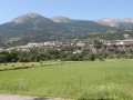
  1. The surrounding mountains from the viewpoint, stretching from Mont Orel to Morgon.
  1. What remains of Embrun’s ancient ramparts. They were largely destroyed with the arrival of the railway in 1882. The ramparts failed to protect Embrun, which was besieged and then invaded on several occasions. Notably by the warlord (then a Protestant) Lesdiguières. It was said at evening gatherings that this warlord, once the town had been taken, invited the town’s notables to a feast during which he served a stuffed pig. He invited the prior of the Cordeliers to cut into it, saying:“Here, get the job done; as you do to it, so shall I do to you”… The unfortunate prior realised that if he tore off one of the pig’s legs, the Protestant would subject him to the same fate. He therefore took out his knife, lifted the pig’s tail, thrust the knife into its rear end and fumbled about for a good while, before withdrawing it and shoving it into his mouth. It is said that Lesdiguières laughed at this, but the outcome is unknown (source : *La saga de l’Embrunais* by Jean Vandenhove). The defensive system was redesigned by Vauban. You pass beneath a section of the remaining ramparts before descending the rock face, and you come across further remains of the ramparts near the Leader Price, which you cross via a wooden staircase.
  1. A powder magazine was built around 1700 – a small vaulted building with external buttresses – but was soon abandoned as it was too close to the fortifications and therefore exposed to mortar fire. It is now used as an activities and concert hall.
  1. The plains below the rock, which, since the construction of a dyke to channel the Durance in the late 16th century, have benefited from its alluvial riches without suffering the vagaries of this unruly river. There are numerous gardens with small structures ranging from makeshift garden sheds to huts converted into small houses. This plain, which still contains a few farms, is a protected area. Of particular note is the system of canals featuring ‘martelières’ (sliding gates to divert water) and ‘étanches’ (gates with semi-circular slates, now replaced by sheet metal), which are raised in turn to irrigate the gardens. This irrigation system dates back to 1895, when the dyke was built. It is managed by an ASA (Authorised Trade Association), which allocates the water and sometimes mediates disputes between those upstream and those downstream. (source: La Durance, April 2015)
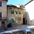
  1. The Maison des Chanonges, the oldest house in Embrun.
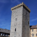
  1. The Tour Brune, dating from the 13th century.
  1. Embrun Cathedral, Notre-Dame du Real (5)

Always be cautious and plan ahead when you're outdoors. Visorando and the author of this route cannot be held responsible for any accidents occurring on this route.

The GR® and PR® markings are the intellectual property of the Fédération Française de Randonnée Pédestre.

Reviews and comments

4.8 / 5
Based on 10 reviews

Reliability of the description
4.8 / 5
Ease of following the route
4.9 / 5
Route interest
4.7 / 5
sylvie couriol
sylvie couriol

Overall rating : 4.7 / 5

Date of your route : Nov 09, 2024
Reliability of the description : ★★★★★ Very good
Ease of following the route : ★★★★★ Very good
Route interest : ★★★★☆ Good
Very busy route : Yes

We didn't know Embrun, but this pleasant outing gave us a chance to discover it for the first time.
Easy to follow, the description is very clear.

Machine-translated

nestor
nestor

Overall rating : 5 / 5

Date of your route : May 31, 2023
Reliability of the description : ★★★★★ Very good
Ease of following the route : ★★★★★ Very good
Route interest : ★★★★★ Very good
Very busy route : Yes

A pleasant walk, with its ramparts, cathedral and gardens.

Machine-translated

sysyl69
sysyl69

Overall rating : 5 / 5

Date of your route : Jul 27, 2022
Reliability of the description : ★★★★★ Very good
Ease of following the route : ★★★★★ Very good
Route interest : ★★★★★ Very good
Very busy route : No

No difficulty following the route. The final climb is a little tough in very hot weather but short. Beautiful view of Embrun.
The little green bridge: actually, it's the railing that's green; the road continues without you really seeing that it's a bridge, so stay alert at this point.

Machine-translated

Yvette Perroche
Yvette Perroche

Overall rating : 5 / 5

Date of your route : Jan 31, 2022
Reliability of the description : ★★★★★ Very good
Ease of following the route : ★★★★★ Very good
Route interest : ★★★★★ Very good
Very busy route : No

A wonderful discovery of the unique site of Embrun and the Durance with its allotment gardens.

Machine-translated

leledederando
leledederando

Overall rating : 4 / 5

Date of your route : Jan 27, 2022
Reliability of the description : ★★★☆☆ Average
Ease of following the route : ★★★★☆ Good
Route interest : ★★★★★ Very good
Very busy route : No

Average for the reliability of the description, as we did not see the small green bridge and the canal coming from Embrun, but the path is easy to find again.

Machine-translated

Yvette Perroche
Yvette Perroche

Overall rating : 5 / 5

Date of your route : Sep 09, 2021
Reliability of the description : ★★★★★ Very good
Ease of following the route : ★★★★★ Very good
Route interest : ★★★★★ Very good
Very busy route : No

This hike provides a good understanding of Embrun's position on its rock.

Machine-translated

Laure75
Laure75

Overall rating : 5 / 5

Date of your route : Aug 18, 2021
Reliability of the description : ★★★★★ Very good
Ease of following the route : ★★★★★ Very good
Route interest : ★★★★★ Very good
Very busy route : No

A lovely little walk, not busy at all. Thank you for the suggestion.

Machine-translated

Viorika
Viorika

Overall rating : 5 / 5

Date of your route : Apr 08, 2021
Reliability of the description : ★★★★★ Very good
Ease of following the route : ★★★★★ Very good
Route interest : ★★★★★ Very good
Very busy route : No

A pleasant route for exploring Embrun and its surrounding area. A beautiful approach to the town. Lots of information boards along the route.
Thank you.

Machine-translated

hubertmi
hubertmi

Overall rating : 4.7 / 5

Date of your route : Jul 14, 2020
Reliability of the description : ★★★★★ Very good
Ease of following the route : ★★★★★ Very good
Route interest : ★★★★☆ Good
Very busy route : Yes

Pleasant walk, with some explanatory texts and panoramic maps along the viewpoint.

Machine-translated

marrirando
marrirando

Overall rating : 4.7 / 5

Date of your route : Jul 04, 2019
Reliability of the description : ★★★★★ Very good
Ease of following the route : ★★★★★ Very good
Route interest : ★★★★☆ Good

An easy walk that allows you to discover Embrun, its rock and its gardens.

Machine-translated

Other walks in the area

For more walks, use our search engine .

The GPS track and description are the property of this route's author. Please do not copy them without permission.