The Verdiny Ravine

A short, easy walk to get back into shape; no particular difficulty, though do take care when descending and climbing out of the ravine if the ground is wet. I wanted a route that didn’t follow the same path back, but unfortunately, due to the numerous closures of hiking trails by farmers, landowners and hunters, I wasn’t able to… The highlight of this route is reaching the Ravin de Verdiny and the magnificent terraced fields.

Details

4406454
Creation:
Last update:
Last review:
  • Walking
    Activity: Walking
  • ↔
    Distance: 4.04 mi
  • ◔
    Average duration: 2h 20 
  • ▲
    Difficulty: Easy

  • ⚐
    Back to start: Yes
  • ↗
    Ascent: + 587 ft
  • ↘
    Descent: - 558 ft

  • ▲
    Highest point: 1,188 ft
  • ▼
    Lowest point: 709 ft

Photos

Description of the walk

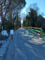
Walk through the town of Le Teil, take the road to Aubenas; at the hamlet of Mélas, continue straight on for 200 m and turn left onto the road leading to the stadium (a narrow road between two walls); behind the stadium, cross the ford where there is little or no water unless there has been a storm. At the junction, take the path opposite towards Serre Girard, heading for Le Retourtour and Le Pélican. Follow this tarmac road, keeping an eye out for the signs for Le Pélican. After 2 km, at the first hairpin bend on the left, park immediately on the right. You’ll see the small path leading into the forest.

(S/E) Follow the path until you reach the forest track.

(1) At the track, take the one on the right until you reach the next junction.

(2) When you reach the junction, continue along the track to the right towards the water reservoir.

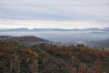
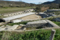
(3) At the reservoir, turn left onto a grassy path through the fir trees. At the end of the small fir copse, you’ll reach the Verdiny ravine. There’s a lovely view of the terraced fields opposite you. Carry on straight along the path and head down towards the ruined house. Go round the back of it, then continue along the narrow path through the terraced fields until you reach the tree in front of you; turn left and follow the path down.

(4) On the descent, there is a sort of small junction. Take the very narrow path on the left which leads back towards the Verdiny Ravine. Head down into it and cross the stream (there is only water here after heavy rain). At the stone wall, go round to the right and head up through the grass in front of you to rejoin the path that branches off to your right, just after the wire fences. The narrow path winds its way up through a small copse to the tarmac road. Head slightly to the left and follow this road to the crossroads you passed on the way there.

(2) Carry on straight ahead along the track you took on the way there.
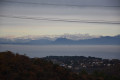
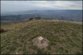
During this descent, enjoy the view to your left of Montélimar, the Drôme valley, the Vercors and the Trois Becs. Carry on to the other crossroads you passed on the way out.

(1) Carry on straight ahead along the track, heading north-east. The track curves and turns due south, passes under the power lines and reaches a fork.

(5) At the tarmac road, turn sharply left and head downhill to the starting point (S/E).

Waypoints

  1. S/E : mi 0 - alt. 709 ft - Parking at the bend
  2. 1 : mi 0.78 - alt. 1,070 ft - Crossroads at the end of the circular loop
  3. 2 : mi 1.42 - alt. 1,152 ft - Crossroads at the end of the circular loop
  4. 3 : mi 1.53 - alt. 1,184 ft - Citerne. On the left, a path through the pine trees
  5. 4 : mi 2.12 - alt. 1,060 ft - Turn left, towards the Ravin de Verdiny
  6. 5 : mi 3.76 - alt. 827 ft - Left onto the tarmac road
  7. S/E : mi 4.04 - alt. 709 ft - Parking at the bend

Notes

As usual, walking boots are recommended.

Worth a visit

In Mélas: a listed church, unfortunately partly destroyed by the earthquake on 11 November 2019; opposite is an excellent bakery and patisserie, serving very good cakes and specialising in Pognes and Saint-Genix.

Reviews and comments

3.5 / 5
Based on 5 reviews

Reliability of the description
3.6 / 5
Ease of following the route
3.2 / 5
Route interest
3.8 / 5
deneb77
deneb77

Overall rating : 4.3 / 5

Date of your route : Jan 19, 2026
Reliability of the description : ★★★★★ Very good
Ease of following the route : ★★★★☆ Good
Route interest : ★★★★☆ Good
Very busy route : No

Beautiful hike, rugged in places

Machine-translated

achettejc
achettejc

Overall rating : 3.7 / 5

Date of your route : Nov 13, 2021
Reliability of the description : ★★★★★ Very good
Ease of following the route : ★★★★☆ Good
Route interest : ★★☆☆☆ Disappointing
Very busy route : No

Same problem: the path is cut off between point 3 and point 4 at the narrowest part of the circular route. We walked down along the boundary of the ACCA Le Teil, which is marked in red and white, and found our way back onto the route (we had our phone with the app on it); we lost our way for about 800 metres.

Machine-translated

mancusoagnes
mancusoagnes

Overall rating : 5 / 5

Date of your route : Apr 09, 2021
Reliability of the description : ★★★★★ Very good
Ease of following the route : ★★★★★ Very good
Route interest : ★★★★★ Very good
Very busy route : No

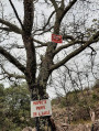
We should have read the comments before setting off to avoid having to turn back at the terraced fields we saw in the distance, as the path is blocked by a lovely welcome sign saying ‘live ammunition’!!! It’s becoming increasingly common to find paths blocked off by landowners, which sometimes forces us to take long detours with no guarantee of being able to get through. Otherwise, it was a lovely walk, which we combined with the Rouvière loop via the Pelican – no difficulties and with some lovely views.

Machine-translated

Gandon Eric
Gandon Eric

Hello Nathalie, I’ll do that.
Kind regards

Machine-translated

grandin
grandin ★

ricounet07,

Please let me know if, after checking, you are unable to amend the route and would like to remove this hike from the website

Machine-translated

Gandon Eric
Gandon Eric

Hello, I’m sorry to hear that… it’s happening more and more often… I’ll go back there to have a look! Thank you very much for your feedback. Kind regards.

Machine-translated

JR56
JR56

Overall rating : 2.7 / 5

Date of your route : Feb 01, 2021
Reliability of the description : ★★☆☆☆ Disappointing
Ease of following the route : ★★☆☆☆ Disappointing
Route interest : ★★★★☆ Good
Very busy route : No

Hello, the path that turns left after the water tank towards the terraced fields is blocked by a sign reading ‘private property – shooting in progress’. So we turned back and took the track towards Montagut, thinking we could get round the restricted access, but once again, it was impossible to reach the Verdiny ravine – the access is blocked by a gate.

Machine-translated

Netra
Netra ★

Hello JR56,

Thank you for your comments. I’m sorry to hear that you had to turn back.

Could you please specify where the path is blocked? Thank you in advance.

Machine-translated

JR56
JR56

Overall rating : 2 / 5

Date of your route : Jan 28, 2021
Reliability of the description : ★☆☆☆☆ Very disappointing
Ease of following the route : ★☆☆☆☆ Very disappointing
Route interest : ★★★★☆ Good
Very busy route : No

This walking route is no longer usable, as a farmer has blocked off the access path to the ravine. You will therefore need to walk there and back.
There’s no point in encouraging people to follow the route, but it needs to be updated.
Please publish my comment and do not delete it.

Machine-translated

Gandon Eric
Gandon Eric

Hello, that’s right! Best regards

Machine-translated

berbou
berbou

An interesting route in a relatively quiet part of the southern Ardèche.

Machine-translated

Other walks in the area

For more walks, use our search engine .

The GPS track and description are the property of this route's author. Please do not copy them without permission.