Country:

 City:


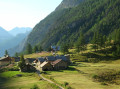
The Refuge de l’Orgère is at the end of the CD 36 road, which starts at Le Freney in the Maurienne Valley and climbs past the village of Saint-André.
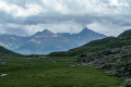
(S/E) From the car park just past the PNV (Vanoise National Park) refuge, continue straight on (north) along the unpaved pastoral track which starts on level ground and leads to the bottom of the valley, crossing the Ruisseau de Povaret.
(1) After the footbridge, the path begins to climb through the meadow, veering to the right up the hillside.
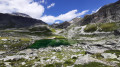
(2) At a junction, let the Sentier de Découverte continue straight on and head due north to reach the valley of the Ruisseau de la Masse. The path climbs steadily in stages alongside this torrent until it reaches the foot of the Rocher de la Masse massif, where it veers right to ascend to the clearly visible pass.
(3) At the pass, leave the signposted path which descends towards Aussois and follow the tracks to the right (south-south-east) along the ridge, initially level and then with a slight descent. You will thus reach the foot of the final slopes of the Râteau.
Tackle this final section of rocky outcrops, which is fairly easy to climb, by following the few visible tracks and, above all, the cairns, which mark the various possible routes up to the plateau between the Petit Râteau and the Râteau d’Aussois and its forest of cairns. Then veer right onto the tracks you have found to reach the summit.
Note: During this traverse from the pass to the summit, it is best to follow the passable eastern slope, keeping a safe distance from the dangerous cliffs on the western side.
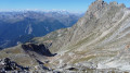
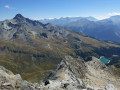
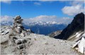
(4) From the triangulation point, take a round trip to the southern ledge and its massive cairn to enjoy the view.
(5) Retrace your steps.
(4) Then head north towards the Petit Râteau. Descend through the boulders and rocks, then find a level patch towards the Masse. As there is no point in climbing back up to the pass, head right along the cairn-marked paths, crossing a persistent snowfield and continuing due north through the folds of the terrain to rejoin, in sight, the path descending from the Col de la Masse.
(6) Follow this signposted and well-marked path downwards, heading north then gradually east. You’ll reach the meadows and the junction at 2,426m.
(7) Turn right onto theGR®5-GRP® Tour de la Haute-Maurienne (leaving the descent towards the Pont de la Sétéria straight ahead). The path heads south, quickly turns south-east, then returns to a southerly direction. It passes through Le Pisset then crosses the edge of the Plateau du Mauvais Berger before climbing slightly to the Col du Barbier.
(8) The path then veers westwards. Ignore a path leading down to the left and continue westwards. The path continues to climb slightly after the pass to the Chalet du Barbier and crosses level above some gullies to reach a broad grassy ridge, where it begins its descent in tight hairpin bends through the forest.
At the foot of the switchbacks, keep heading south-west through the Bois du Bourget, ignoring a few paths branching off to the left. The slope levels out and you reach a major junction near the edge of the forest.
(9) Let the path to the Refuge de l’Aiguille Doran continue to the left and take the more direct path to the right, climbing a few metres towards L’Orgère. It skirts round the top of the clearings before resuming a steady descent towards the Chalets de l’Orgère.
(10) In the middle of the chalets, take the track suitable for vehicles heading north. Cross the footbridge over the Ruisseau de Povaret and immediately take the path that climbs straight up the slope towards the Refuge de l’Orgère (S/E).

 Visorando Member
 Moderate

 Difficult