The Quéronnais

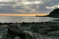
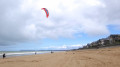
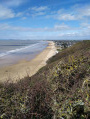
A walk that takes you through the picturesque countryside and along the coast near Kairon. Discover the church and a lovely viewpoint overlooking the beaches and Granville.

Details

n°77640
Creation:
Last update:
Last review:
  • Walking
    Activity: Walking
  • ↔
    Distance: 3.33 mi
  • ◔
    Average duration: 1h 35 
  • ▲
    Difficulty: Easy

  • ⚐
    Back to start: Yes
  • ↗
    Ascent: + 108 ft
  • ↘
    Descent: - 105 ft

  • ▲
    Highest point: 135 ft
  • ▼
    Lowest point: 23 ft

Photos

Description of the walk

(S/E) Starting from the car park at the mouth of the Thar, cross the D911 at the pedestrian crossing, take the small street opposite you and, immediately afterwards, turn right onto Chemin de Beausoleil. Follow this wide track to the end, until you reach a road (Route de la Bruyère), then take it on the right.

(1) Cross the D373 (the map is no longer up to date at this point). Opposite, walk up the small hill; at the three-way junction at the top, turn left onto the path between the pastures, which winds its way through the hedgerows of the bocage. Continue along this path until you reach a concrete road; cross it and take the small street opposite.

(2) At the next junction, turn right (D154) towards the village, continue to Kairon Church and walk round it.

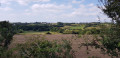
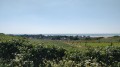
(3) Retrace your steps for about a hundred metres and turn left up the steps. At the top of the steps, take the Chemin du Verchu straight ahead, between the houses. This small tarmac road will soon turn into a track suitable for vehicles. You’ll be walking between two pastures; on your right is a small hill with a viewpoint at its summit (4) – be sure to make a round trip there.

(4) Retrace your steps and continue to the right along this well-maintained path to return to the three-way junction from the outward journey.

(1) Walk down the gentle slope and return to your starting point, the car park at the estuary, via the opposite route to the one you took on the way out (S/E).

Waypoints

  1. S/E : mi 0 - alt. 30 ft - Beach car park
  2. 1 : mi 0.66 - alt. 33 ft - D373
  3. 2 : mi 1.4 - alt. 98 ft - D154
  4. 3 : mi 1.73 - alt. 75 ft - Kairon Church
  5. 4 : mi 2.09 - alt. 135 ft - Viewpoint
  6. S/E : mi 3.33 - alt. 30 ft - Beach car park

Notes

This route consists of small roads and wide tracks. No special equipment is required.

Worth a visit

Kairon Church.
The viewpoint.
The pottery workshop in the bay.

Reviews and comments

4.7 / 5
Based on 1 review

Reliability of the description
5 / 5
Ease of following the route
5 / 5
Route interest
4 / 5
Kyla
Kyla

Overall rating : 4.7 / 5

Date of your route : Aug 13, 2021
Reliability of the description : ★★★★★ Very good
Ease of following the route : ★★★★★ Very good
Route interest : ★★★★☆ Good
Very busy route : No

An easy walk along wide country lanes and small roads, where you’ll come across some beautiful stone houses.
At (4), there’s a magnificent view from the top of the hill.
Thank you for sharing this.

Machine-translated

Other walks in the area

For more walks, use our search engine .

The GPS track and description are the property of this route's author. Please do not copy them without permission.