A circular walk around the Puy de Rabou via the Route Forestière de l’Escout

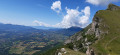
The Puy de Rabou is a modest peak overlooking the village of the same name. It offers a beautiful panoramic view of the Pic de Bure, the Pic Melette and the north-facing slope of Charance. Thisroute via the Bois de l’Escout offers the quickest circular return to the village of Rabou. Other return options are available via the Sentier des Bans, a spectacular path carved into the cliff face, or via the hamlet of Les Tournillons.

Details

n°106741643
Creation:
Last update:
Last review:
–
  • Walking
    Activity: Walking
  • ↔
    Distance: 5.05 mi
  • ◔
    Average duration: 4h 10 
  • ▲
    Difficulty: Moderate

  • ⚐
    Back to start: Yes
  • ↗
    Ascent: + 2,133 ft
  • ↘
    Descent: - 2,126 ft

  • ▲
    Highest point: 6,001 ft
  • ▼
    Lowest point: 3,885 ft

Photos

Description of the walk

On leaving Gap, heading towards Veynes, take the D503 towards Rabou. Drive through the village, heading north, and park at the car park at the start of the hiking trails.

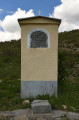
(S/E) Go through the barrier and follow the Route Forestière de l’Escout (GR®93) northwards until you reach a junction (signposted) at the foot of a wayside shrine.

(1) Leave the GR®93: the famous Sentier des Bans. Take the track that climbs to the right, heading east. Pass the first hairpin bend and climb up to a junction of tracks in a loop.

(2) Turn right, heading east, to stay on the main track until the next Y-junction.

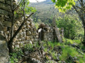
(3) Turn right, heading south-east then east, to follow the track as it makes a wide bend and continues its ascent along the ridge. On this very stony track, the slope rises steeply up the Chaumasse mountain. Generally keep heading north and ignore the faint paths branching off on either side. At the end of the track, you’ll reach a lovely alpine hut which you should go round to the left (next to the ruins of the old sheepfold).

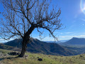
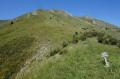
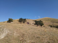
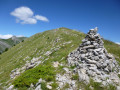
(4) Continue by sight (off the marked path but with no difficulty in finding your way on a clear day), following a track towards the summit of the puy (the marked path goes round the summit to the right). Cross large expanses of grass, dotted only with a few piles of stones, on a climb that remains fairly steep. Reach the ridge and follow it north-east for about 400 m to reach the summit of the Puy de Rabou. Enjoy the view of the Pic de Bure, the Pic Melette and the north-facing slope of Charance.

(5) From the summit, follow the north-eastern ridge, then enter the woods (the route, although not shown on the IGN map, is signposted). Join a yellow-marked path (shown on the IGN map) which circles the puy and passes at the foot of the southern slope of Pic Melette.

(6) Take the path on the left to reach the Col du Ferlieu, in a fairly open area. The view opens out to the east, whilst to the north the ascent to the grassy southern ridge of Pic Melette comes into view. Head south-west to the left, towards the Bois de l’Escout. After crossing the north-western slope of the hill and passing through a ravine (which can be avoided by taking a higher route round the left), you’ll reach the Route Forestière de l’Escout , which turns out to be a track usable only by foresters (rutted and sloping). Ignore the forest tracks coming from the right. You’ll reach a junction of tracks at a bend, just as you leave the forest.

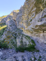
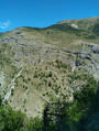
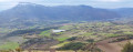
(7) Turn left, heading south-east, to follow the main track towards Rabou. The track, which is suitable for vehicles, crosses a vast landscape dominated by the Pic de Bure and the Barre and Clape mountains. Cross a ravine overlooking the Sentier des Bans. Reach a Y-junction.

(8) Leave the main track (Route Forestière de l’Escout) just before crossing a second ravine. Continue to the right, heading south. You’ll rejoin the track you took on the way up at a bend.

(2) Descend opposite along the reverse route of the outward journey, heading south. Pass the wayside shrine (1) and return to the Rabou car park (S/E).

Waypoints

  1. S/E : mi 0 - alt. 3,888 ft - Rabou hiking car park (north of the village)
  2. 1 : mi 0.14 - alt. 3,921 ft - Oratoire de Sainte Roseline
  3. 2 : mi 0.43 - alt. 4,117 ft - Crossroads of the circular loop
  4. 3 : mi 0.6 - alt. 4,206 ft - Y-junction of tracks
  5. 4 : mi 1.4 - alt. 5,259 ft - Cabane du Berger du Puy
  6. 5 : mi 1.99 - alt. 6,001 ft - Summit of the Puy de Rabou – elevation 1,834
  7. 6 : mi 2.36 - alt. 5,472 ft - Col du Ferlieu
  8. 7 : mi 3.54 - alt. 4,931 ft - Trail junction at a bend – elevation 1,501
  9. 8 : mi 4.29 - alt. 4,386 ft - Y-junction – elevation 1,335
  10. S/E : mi 5.05 - alt. 3,888 ft - Rabou hiking car park (north of the village)

Notes

There are no water sources along the route. There is a fountain in the village of Rabou. Make sure you carry enough water, particularly in summer, as the route is largely exposed to the sun.

There are a few grassy areas where you can take a break or have a picnic at the (5) summit of Le Puy and at the (6) Col du Ferlieu. There are no picnic tables. The welcome shade of the Bois de l’Escout also offers a spot for a picnic out of the sun.

The ascent is quite steep and very exposed to the sun (south, south-west facing). Only the section through the Bois de l’Escout, between (6) the Col du Ferlieu and (7) the junction with the track, offers any shade. Note that the Puy ridge and the Escout forest road offer stunning views.

Herds are frequently present on the summer pastures on the slopes of Le Puy. Please respect the grazing areas, close any gates you come across and do not approach the animals. Guard dogs (patous) may be present. Please behave accordingly and give the herds a wide berth. Please also respect the shepherd’s living quarters near the shepherd’s hut (4).

The village of Rabou does not have any permanent tourist facilities. The main shops, restaurants and accommodation can be found in Gap.

Alternatives:

  • Round trip to Pic Melette: at the Col du Ferlieu (6), head north towards Pic Melette. Climb up the ridge following faint trail marks (the path narrows but presents no difficulty). Then follow the ridge as far as the eye can see to the summit. You’ll need to zigzag as best you can as the slope is steep (900 m elevation gain, total time 5 h 30 mins).
  • Return via the hamlet of Les Tournillons: at the Col du Ferlieu (6), head down towards the north-east; then, at the Y-junction, continue the descent to the right, heading east, towards Les Tournillons. Then descend, following the left bank of the torrent to the hamlet of ‘La Rivière’, then head back up the road and take a path on the right to reach the car park (elevation gain 650 m, total time 4 hours 20 minutes).
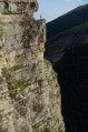
  • Return via the Sentier des Bans: at the junction (7), carry on straight ahead to descend through the woods towards the GR® 93, which you should follow due south. You will then be walking along the Sentier des Bans, which requires careful attention near steep slopes. Continue to the wayside shrine (1) and then to the car park (elevation gain 850 m, total time 5 hours 30 minutes). Please note that the Sentier des Bans is more exposed and requires constant vigilance (not recommended for those prone to vertigo).

Worth a visit

(1) Oratory of Sainte Roseline: erected on the initiative of Canon Clos and donated to Marcel Hubaud, it was restored in 1982.
Born in 1263, Roseline was the daughter of Arnaud de Villeneuve, Lord of Les Arcs in the Var. Her brother Elzéard was Bishop of Digne. Drawn to monastic life, she came at the age of 17 to the Carthusian monastery of Bertaud, beyond Rabou, at the foot of the Aurouze massif. She took her vows there at Christmas 1280. In these very austere surroundings, living conditions for this Carthusian community were extremely harsh: the monastic rules of Saint Bruno, observance of the ‘great silence’, privations, and a life of complete self-sufficiency. In 1282, she returned to more hospitable climes, to the monastery of La Celle-Roubaud in the Var, before becoming a deaconess there at the age of 25, then Prioress in 1300 at the age of 37 during a ceremony attended by the future Pope John XXII (also from Provence). She remained cloistered there until the end of her days. She died there on 17 January 1329. Venerated in Provence, Roseline was the subject of popular devotion and was recognised as a saint by the Catholic Church.

(5) From the summit of the Puy de Rabou, there is a 360° view.

  • To the south, the village of Rabou perched on its promontory.
  • To the north-west lies the Pic de Bure, the prow of the Dévoluy. Facing this stone prow, it was the legendary mountaineer René Desmaison who pioneered the legendary East Pillar route in 1961.
  • To the north, the Pic Melette (2,040 m) and the Pic des Miauzes (1,960 m), linked by a ridge, block the view.
  • To the north-east, the Pic de Gleize (2,120 m) seems to dominate the area.

(6) The Bois de l’Escout is a suspended forest massif covering the western flanks of the Puy de Rabou. It offers a striking contrast to the limestone and rocky landscapes of the Dévoluy and the Sentier des Bans. Its welcome shade stands in stark contrast to the aridity of the surrounding rocky ridges, and provides a sheltered spot for a picnic out of the sun.

(S/E) Perched on its rocky outcrop above the Petit Buëch, the village of Rabou lies at an altitude of 1,150 metres. Particularly well-known amongst canyoning enthusiasts, the village is dominated by the majestic Pic de Bure, the highest peak in the Dévoluy. Rabou belongs to the Vivaro-Alpine linguistic area, an Alpine variety of the Occitan language historically spoken in the Gapençais region. The village has retained few remains of its former fortified walls. Further upstream in the valley stood the Bertaud Charterhouse, founded in 1188, of which a few traces remain today.

Always be cautious and plan ahead when you're outdoors. Visorando and the author of this route cannot be held responsible for any accidents occurring on this route.

The GR® and PR® markings are the intellectual property of the Fédération Française de Randonnée Pédestre.

Other walks in the area

For more walks, use our search engine .

The GPS track and description are the property of this route's author. Please do not copy them without permission.