The Brèche de Charance via the Route de l’Avalanche

A gentle climb along quiet forest tracks to the Brèche de Charance, on the north-facing slope. An easier route in summer.

Details

56590621
Creation:
Last update:
Last review:
  • Walking
    Activity: Walking
  • ↔
    Distance: 3.34 mi
  • ◔
    Average duration: 2h 20 
  • ▲
    Difficulty: Easy

  • ⚐
    Back to start: Yes
  • ↗
    Ascent: + 932 ft
  • ↘
    Descent: - 932 ft

  • ▲
    Highest point: 5,413 ft
  • ▼
    Lowest point: 4,482 ft

Photos

Description of the walk

On the D994 road, between Gap and Veynes, head towards Rabou via the D503. Before reaching the village of Rabou, take the road on the right towards La Chau. Drive through the hamlet, then take the Route Forestière de Tavanet, which climbs gently north-east. Pass a hairpin bend on the right and continue straight ahead until the next hairpin bend.
Park near the barrier (only a few spaces available).

(S/E) Go through the barrier and follow the Route Forestière de l’Avalanche straight ahead. Cross the Torrent de la Combe, then ignore the path that crosses the track and join another track.

(1) Ignore the small paths to the left and right and continue straight ahead along the forest track until you reach the Route de la Brèche (track D53).

(2) Turn sharply left onto this track. At the end, continue along the path to the nearby Brèche de Charance.

(3) At the top of the ridge, take in the view over the Gap region

(4) Turn back a few metres.

(3) Then take the path that descends to the right, heading north-west, to walk down alongside the Combe torrent, eventually coming out onto the Route Forestière de l’Avalanche and the original junction.

(1) Turn right here, heading in the opposite direction to your outward journey, to return to the barrier at the start (S/E).

Waypoints

  1. S/E : mi 0 - alt. 4,482 ft - Avalanlanche Forest Road – elevation 1,366
  2. 1 : mi 0.67 - alt. 4,764 ft - Crossroads of the circular loop
  3. 2 : mi 1.25 - alt. 4,908 ft - La Brèche Forest Track – elevation 1,493
  4. 3 : mi 2.16 - alt. 5,404 ft - Junction leading to the pass
  5. 4 : mi 2.17 - alt. 5,413 ft - La Brêche de Charance (1648m)
  6. S/E : mi 3.34 - alt. 4,482 ft - Avalanlanche Forest Road – elevation 1,366

Notes

There are no water sources along the route, but there is a fountain in the village of Rabou.

Longer alternatives
- You can leave your car at the hamlet of ‘La Chau’ and then walk up via the Tavanet Forest Road.
- From the pass, you can make a round trip to the Pic de Charance by taking the path on the right (yellow markings), heading west.
- From the pass, you can return via the Col de Guizière and descend into the Bois de Tavanet (elevation gain 500 m, total time 4 hours 45 minutes).

Worth a visit

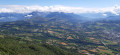
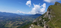
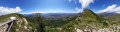
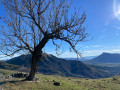
The Charance ridges offer a beautiful panoramic view over Gap towards Céüse, the Dévoluy, the Pic de Gleize, the Vieux Chaillol, the Ubaye, the Montagne de la Blanche, etc.

Reviews and comments

4.5 / 5
Based on 2 reviews

Reliability of the description
4.5 / 5
Ease of following the route
4.5 / 5
Route interest
4.5 / 5
User 30538439
• Edited:

Overall rating : 4.3 / 5

Date of your route : Aug 10, 2026
Reliability of the description : ★★★★☆ Good
Ease of following the route : ★★★★☆ Good
Route interest : ★★★★★ Very good
Very busy route : No

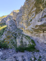
The difficulty level of the descent is more ‘Moderate’ than ‘Easy’: steep and slippery. Walking shoes with good grip are essential. Not recommended with children; if you do take children, you should return via the same route you took up.

Machine-translated

BAMX
BAMX

Overall rating : 4.7 / 5

Date of your route : Aug 08, 2025
Reliability of the description : ★★★★★ Very good
Ease of following the route : ★★★★★ Very good
Route interest : ★★★★☆ Good
Very busy route : No

Beautiful hike. No crowds on the trail, but there were people at the breach. Beautiful 360° view

Machine-translated

Other walks in the area

For more walks, use our search engine .

The GPS track and description are the property of this route's author. Please do not copy them without permission.