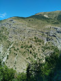
The Brèche de Charance from Rabou

A gentler route to the Brèche de Charance and the ridges, via the northern (shaded) slope. This easy route follows little-used forest tracks almost all the way to the pass. The return journey takes you via the Col de Guizière, descending back through the woods.

Details

n°56575375
Creation:
Last update:
Last review:
  • Walking
    Activity: Walking
  • ↔
    Distance: 7.16 mi
  • ◔
    Average duration: 4h 45 
  • ▲
    Difficulty: Moderate

  • ⚐
    Back to start: Yes
  • ↗
    Ascent: + 1,667 ft
  • ↘
    Descent: - 1,670 ft

  • ▲
    Highest point: 5,676 ft
  • ▼
    Lowest point: 4,006 ft

Description of the walk

On the D994 road between Gap and Veynes, head towards Rabou via the D503. Before reaching the village of Rabou, take the road on the right towards La Chau.
Park at the start of the dirt track (only two or three spaces available), or else in the hamlet.

(S/E) Take the Route Forestière de Tavanet, which climbs gently north-east.

(1) Stay on the wide forest track straight ahead, and ignore the paths branching off to the left and then to the right. Pass a hairpin bend on the right.

(2) Immediately afterwards, ignore the track leading uphill to the left and continue straight ahead to the next hairpin bend.

(3) Go through the gate and follow the Route Forestière de l’Avalanche straight ahead. Cross the Torrent de la Combe, then ignore the path that crosses the track. Join another track.

(4) Turn left at the hairpin bend to climb up the Route Forestière de la Brèche (track D53). At the end of the track, continue along the path to the nearby Brèche de Charance.

(5) Turn left along the ridge, heading towards the Col de Guizière (Tour de l’Odysée). Pass a telecoms mast, then the highest point of the route, Côte Plaine (elevation 1735), and descend the ridge, heading north-east, until you reach the Col de Guizière.

(6) Then take the path on the left, heading north-west, to descend towards the Bois de Tavanet. After a good ten metres, ignore the path on the left and continue straight ahead.

(7) At the junction, ignore the path leading down to the right, carry on straight ahead and head into the forest.

(8) At the junction, ignore the path leading down to the right and continue by keeping to the left. Around the 1548 mark, you’ll reach a flat area with picnic tables and cattle grids, which you’ll need to cross. The path then becomes the Tavanet Forest Road. Follow it to the second hairpin bend (1449 mark).

(9) Ignore the path leading down to the right and continue along the track to the next hairpin bend, which you have already passed on the way up.

(3) Continue to the right, in the opposite direction, down the Tavanet Forest Road, until you reach (S/E).


Waypoints

  1. S/E : mi 0 - alt. 4,009 ft - Tavanet forest track - Petit Buëch (rivière)
  2. 1 : mi 0.44 - alt. 4,177 ft - Crossroads (alt. 1,268 m)
  3. 2 : mi 0.77 - alt. 4,341 ft - Crossroads (alt. 1,324 m)
  4. 3 : mi 1.13 - alt. 4,469 ft - Barrier. Junction of the circular loop
  5. 4 : mi 2.38 - alt. 4,882 ft - Forest track from La Brèche. Elevation 1,493
  6. 5 : mi 3.3 - alt. 5,410 ft - La Brêche de Charance (1648m)
  7. 6 : mi 3.88 - alt. 5,390 ft - Col de Guizière (1649m)
  8. 7 : mi 4.08 - alt. 5,322 ft - Crossroads (alt. 1,630 m)
  9. 8 : mi 4.32 - alt. 5,125 ft - Crossroads (alt. 1,570 m)
  10. 9 : mi 5.28 - alt. 4,741 ft - Épingle. Elevation 1,455
  11. S/E : mi 7.16 - alt. 4,006 ft - Tavanet forest road - Petit Buëch (rivière)

Notes

There are no water sources along the route, but there is a fountain in the village of Rabou.
Picnic tables in the Bois de Tavanet.

You can avoid the ridge walk between points (5) and (6) by taking the small path heading north, which goes round Côte Plaine on the left and also leads to the Col de Guizière.

Shorter alternatives
- It is possible to shorten the route by driving up the Route Forestière de Tavanet for 2 km along a somewhat rough stretch, parking just after the hairpin bend at point (3), near the barrier blocking the Route Forestière de l’Avalanche (elevation gain 350 m, total time 3 hours 30 minutes).
- Starting from the waypoint (3) to the Brèche (5), then take the grassy valley via a small path heading north-west, which runs alongside the Torrent de la Combe (elevation gain 290 m, total time 2 hours 30 minutes).

A longer variant from La Brèche (5): you can make a round trip to the Pic de Charance by taking the path on the right (yellow markings), heading west.

Worth a visit

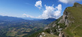
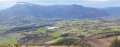
The Charance ridges offer a beautiful panorama over Gap towards Céüse, the Dévoluy, the Pic de Gleize, the Vieux Chaillol, the Ubaye and the Montagne de la Blanche...

Reviews and comments

4 / 5
Based on 2 reviews

Reliability of the description
3.5 / 5
Ease of following the route
4 / 5
Route interest
4.5 / 5
Annemarieclausse
Annemarieclausse

Overall rating : 5 / 5

Date of your route : Oct 13, 2026
Reliability of the description : ★★★★★ Very good
Ease of following the route : ★★★★★ Very good
Route interest : ★★★★★ Very good
Very busy route : No

A lovely walk that makes it easier to reach the Brèche de Charance than from Gap.

Machine-translated

diggi
diggi
• Edited:

Hello Jeff from Montbrand (05),

Thank you for reporting snow on the north-facing slope (which is common in April, and I believe the Visorando app also indicates snow cover).

However, you noted that the reliability of the description was “disappointing”. Could you tell me what you didn’t like?

Machine-translated

Jeff de Montbrand (05)

Overall rating : 3 / 5

Date of your route : Apr 21, 2026
Reliability of the description : ★★☆☆☆ Disappointing
Ease of following the route : ★★★☆☆ Average
Route interest : ★★★★☆ Good
Very busy route : No

There’s still plenty of snow on the north-facing slopes and as soon as you reach the forest!

Machine-translated

Other walks in the area

For more walks, use our search engine .

The GPS track and description are the property of this route's author. Please do not copy them without permission.