A circular walk to the Puy de Bessolles starting from La Roche Romaine

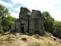
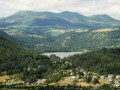
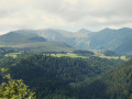
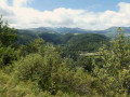
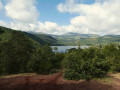
Starting from the strange rock formation known as the Roche Romaine and the hamlet of the same name, the Puy de Bessolles offers a natural balcony, followed by access to a viewpoint. On a clear day, the route provides views of the Sancy massif, the Chaîne des Puys and the Monts du Forez.

Details

61821671
Creation:
Last update:
Last review:
  • Walking
    Activity: Walking
  • ↔
    Distance: 2.93 mi
  • ◔
    Average duration: 1h 40 
  • ▲
    Difficulty: Easy

  • ⚐
    Back to start: Yes
  • ↗
    Ascent: + 387 ft
  • ↘
    Descent: - 397 ft

  • ▲
    Highest point: 3,451 ft
  • ▼
    Lowest point: 3,117 ft

Photos

Description of the walk

To reach the starting point, between Saint-Victor-la-Rivière and Murol, take the D619, then the small road that climbs to the left, leading to the hamlet of Roche Romaine. Drive through the hamlet and park in the car park above, facing the Roche Romaine rock.

(S/E) From the car park, head to the Roche Romaine rock formation, then follow the path to the three-way junction, a few metres before the hamlet. Ignore the road leading downhill and continue along the track that runs above the houses. Carry on along a path until you reach the start of a footpath on the left.

(1) Take this path, which runs horizontally, until you reach a track suitable for vehicles. Continue uphill to the right until you reach the top of the hill.

(2) Turn left and continue along the path running along the hillside until you reach the next junction.

(3) Head up the track to the right until you reach the telecoms mast at the top of the hill.

(4) Turn onto the path on the left and head downhill until you quickly reach a viewpoint.

(5) Return to the track at the top of the hill.

(4) Continue along the track to the left, which runs almost level through the woodland, but with no views. Follow it until you rejoin the route you took earlier.

(2) Turn left, head down the fairly steep path, and arrive at the start of the path you took on the way there.

(1) Continue left along the path and head for the car park near the Roche Romaine rock (S/E).

Waypoints

  1. S/E : mi 0 - alt. 3,150 ft - La Roche Romaine car park
  2. 1 : mi 0.27 - alt. 3,179 ft - Junction with the first circular loop
  3. 2 : mi 0.48 - alt. 3,297 ft - Junction with the circular loop of the - Puy de Bessolles
  4. 3 : mi 1.38 - alt. 3,330 ft - Trail
  5. 4 : mi 1.51 - alt. 3,363 ft - Junction – Access to the viewpoint
  6. 5 : mi 1.57 - alt. 3,304 ft - Viewpoint
  7. S/E : mi 2.93 - alt. 3,150 ft - La Roche Romaine car park

Notes

(4) The return path, through the woodland, is pleasant but offers no views.

Worth a visit

Reviews and comments

4.4 / 5
Based on 3 reviews

Reliability of the description
4.3 / 5
Ease of following the route
4.3 / 5
Route interest
4.7 / 5
User 13430637

Overall rating : 5 / 5

Date of your route : Jun 20, 2025
Reliability of the description : ★★★★★ Very good
Ease of following the route : ★★★★★ Very good
Route interest : ★★★★★ Very good
Very busy route : No

A lovely walk through the woods with the option to extend the distance.

Machine-translated

Jean Claude 63
Jean Claude 63

Overall rating : 3.3 / 5

Date of your route : Oct 21, 2024
Reliability of the description : ★★★☆☆ Average
Ease of following the route : ★★★☆☆ Average
Route interest : ★★★★☆ Good
Very busy route : No

We really enjoyed this walk. We had no trouble finding our way with your directions. The signposting along the route isn’t very clear. Otherwise, there were magnificent views along the first part of the route and at the viewpoint.

Machine-translated

fgregory63
fgregory63

Overall rating : 5 / 5

Date of your route : Sep 02, 2024
Reliability of the description : ★★★★★ Very good
Ease of following the route : ★★★★★ Very good
Route interest : ★★★★★ Very good
Very busy route : No

A short alternative to the yellow PR route starting from Murol. A good way to explore La Roche and enjoy the view from the relay mast, when, for whatever reason, you don’t have time to do the main route!

Machine-translated

Other walks in the area

For more walks, use our search engine .

The GPS track and description are the property of this route's author. Please do not copy them without permission.