The port of L’Ilon from Guernes

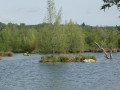
A route to explore the Sandrancourt ponds, the Flicourt nature reserve and the banks of the Seine

Details

44647773
Creation:
Last update:
Last review:
  • Walking
    Activity: Walking
  • ↔
    Distance: 7.43 mi
  • ◔
    Average duration: 3h 30 
  • ▲
    Difficulty: Moderate

  • ⚐
    Back to start: Yes
  • ↗
    Ascent: + 72 ft
  • ↘
    Descent: - 72 ft

  • ▲
    Highest point: 144 ft
  • ▼
    Lowest point: 52 ft
  • ⚐ Country: France
  • ⚐
    Area: Vexin
  • ⚐ City: Guernes (78520)
  • ⚑
    Start/End: N 49.012309° / E 1.640259°
  • ❏
    IGN map(s): Ref. 2113ET, 2113O
  • Hour-by-hour weather

Photos

Description of the walk

Start from the car park at the Foyer Neyens on Chemin Saint-Martin in Guernes.

(S/E) With your back to the car park, head left, north-east along Chemin Saint-Martin. As you leave the village, at a Fork in the road, keep to the left. Continue until you reach the first crossroads (model aeroplane field on the left).

(1) Turn left, heading due north, and follow this track straight on until you reach a tarmac road.

(2) Take this road to the left. After about 200 m, leave the Route de Guernes on your left and continue towards Sandrancourt. Pass a shed on your left and turn left at the next street towards the lake car park.

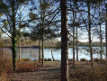
(3) Turn left and, at the car park, turn right (at the barrier) then follow the path alongside the lake. Pass thefirst path on the right, then thesecond, keeping to the lakeshore; turn right twice until you reach the next junction.

(4) Turn left, go through the barrier and continue along the path that runs alongside the lake until it ends. You’ll come out onto a small road.

(5) Follow it to the left, cross a bridge and, shortly afterwards, take a small path on the right which leads down towards the pond. Follow the main path, which initially runs alongside the pond before eventually crossing the woodland until it joins a track suitable for vehicles.

(6) Follow this track to the right and continue straight on to Flicourt Farm. In front of the farm, turn right, go round the farm and, about 250 metres further on, at the next crossroads, turn right again. Cross a bridge over a backwater of the Seine.

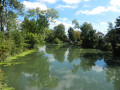
(7) At the end of the bridge, turn right and follow the riverbank until you reach the spillway of the backwater (the village of Rolleboise is on the opposite bank of the Seine).

(8) Retrace your steps for about fifty metres and, at the Fork in the road, take the path on the right which follows the Seine for nearly 3 km until you reach a commemorative plaque marking the US Army’s crossing of the Seine.

(9) Take the road on the left which leads back to Guernes; cross two bridges to reach a crossroads at the entrance to the village.

(10) Faced with two roads, take Rue André Mendon on the right, which climbs up behind the church. At the top, turn left onto Rue des Caillouets and immediately right onto the tiny Ruelle du Point du Jour, which then widens. At the end, turn left onto Rue des Clos, then take the first right and the first left. Cross Rue Émile Ledebt and head for the car park (S/E).

Waypoints

  1. S/E : mi 0 - alt. 125 ft - Neyens Community Centre car park
  2. 1 : mi 0.77 - alt. 135 ft - Model aeroplane flying field
  3. 2 : mi 1.7 - alt. 79 ft - Road junction
  4. 3 : mi 2.05 - alt. 69 ft - Junction towards the lake
  5. 4 : mi 2.64 - alt. 69 ft - Crossroads – Sandrancourt Pond
  6. 5 : mi 3.83 - alt. 72 ft - Road to the hydroelectric power station
  7. 6 : mi 4.25 - alt. 79 ft - Chemin de Flicourt
  8. 7 : mi 4.96 - alt. 59 ft - Herville Bridge
  9. 8 : mi 5.32 - alt. 56 ft - Spillway - Seine [la]
  10. 9 : mi 6.78 - alt. 59 ft - Moulin de la Chambre
  11. 10 : mi 7.05 - alt. 72 ft - Entrance to Guernes
  12. S/E : mi 7.43 - alt. 125 ft - Back to the car park

Reviews and comments

4.7 / 5
Based on 3 reviews

Reliability of the description
4.7 / 5
Ease of following the route
4.7 / 5
Route interest
4.7 / 5
User 21911230

Overall rating : 5 / 5

Date of your route : Aug 11, 2026
Reliability of the description : ★★★★★ Very good
Ease of following the route : ★★★★★ Very good
Route interest : ★★★★★ Very good
Very busy route : No

A lovely walk along the water’s edge; I spotted a deer towards the end of the walk

Machine-translated

VéroV
VéroV

Overall rating : 4 / 5

Date of your route : Jul 05, 2024
Reliability of the description : ★★★★☆ Good
Ease of following the route : ★★★★☆ Good
Route interest : ★★★★☆ Good
Very busy route : No

A varied route, with the first few kilometres taking you through fields of flowers – very pretty at this time of year.
We did this walk at the end of June; the section between points 6 and 7 includes a path that is virtually impassable due to brambles and stinging nettles.
So make sure you wear long trousers, long sleeves and take a walking stick!
On the sections running alongside the water, you don’t always have a clear view of the river.

Machine-translated

Sandra24
Sandra24

Overall rating : 5 / 5

Date of your route : May 19, 2024
Reliability of the description : ★★★★★ Very good
Ease of following the route : ★★★★★ Very good
Route interest : ★★★★★ Very good
Very busy route : No

A very enjoyable walk.
The scenery and routes are really lovely.

Machine-translated

microb
microb

A very original walk that I hope to be able to go on one day

Machine-translated

Other walks in the area

For more walks, use our search engine .

The GPS track and description are the property of this route's author. Please do not copy them without permission.