Lake Moisson, starting from Méricourt

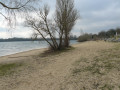
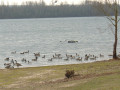
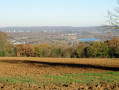
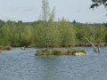
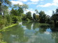
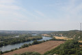
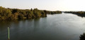
A walk through two villages, exploring local heritage, with some lovely views, winding through fields, meadows and small woods, alongside the River Seine and Lake Moisson-Lavacourt.

N.B. The walk around Lake Moisson is only possible when entry to the leisure centre is free (see practical information).

Details

22236873
Creation:
Last update:
Last review:
  • Walking
    Activity: Walking
  • ↔
    Distance: 9.65 mi
  • ◔
    Average duration: 4h 35 
  • ▲
    Difficulty: Moderate

  • ⚐
    Back to start: Yes
  • ↗
    Ascent: + 194 ft
  • ↘
    Descent: - 167 ft

  • ▲
    Highest point: 210 ft
  • ▼
    Lowest point: 52 ft

Photos

Description of the walk

To get to the start point, from the D113 at Rolleboise, take the Route de Méricourt along the banks of the Seine. After a sign indicating a left-hand bend, in the next bend, carry on straight ahead (signposted ‘La Plage’) to find a small car park on the banks of the Seine.

(S/E) With your back to the Seine, head to the right.

(1) At the Fork in the road, carry on to the right, following the river. Pass the starting points on your left, then turn left at a gate, following the path.

(2) At the next junction, turn slightly right onto a path with a backwater of the Seine on your right. Carry on to a T-junction.

(3) Take the road on the left. Ignore two turn-offs on the left.

(4) Go through the small gate on the right leading to the leisure centre, then turn right and walk round the lake. When you reach the buildings at the Île de Loisirs, turn left to walk past the café on your right, go down a few steps, then turn right and continue round the lake. Exit through the small gate.

(4) Head slightly to the right, then take the first left onto Rue des Bretons.

(5) Carry on to the left along Rue des Carterons until you reach a T-junction.

(6) Turn left into Grande Rue and walk as far as the church and the town hall. Then carry on until you reach the old school on your right (commemorative plaque).

(7) A little further on, turn left down Rue de l’Eau. At the next junction, turn right onto a grassy path.

(8) When the path becomes more even, ignore a turn-off to the right at this point.

(9) A few metres further on, turn right onto a grassy path and join the Grande Rue, which you follow to the right. Then take a sharp left-hand bend (marked by an old road signpost).

(10) Shortly afterwards, take the path leading uphill to the right to reach the Route des Crêtes, which you follow to the right for a few metres (there is a gate).

(11) Cross over and take a forest track (north-east). After about 200 metres, as you emerge from the small copse, continue for a few metres then turn left between two fields. Carry on along this track, which will turn left further on.

(12) At the T-junction, take thePR® on the left towards the Route des Crêtes, ignoring any side paths. Cross the road to the right, passing close to a metal sculpture.

(13) Head left onto Rue de la Vieille Côte. Stop on the right near the cross to enjoy the view, then head back down to the left into Méricourt. Pass by the church and then the town hall.

(14) At No. 81, head downhill to the right along the Sente de la Plage (signposted). At the T-junction, turn right to quickly return to the starting point (S/E).

Waypoints

  1. S/E : mi 0 - alt. 62 ft - A place known as La Plage - Seine [la]
  2. 1 : mi 0.19 - alt. 56 ft - Fork in the road
  3. 2 : mi 1.26 - alt. 56 ft - Dead arm of the Seine on the right-hand side
  4. 3 : mi 2 - alt. 56 ft - Junction of footpath and road
  5. 4 : mi 2.14 - alt. 62 ft - Junction of the circular loop at the - Lac de Moisson
  6. 5 : mi 5.83 - alt. 138 ft - Rue des Carterons
  7. 6 : mi 6.28 - alt. 161 ft - Grande Rue
  8. 7 : mi 6.69 - alt. 79 ft - Rue de l’Eau
  9. 8 : mi 7.34 - alt. 56 ft - Gravel path
  10. 9 : mi 7.42 - alt. 56 ft - Grassy path on the right
  11. 10 : mi 7.68 - alt. 102 ft - Path leading up to the Route des Crêtes
  12. 11 : mi 7.9 - alt. 187 ft - Path opposite a gate
  13. 12 : mi 8.46 - alt. 174 ft - T-junction with a PR
  14. 13 : mi 9.05 - alt. 210 ft - Rue de la Vieille Côte
  15. 14 : mi 9.43 - alt. 89 ft - Sente de la Plage
  16. S/E : mi 9.65 - alt. 62 ft - A place known as La Plage

Notes

Alternative parking available along the Seine before the bend.

The Suricate portal
You, as users of the trails and natural environments, can play an active part in this scheme from today by reporting any issues you encounter whilst out walking: Sentinelles sports de nature.

Signposting: a quick reminder.

Moisson Lavacourt Lake Circuit: approx. 5.5 km
Entry to the leisure centre is free:
from September to the end of April and on weekdays in May and June
Île de Loisirs des Boucles de Seine

Picnic:
‘La Plage’ in Méricourt (benches)
Designated area near the swimming area at the leisure centre (tables)

Worth a visit

Méricourt
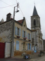
Church of the Nativity of the Blessed Virgin Mary.
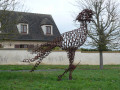
Horseshoe-shaped sculpture of a giant bird by Jean Luc Leleux.
Stone Calvary.
Cave dwellings, most of which have been converted into garages, as in Mousseaux-sur-Seine.
On the wall opposite Méricourt beach, you can see two plaques commemorating the successive floods experienced by the River Seine in the 20th century.
Nearby: the lock and dam

Mousseaux-sur-Seine
Saint-Léger Church: a neo-Gothic limestone church dating from 1875. It replaced an old cave church dating from 1749, of which only the square bell tower, topped by a conical stone roof, rises above the ground.
Former school and, in the courtyard, an old wine press in a cave.

Always be cautious and plan ahead when you're outdoors. Visorando and the author of this route cannot be held responsible for any accidents occurring on this route.

The GR® and PR® markings are the intellectual property of the Fédération Française de Randonnée Pédestre.

Reviews and comments

4.3 / 5
Based on 2 reviews

Reliability of the description
4.5 / 5
Ease of following the route
4.5 / 5
Route interest
4 / 5
COCHARDMOD
COCHARDMOD

... that’s normal... as stated in the information sheet
N.B. The walk around Lac de Moisson is only possible when entry to the leisure centre is free (see practical information).

Machine-translated

joelle78
joelle78
• Edited:

A lovely walk. Please note that the gate at the leisure centre at point 4 was locked with a padlock when we were out walking. You can get back in by returning to point 3, walking along the edge of the field and crossing it at the far end (straight on from point 3). Thank you for this lovely discovery.

Machine-translated

COCHARDMOD
COCHARDMOD

Thank you!

Machine-translated

Mirna
Mirna

Overall rating : 4.7 / 5

Date of your route : Apr 24, 2023
Reliability of the description : ★★★★☆ Good
Ease of following the route : ★★★★★ Very good
Route interest : ★★★★★ Very good
Very busy route : No

A lovely walk along the water’s edge. An easy, almost flat route.
Walk round the lake and then back through the fields; lovely views as you climb to the top of the cliffs.
Very quiet on a weekday, but be aware that it can get busy at weekends and on public holidays.

Machine-translated

ovil
ovil

Overall rating : 4 / 5

Date of your route : Jan 23, 2023
Reliability of the description : ★★★★★ Very good
Ease of following the route : ★★★★☆ Good
Route interest : ★★★☆☆ Average
Very busy route : No

A walk with no difficulties other than the rather chilly weather. Good paths and pleasant scenery.
We carried on as far as Lavacourt.
We went too far at point 11. We hadn’t realised we were in ‘le petit bois’ as soon as we crossed the road and carried on to the next wood before realising our mistake. The density of the points makes the map difficult to read.

Machine-translated

Other walks in the area

For more walks, use our search engine .

The GPS track and description are the property of this route's author. Please do not copy them without permission.