Country:
 City:



Set off from the car park on the Rance at Vigneux beach.
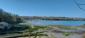
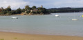
(S/E) Head south towards the Pont Chateaubriand, which is clearly visible. Follow the riverbank to reach Port St-Jean. Pass under the Pont Chateaubriand.
(1) Continue along the path until you reach the D366. Cross the road and turn left, then right towards Rue des Terras Neuvas. Turn into this street and continue to the riverbank, then follow it eastwards, keeping to the left.
(2) Climb the few steps and continue along the path for about 700 metres.
(3) Turn left uphill. When you reach a track, turn right and carry on until you reach the road.
(4) Turn left and go under the bridge. At the entrance to the village, by the signpost, turn right onto the stony track. The track curves to the left and leads to a crossroads.
(5) First turn right then left to cross the D366 and carry on along the track opposite. Pass the tree-lined avenue on your right until you reach the next road, then turn left towards the houses before beginning the descent.
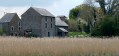
(6) Turn right at the corner of the manor house. Pass the sheds on your right. At the junction, cross the D7 and take the gravel track opposite. Follow it for about 650 metres and turn left to rejoin the D7. Turn right
(7) After the bend, turn left towards the farm buildings. Then head left to quickly reach the menhir.
(8) Retrace your steps.
(7) Follow the D7 again, to the left. Turn left after the sheds and take the path under the trees, heading south-west. Turn right and head uphill to reach a crossroads overlooking Saint-Suliac to the right. Cross it towards the car park.
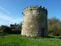
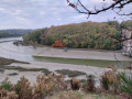
(9) Carry on straight ahead after a short stop to take in the view of the Rance valley and pass by the mill. Take the path on the left which descends gently to the banks of the Rance.
(10) Take the track on the left and follow the riverbank. Join a road and carry on to the next crossroads.
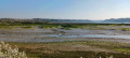
(11) Turn right and follow the fairly wide path, which narrows further on to become a footpath. Keeping to the banks of the Rance, make your way back to the car park where you started (S/E).
 Visorando Member
 Easy


 Association / Club / Walk leader
 Difficult