The Verdaches Hamlets Route

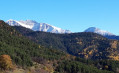
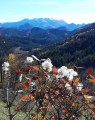
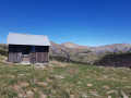
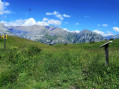
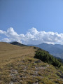
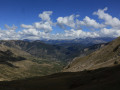
A fairly easy walk allowing you to explore the hamlets of Verdaches, La Sambue and La Route along a peaceful path. You’ll find lovely panoramic views of Blayeul as you follow a pleasant, varied route through farms, pastures and woodland.

Details

16777279
Creation:
Last update:
Last review:
  • Walking
    Activity: Walking
  • ↔
    Distance: 3.72 mi
  • ◔
    Average duration: 2h 25 
  • ▲
    Difficulty: Easy

  • ⚐
    Back to start: Yes
  • ↗
    Ascent: + 801 ft
  • ↘
    Descent: - 791 ft

  • ▲
    Highest point: 4,452 ft
  • ▼
    Lowest point: 3,694 ft

Photos

Description of the walk

The start is in the main square of the village of Verdaches, near the church and the town hall (a few parking spaces nearby).

Yellow markings

(S/E) From the town hall, head towards the fountain, keeping the church on your right; turn left immediately afterwards, which will take you onto a side road. Turn right and follow the road for about a hundred metres until you reach a Fork in the road.

(1) Ignore the turn-off to the left for the Saint-Domnin Chapel; continue to the right, following the yellow markings. Shortly afterwards, at a right-hand bend, leave the road and pass to the left of a farm shed, continuing along a path still marked in yellow. It becomes a footpath and begins to climb, before descending into a ravine, then climbing again to emerge at a junction of farm tracks.

(2) At the junction, take the path on the left marked towards La Sambue to the north-west. This path continues until you reach the foot of a fortified country house. Then continue along the fence at the bottom of the meadow, keeping to the right of the fence. Do not descend into the ravine until you reach the far end of the meadow. Walk along the bank, keeping the stream on your left, until you reach a path marked in yellow which climbs to the right towards the north-east. The ascent begins facing the slope, then continues across to the left, then along the bottom of a ravine, and finally through a wood to reach a junction near the highest point of the route.

(3) Turn right until you reach the bottom of a meadow. Turn left and follow the path until it joins a second path. Take this path to the left until you reach the hamlet of La Sambue. Pass to the right of the first houses until you reach the fountain and the access road to the hamlet.

(4) Do not take the road; cross it and continue straight on along the path, which is still marked in yellow, passing between two buildings. Shortly afterwards, cross the Ravin du Tourondet, then continue downwards to the right as the path splits. Carry on to the drinking troughs, then head down into the valley floor by taking the path on the right. This path then crosses off to the left to join another path.

(5) Carry on straight ahead, descending in hairpin bends to the bottom of the Ravin du Tourondet. Turn left and follow the stream bed until you reach the access road to the hamlet of La Sambue. Take this road to the left as far as the crossroads, then turn left again to climb up to the hamlet of La Route and reach the fountain.

(6) At the fountain, head down to the right along the path running between the houses, until you come out at a second fountain by the D 507 road. Continue straight on along the road through the houses of the hamlet of Les Sauves, then follow the Mardaric (a tributary of the Bès). This will take you back to the village of Verdaches and its town hall (S/E).

Waypoints

  1. S/E : mi 0 - alt. 3,698 ft - Verdaches Town Hall
  2. 1 : mi 0.13 - alt. 3,802 ft - Fork in the road – Yellow markings
  3. 2 : mi 0.67 - alt. 3,832 ft - Crossroads – Towards La Sambue
  4. 3 : mi 1.42 - alt. 4,364 ft - Crossroads – Yellow markings
  5. 4 : mi 1.72 - alt. 4,452 ft - Access road to La Sambue
  6. 5 : mi 2.36 - alt. 4,045 ft - Crossroads – Tourondet Ravine
  7. 6 : mi 2.9 - alt. 3,845 ft - Turn right at the fountain
  8. S/E : mi 3.72 - alt. 3,694 ft - Verdaches Town Hall

Notes

This is a hike with no particular difficulties, but good walking boots are recommended.

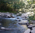
Please note: the section through the Tourondet riverbed is impassable after heavy rain.

Worth a visit

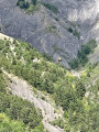
Verdaches lies at a crossroads of climatic influences. Here we are on the edge of the Mediterranean climate zone, and the forest reflects the diversity of these environmental conditions.
The village of Verdaches has long benefited from the quality of the timber from its forests (notably Scots pine, silver fir, Norway spruce and larch).

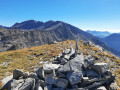
Viewpoint at the summit of Blayeul (2,189 m).

Reviews and comments

4.4 / 5
Based on 3 reviews

Reliability of the description
4.7 / 5
Ease of following the route
4.7 / 5
Route interest
4 / 5
User 2620088

Overall rating : 4 / 5

Date of your route : Aug 20, 2025
Reliability of the description : ★★★★★ Very good
Ease of following the route : ★★★★☆ Good
Route interest : ★★★☆☆ Average
Very busy route : No

The last quarter of the walk is on the road (which is not busy at all, however). The start is pleasant, even if it climbs quite a bit before reaching La Sambue. You are rewarded with a lovely view of Auzet. In short, a pleasant walk, but I don't think I'll be back.

Machine-translated

Stéphane Drujon
Stéphane Drujon

Overall rating : 5 / 5

Date of your route : Aug 19, 2024
Reliability of the description : ★★★★★ Very good
Ease of following the route : ★★★★★ Very good
Route interest : ★★★★★ Very good
Very busy route : No

A lovely little walk with some beautiful views; a peaceful and very pleasant spot.

Machine-translated

miandme
miandme

Overall rating : 4.3 / 5

Date of your route : Nov 20, 2021
Reliability of the description : ★★★★☆ Good
Ease of following the route : ★★★★★ Very good
Route interest : ★★★★☆ Good
Very busy route : No

Completed solo on 20 November 2021.
Thank you for introducing me to this route, which I hadn’t known about before.
A lovely circular route that passes through the hamlets of Verdache. WARNING: choose your time of year carefully and avoid days following rain or snowmelt, as some sections follow stream beds that can become very muddy. I learnt this the hard way, so make sure you’re wearing proper footwear. There are some beautiful stretches, especially in the upper section. A few sources of non-potable water.

Machine-translated

Other walks in the area

For more walks, use our search engine .

The GPS track and description are the property of this route's author. Please do not copy them without permission.