


 Country:
 City:


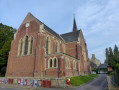
Parking and starting point: the church car park, Rue or Place de l’Église in Croix-Mare.
(S/E) With your back to the car park, facing the grocery shop, turn right onto Rue de l’Église. Then take the first left onto Route du Calvaire. At the crossroads by the calvary, turn left onto Route du Mouchel (D 304). Continue for about 1 km until you reach Impasse du Mouchel on your left and a house on your right.
(1) Turn right onto the path running alongside the house, directly opposite the cul-de-sac, Chemin du Hameau-en-Caux. Continue straight on until you reach the T-junction, Route du Hameau-en-Caux. Turn left until you reach Impasse-en-Caux 300 metres further on, at the bottom of a small hill, on your right.
(2) Turn right onto Impasse-en-Caux, which winds down through the woods to Route du Val au Cesne (D 89).
(3) Turn right onto the Route du Val au Cesne and follow it for 2 km, ignoring the first path on the right.
(4) Take the path on the right which climbs through the woods until you rejoin the road. Pass the sewage treatment works on your left to reach Impasse du Hameau Yvelin, and proceed to the T-junction at the end of the cul-de-sac.
(5) Turn left onto Route du Hameau Yvelin and immediately take the first right onto the street of the same name. At the next crossroads, continue straight ahead along Rue de l’Église to return to the starting point (S/E).

 Visorando Member

 Moderate

 Difficult

