The Saint-Martin-de-l’If route starting from Fréville

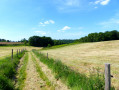
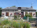
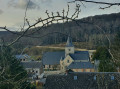
A pleasant walk through the countryside, passing through five villages, four of which now form a single municipality.
The municipalities of Fréville, Mont-de-l’If, La Folletière and Betteville merged on 1 January 2016 to form the new municipality of Saint-Martin-de-l’If and, from that date, became delegated municipalities.

Details

2818876
Creation:
Last update:
Last review:
  • Walking
    Activity: Walking
  • ↔
    Distance: 9.77 mi
  • ◔
    Average duration: 5h 00 
  • ▲
    Difficulty: Moderate

  • ⚐
    Back to start: Yes
  • ↗
    Ascent: + 538 ft
  • ↘
    Descent: - 541 ft

  • ▲
    Highest point: 453 ft
  • ▼
    Lowest point: 135 ft
  • ⚐ Country: France
  • ⚐ City: Fréville (76190)
  • ⚑
    Start/End: N 49.567934° / E 0.831713°
  • ❏
    IGN map(s): Ref. 1910SB, 1911OT
  • Hour-by-hour weather

Photos

Description of the walk

Park in the car park at Fréville Town Hall or nearby.

(S/E) With your back to the town hall, cross Rue d’Yvetot at the pedestrian crossing and turn left. Take the alleyway on the right next to the bakery, Rue du Four à Pain, and continue straight on. At the T-junction, turn right and continue to the ‘Stop’ sign.

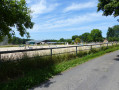
(1) Turn right onto Route du Mont de l’If. Continue straight on along the road which branches off to the left at the dog boarding kennels. Follow this road and ignore the road on the right. 600 metres further on, at the riding school, the road becomes Route des Écuries: follow it for 1 km until you reach the T-junction at Mont de l’If.

(2) Turn left onto Route de l’Église (D 304), pass the church and the cemetery, and go straight on at the first T-junction until you reach a three-way junction. Turn left, still on Route de l’Église, and follow it until it joins the main road (D 5).

(3) Turn right onto Rue d’Yvetot, taking care of the traffic. After about 150 metres, turn left and then left again onto Route du Val au Cesne. Follow the road, passing the pumping station – which is painted with a hunting scene – and the town hall, until you reach the first road on the left.

(4) Take the road leading uphill to the left (D 289). Continue straight on along this road until you reach the village of Betteville. Ride straight through the village, passing the church and the cemetery via the Route d’Épinay, which you should follow for approximately 400 m.

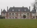
(5) Leave the Route d’Épinay and turn right into the Impasse du Manoir. The manor house and outbuildings are occupied by the company SCA de Carville De Sutter; photographs may be taken with the owner’s permission.
Opposite the manor house, take the path on the left to return to the Route d’Épinay. Turn right, ignore the road branching off to the left and carry on to the next Y-junction.

(6) Continue to the left, still on Route d’Épinay, and ignore the next turn-off to the left. After the hairpin bend to the right, turn left onto the D20 (Rue du Château) and follow this road to the next junction.

(7) Carry on to the right along the D20. At the junction, head straight on into Rue du Village Sud. At the second junction, turn left and then immediately take the first right, Rue de l’Église. Pass, in turn, the church, the cemetery, the Mare Saint-Germain and the oratory by the pond, which is on your left. Continue to the next junction.

(8) Turn right, enter Fréville and continue to the town hall car park (S/E).

Waypoints

  1. S/E : mi 0 - alt. 446 ft - Car park at Fréville Town Hall
  2. 1 : mi 0.32 - alt. 446 ft - Mont de l’If Road
  3. 2 : mi 1.93 - alt. 427 ft - Road to the church
  4. 3 : mi 3.03 - alt. 180 ft - Rue d’Yvetot
  5. 4 : mi 4.13 - alt. 135 ft - D289
  6. 5 : mi 6.08 - alt. 384 ft - Route d’Épinay, Impasse du Manoir
  7. 6 : mi 6.77 - alt. 318 ft - Épinay Road
  8. 7 : mi 8.22 - alt. 367 ft - D20
  9. 8 : mi 9.03 - alt. 387 ft - Fréville Road, D22
  10. S/E : mi 9.77 - alt. 446 ft - Car park at Fréville Town Hall

Worth a visit

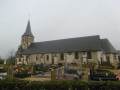
Fréville: Saint-Martin’s Church, the war memorial.

Mont-de-l’If: the Church of the Trinity, a 12th- and 13th-century building, the war memorial, and the cemetery cross.

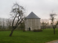
La Folletière: a cross commemorating the church that no longer stands, and the dovecote.

Betteville: Saint-Ouen Church, dating from the 17th, 18th and 19th centuries, though it retains some traces of the 12th century.
The war memorial, the cemetery cross, the Calvary.
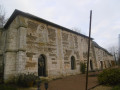
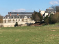
The Betteville Manor House: this building served as the former winter manor house of the monks of Saint-Wandrille from the 11th century onwards. The complex comprises a series of three adjoining buildings, known as the old northern residence, oriented west-east and stretching for nearly 45 metres, built in the 14th and 15th centuries from cut limestone and flint masonry. The first dwelling is probably 14th-century, with a square upper storey and corner buttresses, featuring mullioned windows; its interiors were altered in the 20th century; the second wing is probably from the 15th century, with a square upper storey and mullioned windows; its interiors, which were re-partitioned in the 18th century, feature an upper storey with a barrel-vaulted ceiling; the third building has the same structure, the upper storey of which formed the manor’s chapel. The manor also comprises: a dovecote built of cut stone and flint, dating from 1699 and 1700, a complex of residential buildings and farm buildings erected in the 19th century.

Carville-la-Folletière: the Church of Saint-Germain in Carville-la-Folletière, situated some distance from the village.
The war memorial, the Calvary on the road to Fréville (D 22), the Mare Saint-Germain and the oratory by the pond.

Reviews and comments

4.5 / 5
Based on 2 reviews

Reliability of the description
5 / 5
Ease of following the route
4.5 / 5
Route interest
4 / 5
Laurent R.
Laurent R.

Overall rating : 4.7 / 5

Date of your route : Dec 05, 2021
Reliability of the description : ★★★★★ Very good
Ease of following the route : ★★★★★ Very good
Route interest : ★★★★☆ Good
Very busy route : No

Hello,
The route consists of 90 per cent very narrow roads, so there is very little traffic; there is just one rather unpleasant section crossing the D5 and CD 89 to La Folletière, which are quite busy (the D5 is constantly busy, whilst the CD 89 has around four cars on the stretch).
Ideal for winter rides if you want to avoid muddy tracks whilst still enjoying the typical Normandy countryside and villages.
On the Fréville plateau, it’s quite windy, so make sure you’re prepared for it.

Completed in the rain and wind in 2 hours 40 minutes without a break.
Laurent

Machine-translated

benoitrando
benoitrando

It’s true that the route is entirely on tarmac. At the moment, I’m looking for footpaths, tracks and the like to put together a route – still around Fréville – with as little tarmac as possible. As some of these paths are on private land, I’m either in discussion with the owners or trying to track them down.
Thank you, manu7612, for your comment.

Machine-translated

manu7612
manu7612

Overall rating : 4.3 / 5

Date of your route : Jan 27, 2020
Reliability of the description : ★★★★★ Very good
Ease of following the route : ★★★★☆ Good
Route interest : ★★★★☆ Good

A walk on 26 January in the sunshine!
There are some lovely little villages to explore, with charming manor houses.
It’s a shame that the route follows roads for the entire walk;

Machine-translated

Other walks in the area

For more walks, use our search engine .

The GPS track and description are the property of this route's author. Please do not copy them without permission.