Country:

 City:
City:


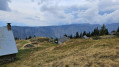
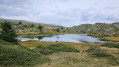
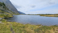
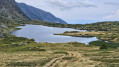
From La Séchilienne, follow the D114 towards the village of La Morte, then turn off onto the D114E, Route du Poursollet. Park in the car park at the end of the road (chalets).
(S/E) Set off eastwards and go through the barrier. You’ll immediately come to a Fork in the road and a signpost.
(1) Follow the path on the right (the one on the left is the return route) towards the chalets. Take a detour to the shore of Lac de Poursollet, then rejoin the path at a footbridge. On leaving the hamlet, turn left towards the east and pass the signposts for “Buvette (1,665 m)” and “Pied du Petit Taillefer (1,655 m)” in turn. Follow the signs for the Plateau des Lacs, marked with red and white markings on the GR®50. The path starts off gently through the forest, but after crossing the Ruisseau de Taillefer, it becomes steeper and the gradient increasingly steep. You’ll reach a Y-junction and a signpost for “Dessus de la Sagne (2008 m)”.
(2) Turn right towards the Plateau des Lacs. You’ll reach a Y-junction with a signpost for “Sous le Rocher Culasson (2,084 m)”.
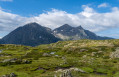
(3) Turn left, still heading towards the Plateau des Lacs. Reach the summit. Admire the view. Follow the level path that runs eastwards alongside the Taillefer.
(4) On the left, a dry lake bed filled with tall grass. A little further on, you’ll catch a glimpse of the southern end of Lac Fourchu, which you’ll come to later. On the right, look out for a waterfall on the heights and, below it, Lac de Culasson. You’ll reach a signpost marked “Plateau des Lacs (2,068 m)”.
(5) Continue eastwards towards Lac Noir. You’ll soon catch sight of this lake and, behind it, Lac de l’Agneau. You’ll reach the signpost marked “Lac Noir (2039 m)”. The scenery is magnificent.
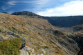
(6) Continue towards the Refuge du Taillefer. You’ll catch sight of Lac de la Veche. Then, amidst a landscape of northern tundra, follow the path that runs alongside a stream flowing from the lake. Opposite, in the distance, lies the Oisans Valley. Cross a few rocks using a fixed cable, then reach a Y-junction and a signpost for “La Jasse (2,010 m)”.
(7) Turn left towards Pas de l’Envious for an easy climb. Reach the summit at an X-shaped junction with a signpost marked ‘Pas de l’Envious (2,072 m)’. Note the Refuge du Taillefer on the right, with a few yurts set up for walkers.
(8) Follow thefirst path on the left (Yellow Cross) for a climb through the rocks. The descent is magnificent, with a bird’s-eye view of Lac Fourchu. Walk round the lake on the left-hand side.
(9) At the southern end, take a short detour to two small lakes, then rejoin the path as close as possible to Lac Fourchu.
(10) Wade across a lake overgrown with aquatic plants, then continue along Lac Fourchu. You’ll reach the northern end of the lake and a Y-junction.
(11) Keep to the left, heading north. On your right, you’ll see a small lake completely covered in reeds. Keep heading north until you reach Lac Canard and a Y-junction.
(12) Keep to the right along the lake. The path climbs and then branches off to the left. You’ll reach a small headland.
(13) Head down to the far left near the rocks. The path, which is sometimes overgrown with branches, then turns right alongside a stream bed. You’ll reach the valley at a T-junction and a signpost for “La Valette (1976 m)”.
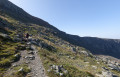
(14) Turn left towards La Barrière. Follow the path along the mountainside overlooking the magnificent Ruisseau de Rioupéroux. You’ll reach the Chalets de la Barrière de Clavaux and a signpost for “Chalets de la Barrière (1,873 m)”.
(15) Head left towards Lac de Poursollet. Cross a bridge over the stream, pass a memorial stone and follow the forest track which descends gently through the woods. You will arrive next to a large grassy area, the Pré d’Ornon, and a signpost marked “Pré d’Ornon (1,824 m)”.
(16) Continue along a path to the left, heading east towards Lac de Poursolet. Further on, you’ll reach the junction from the outward journey.
(1) Carry on straight ahead to return to the car park (S/E)

 Visorando Member
 Very difficult
 Difficult