Country:
 City:
City:


The route starts at Place du Maréchal Lyautey in Carnoux-en-Provence, situated directly opposite the town hall and near the church.
(S/E) Walk up Avenue du Mont Fleuri to a leisure area situated on the bend. Climb the few steps.
(1) Turn slightly to the right, leaving the return path on your left. Walk for about a hundred metres. Look for the ‘Sentier botanique’ signpost and begin the climb up a gentle, shaded slope, which then winds in hairpin bends; ignore any side paths until you reach the summit.
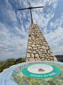
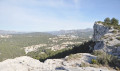
(2) When you reach the cross, take a look at the orientation board, then head back down to the right and join a track.
(3) Follow the track straight ahead, heading west, for about 1 km.
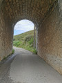
(4) Take a path leading down to the left, towards the south, marked by a Yellow Cross and just before a stone arch. It runs alongside a railway tunnel, which explains the ventilation shafts dotted along it.
(5) Continue along the path on the left. You’ll reach a vineyard running alongside the railway line and then the station.
(6) Go through a gate and follow the road straight on to a junction, turn left and go under the railway bridge. Follow the road marked by the PR® sign up to a waste collection centre.
(7) Follow the track to the right for 1,500 metres.
(8) Leave the track to the left just before a housing estate. The path runs alongside some houses. Continue straight on.
(9) Turn right then left to leave the track and walk past some sheds on the left. Continue along the road heading north for 200 metres.
(10) Turn left into the woodland and follow the path, veering to the right. Return to a track.
(11) Follow it to the left, heading west. Turn right at the junction. Join the path leading to the entrance of the leisure area.
(1) Follow the route back in the opposite direction to the way you came, towards the car park (S/E).
 Visorando Member
 Association / Club / Walk leader
 Moderate