


 Country:

 City:
City:


Park in the designated spaces near the church.
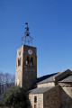
(S/E) Head towards the Church of Sainte-Marie de Corneilla, a jewel of Catalan Romanesque art. Follow the path down to the right, passing a fountain. Cross the Ribera de Fillols and head back up the other side. Follow the yellow markings, which run alongside the tarmac access road to a property before veering right and reaching a junction.
(1) Set off straight ahead and diagonally to the right onto a path that runs more or less parallel to another path on the left, eventually joining it further up.
(2) Continue uphill to the right until you reach the crossroads at Roc Ampla.
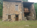
(3) Turn left and head towards the old ruined farmhouse at Cortal de les Baixes.
(4) Immediately afterwards, leave the path by turning left towards a copse where you will find several rocks with cup marks.
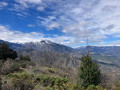
(5) Return to the track and head off to the left. Walk past a ruined farmhouse with a dried-up spring, keep to the left at the three-way junction and continue to the El Serrat junction. Turn left for a panoramic view of Villefranche-de-Conflent and the Têt Valley.
(6) Turn back and rejoin the route to the left. Follow the track, passing the old talc quarries, then take the path on the left until you reach the sign for “Bergerie”.
(7) Turn left. At the next junction with a signpost, take the small path on the left which leads to an old Romanesque sheepfold (Orri or Cabane d’Ambullà), unique in terms of its architecture and size. This old sheepfold was used to store milk after milking and for cheese-making.
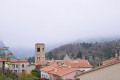
(8) Return to the path and head left towards the second viewpoint, which offers a breathtaking view of the Têt Valley. You’ll be overlooking Villefranche-de-Conflent, with views of Fort Libéria and the departure station of the ‘Petit Train Jaune’.
(9) Head back along the path in the opposite direction.
(7) Turn left and continue to the next junction, where there is a sign pointing towards Villefranche-de-Conflent and La Redoute.
(10) Turn left and walk for about 600 m.
(11) Leave the Villefranche-de-Conflent path and turn right onto the very narrow path to La Redoute. Pass a cave on the right (closed to the public) and continue along the path, which winds upwards at a steady gradient: admire the magnificent scenery featuring the three chapels.
Reach the Bastion d’en Bullà.This military fortification, dating from the mid-19th century, housed several artillery pieces that were used in the event of conflict. Beautiful panoramic views over the Conflent.
(12) Begin the descent, then turn off to the right. After about 300 metres, a small path on the right leads to a dry cistern housed in a shelter, the Font de la Perdiu. It was used to supply the redoubt.
(13) Return to the track by turning right and head down to a T-junction with another track.
(14) Turn left towards Camp del Gascó.
(15) Turn right onto the small path that climbs through the pine trees. You’ll reach a fork on the plateau.
(16) Turn right, join a track at a bend and head left. Keep to the right at the three-way junction ahead and continue for about a hundred metres. Then leave the track and take a path on the right leading to the junction with another track.
(17) Turn left, reach the Dolmen d’en Perot and continue along the track. At the inverted Y-shaped junction, carry on in the same direction until you reach a Canadian gate.
(18) Immediately turn right onto the small path (yellow markings). Join the uphill path.
(3) Turn left onto it, going in the opposite direction to the outward journey, and head towards a junction you passed on the way out.
(2) Head straight on towards the three orris. After the last one, you’ll likely spot an ancient dolmen with numerous cup marks and other engravings. Continue downhill to reach the first junction you passed on the way up.
(1) Head straight on to return to the Church of Sainte-Marie de Conflent , enjoying the lovely views over the village. Finally, turn left to return to the car park (S/E).


 Visorando Member
 Easy
Easy 
 Difficult
