Country:

 City:
City:


Head to the end of Vernet-les-Bains. Pass the road bridge leading to the spa and ignore the road heading up to Casteil. Turn round at the long roundabout and head straight up to the right along Avenue des Thermes, then take the first road on the right towards Fillols. There is a car park on the left, another car park on the left a little further on, or you can park after the right-hand bend at the very top.
See practical information
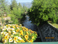
(S/E) Before the cemetery, head down to the left along theGRP® marked in yellow and red. Cross the large footbridge over the Ruisseau Saint-Vincent.
(1) Leave theGRP® and head right along the stream, following the yellow markings.
After about 80 m, turn left at a signpost and follow the yellow markings.
Cross the D27, which has very little traffic (signposts: Refuge de Bonaigua*).
Continue climbing along a track to a clear area at an elevation of 793 metres, where you’ll find signposts.
(2) Head straight up to the right along a steep path.
After a gruelling climb, you’ll reach the open area of La Portella de Dalt (pass, upper pass).
(3) Turn right for a round trip to the Henri Barbusse Maquis Monument. A very beautiful viewpoint.
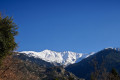
Return to the fork and continue climbing towards a lovely orri (1,215 m) along the beautiful path. Stunning views of the mountain range to the right. Reach another fork (elevation 1,434).
(4) At the wooden signpost, turn left, following the path up a very steep climb. Ignore the sign for Bonne Aigue opposite.
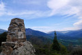
Reach the highest point of the walk at a small pass (altitude 1,503). A lovely spot. Stunning panoramic views.
Head down towards the north-east and pass the Fontaine de la Barraqueta (no water on 10 February 2022). The path then climbs slightly before levelling out almost completely.
You’ll reach another fork in a vast flat area at Coll de Cogulló (elevation 1,494).
(5) Ignore the first path leading uphill to the right (steel signpost). Continue for 20 metres straight ahead to another signpost with a letterbox attached.
From here, it is possible to take a north-westerly round trip to the Pic de Cogullò outcrop, where you’ll find the Catalan flag and a superb panoramic view.
Return to the pass and then head down to the right through the forest towards Fillols.
Please note: Allow an hour and a half to reach the village, contrary to what is stated.
Take care on the first few metres, which may be icy in winter and where there is a small slab to descend. You’ll reach another junction at a signpost.
(6) Continue down to the right towards Fillols until you reach a small clearing with paths leading in four directions.
(7) Take care. At the first fork, ignore the path on the right towards Coll de Voltes.
Carry on for about twenty metres until you reach the second fork. Ignore the path leading straight ahead on level ground. Turn right, heading downhill towards Fillols, due west. You’ll reach another fork (elevation 833).
(8) Continue to the right along the track, heading north-west. Ford the Ribera de Fillols. A little further on, turn left onto Rue du Commandant Constantin.
(9) Join theGRP® trail again, marked with yellow and red signs. Turn left onto Carrer del Riu (Rue du Ruisseau). Cross the D27, which has very little traffic. Turn into the first street on the right towards Saint-Félix Church and the village square. A lovely spot for a break, with a bistro and a café-restaurant.
(10) Turn round to return to Carrer del Riu and head right, walking slightly downhill.
(11) Turn left and cross the narrow road bridge over the Ribera de Fillols, following the GRP®. This will take you to the D27 (the road from Vernet to Fillols); follow it to the right for 300 m.
(12) Leave the D27 and head up to the left along the wide path marked by the GRP®. Soon, ignore a path branching off to the left and continue along theGRP® to reach Coll Vell (elevation 845).
(13) Descend straight ahead, still following the GRP®. Join the D27 and follow it to the left for 50 m.
(14) Leave the road and turn right onto the wide path with wooden steps. You’ll come to the long footbridge over the Ruisseau Saint-Vincent.
(1) Cross this footbridge and continue straight ahead to return to the car park (S/E).

 Visorando Member

 Easy
Easy 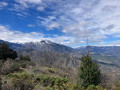
 Difficult