Country:

 City:
City:


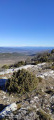
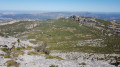
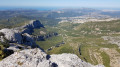
Park in the Brasque car park, well known to hikers in Plan d'Aups.
(S/E) Take theGRP®2013Marseille Provence Métropole trail eastwards, leaving it at the entrance to Plan-d'Aups to reach the crossroads with the Chemin de l'Ubac.
(1) Take it on the right, following the houses of Ubac. You will reach a crossroads with several directions.
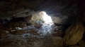
(2) Turn almost 90° left onto a nearly flat track. Pass in front of a cave, overlooking the Pas de Roubaud neighbourhood. Then join the Chemin des Braconniers.
(3) Take the small path on the left, continue and start a fairly steep climb towards the top of the Sainte-Baume plateau. Some sections require the use of your hands, but nothing impossible. Follow the signs at the start of the path carefully so as not to miss the trail, which is well marked thereafter. You will come out on the ridge at the junction withthe GR® 98.
(4) Turn right heading west towards the antennas and telecommunications masts. Follow the GR° to the Col du Fauge.
(5) Leave theGR®98here, turning right towards the north and then west until you reach the tarmac road.
(6) Take this road on the left to reach the Pic de Bertagne and its famous dome.
(7) Follow the road to the previous crossroads.
(6) Turn left to access a fairly technical descent to the Col de Bretagne, where you will also join the Vallon du Chemin de Fer.
(8) Take theGRP® 2013 Marseille Provence on the right. Follow it to the Brasque car park (S/E).



 Visorando Member

 Easy
Easy  Association / Club / Walk leader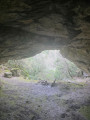
 Very difficult
 Difficult