Pic de Bertagne and Grande Baume

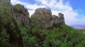
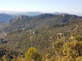
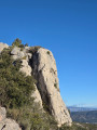
A slightly less challenging variation on one of my previous walks, which will take you to two ‘landmarks’ of the Sainte-Baume massif: the Pic de Bertagne and the Grande Baume.

Details

41105184
Creation:
Last update:
Last review:
  • Walking
    Activity: Walking
  • ↔
    Distance: 4.54 mi
  • ◔
    Average duration: 3h 30 
  • ▲
    Difficulty: Moderate

  • ⚐
    Back to start: Yes
  • ↗
    Ascent: + 1,634 ft
  • ↘
    Descent: - 1,654 ft

  • ▲
    Highest point: 3,389 ft
  • ▼
    Lowest point: 2,159 ft

Description of the walk

The start is roughly two-thirds of the way up the climb to Espigoulier from Gémenos, 2 km before the Col de l’Espigoulier. There are only a few parking spaces available here, so car-sharing is essential!

(S/E) A track with a barrier marks the start of this walk. Head straight east for 300 m.

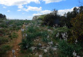
(1) On the left, after a meadow, look for a small path that climbs northwards. It is marked from time to time by purple dots. The path winds its way sometimes through the bushes, sometimes between the trees. Join aPR® signpost.

(2) Head up to the right, towards the east, and reach the Col de Bertagne.

(3) Continue eastwards. Follow the yellow markings. The path is sometimes a little hard to follow, but you can’t go wrong. You’ll arrive at the foot of the Pic de Bertagne, near a monument erected in memory of hikers from Marseille.

(4) Begin the ascent to the peak via a well-signposted path. The climb is strenuous, particularly in the second half, and in places the markings are not very clear. At the top, join the road.

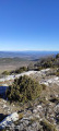
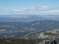
(5) Turn right towards the clearly visible dome to the west. Go round the civil aviation buildings on the left, following the yellow markings. Head for the viewpoint.

(6) Retrace your steps to the previous junction.

(5) Take the path heading due east to reach the Col du Fauge.

(7) Take the path on the right towards the Col de Bertagne and the Saint Pons Valley. Head downhill, keeping well to the right as the path is sometimes difficult. You’ll reach a fork.

(8) Climb up to the right, follow the foot of the Pic de Bertagne for 600 m and join theGRP® Marseille-Provence-Métropole.

(4) Retrace your steps along the path you took on the way out and arrive at the Col de Bertagne, which you passed earlier.

(3) Head down to the left, towards the south-west in the direction of Grande Baume, until you reach a fork in the path.

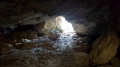
(9) Turn off to the right, heading due west, reach the cave and go through it. The path emerges on the other side. Continue for 400 m.

(10) Turn right, then left, to return to the original fork.

(S/E) Carry on straight ahead and return to the gate to get back to the car park (S/E).

Waypoints

  1. S/E : mi 0 - alt. 2,192 ft - Barrier
  2. 1 : mi 0.12 - alt. 2,175 ft - Crossroads at the end of the circular loop
  3. 2 : mi 0.55 - alt. 2,589 ft - Path on the right
  4. 3 : mi 1.06 - alt. 2,835 ft - Col de Bertagne
  5. 4 : mi 1.32 - alt. 2,864 ft - Monument. Common junction for the out-and-back route
  6. 5 : mi 1.65 - alt. 3,307 ft - T-junction (out and back) – panoramic view
  7. 6 : mi 1.87 - alt. 3,389 ft - Panorama
  8. 7 : mi 2.34 - alt. 3,173 ft - Col du Fauge (967m)
  9. 8 : mi 2.87 - alt. 2,575 ft - Path on the right
  10. 9 : mi 4 - alt. 2,425 ft - Cave
  11. 10 : mi 4.27 - alt. 2,172 ft - Path on the right
  12. S/E : mi 4.54 - alt. 2,192 ft - Car park

Always be cautious and plan ahead when you're outdoors. Visorando and the author of this route cannot be held responsible for any accidents occurring on this route.

The GR® and PR® markings are the intellectual property of the Fédération Française de Randonnée Pédestre.

Reviews and comments

4.6 / 5
Based on 3 reviews

Reliability of the description
4.7 / 5
Ease of following the route
4.3 / 5
Route interest
4.7 / 5
anne-marie 13
anne-marie 13

Overall rating : 5 / 5

Date of your route : Apr 11, 2026
Reliability of the description : ★★★★★ Very good
Ease of following the route : ★★★★★ Very good
Route interest : ★★★★★ Very good
Very busy route : No

The Grande Baume is stunning; walking through it gives this hike a unique character, and the view from the Pic de Bertagne is magnificent

Machine-translated

Lapinos13
Lapinos13

Overall rating : 4 / 5

Date of your route : Feb 20, 2025
Reliability of the description : ★★★★☆ Good
Ease of following the route : ★★★★☆ Good
Route interest : ★★★★☆ Good
Very busy route : No

After the Col de Fauge, heading towards the Col de Bertagne, you can descend to a large ice house, then climb back up to the pass via another path.
A major disappointment: the ice house has been enclosed by an impassable fence (which is understandable for safety reasons).
The part visible above ground does not allow one to appreciate the scale of the structure, nor its considerable depth. Furthermore, the large information board has not been put back up. The effort involved in visiting it is therefore no longer justified.

Machine-translated

ulysse13
ulysse13

Overall rating : 4.7 / 5

Date of your route : Nov 27, 2023
Reliability of the description : ★★★★★ Very good
Ease of following the route : ★★★★☆ Good
Route interest : ★★★★★ Very good
Very busy route : Yes

Hello,

A very pleasant walk. Thank goodness there were those purple markers at the start to confirm we were heading in the right direction. These purple markers really ought to be reinforced and repainted...

Machine-translated

Other walks in the area

For more walks, use our search engine .

The GPS track and description are the property of this route's author. Please do not copy them without permission.