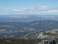
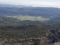
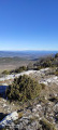
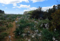
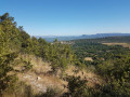
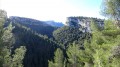
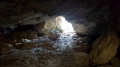
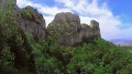
Glacière and Pic de Bertagne as seen from Plan d’Aups

A short walk with no major difficulties, apart from the direct descent on the return leg, which is a little steep but not dangerous. The views over the Bay of Marseille, Cassis, Sainte-Victoire and the Var are magnificent. For those who enjoy the dry cold: best done in the mistral in winter.

Details

1368532
Creation:
Last update:
Last review:
  • Walking
    Activity: Walking
  • ↔
    Distance: 5.07 mi
  • ◔
    Average duration: 4h 00 
  • ▲
    Difficulty: Moderate

  • ⚐
    Back to start: Yes
  • ↗
    Ascent: + 1,965 ft
  • ↘
    Descent: - 1,959 ft

  • ▲
    Highest point: 3,366 ft
  • ▼
    Lowest point: 2,077 ft

Photos

Description of the walk

Park at the Brasque car park.

(S/E) From the barrier blocking the Route de la Brasque – the tarmac road leading up to the Sainte-Baume ridge – follow the road uphill until you reach the first hairpin bend, which turns left.

(1) At the Col de Bertagne hairpin bend, several paths cross. Take the track directly opposite, heading downhill (yellow signs pointing towards the ice house).

(2) Leave the path that follows the contour lines to your left and take the track that descends steeply down the slope towards the ice house.

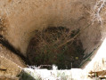
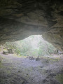
(3) Enjoy the coolness of the woodland and the old ruined ice house. Be careful not to get too close – the drop is about twenty metres and the broken dome overhangs the path. Take the path that descends towards the valley to the east of the ice house.

(4) At the hairpin bend, leave the path and head left, following a track that climbs directly up the valley floor towards the Col du Fauge.

(5) Climb up the ridge on the right to join the higher, more direct (but less shaded) path. This area has recently experienced a significant rockfall, which has disrupted the path. Follow the valley uphill without difficulty.

(6) As you approach the Col du Fauge, head straight left towards the access road to the radar station: the rocky ridges are low and pose no danger.

(7) Take the road on the left and go round the military fence on the left to enjoy the view to the west.

(8) After stopping to take in the view at the Pic de Bertagne, retrace your steps.

(7) Turn left. The Huveaune valley stretches westwards as far as Marseille.On mistral days, the view across the whole region is superb, from Sainte-Victoire in the north to the hills of the Var in the south-east.

(9) As you head down the road, keep an eye out on the left for a signposted path leading back north. You’ll need to navigate some boulders, but it’s not difficult. The descent is a little steep but the path is clearly marked. You’ll need sure-footedness to reach the Col de Bertagne directly, or you’ll need to descend very slowly.

(1) At the Col de Bertagne, join the road and, following the reverse route of the outward journey, return to the Brasque car park (S/E).


Waypoints

  1. S/E : mi 0 - alt. 2,257 ft - La Brasque car park
  2. 1 : mi 1.18 - alt. 2,835 ft - Col de Bertagne
  3. 2 : mi 1.42 - alt. 2,736 ft - Steep descent towards the ice house
  4. 3 : mi 1.94 - alt. 2,142 ft - The ice house
  5. 4 : mi 2.18 - alt. 2,087 ft - Bottom of the valley
  6. 5 : mi 2.41 - alt. 2,575 ft - Area affected by recent rockfalls
  7. 6 : mi 2.84 - alt. 3,150 ft - Junction before the Col du Fauge
  8. 7 : mi 3.02 - alt. 3,297 ft - Access to the peak
  9. 8 : mi 3.27 - alt. 3,271 ft - Pic de Bertagne
  10. 9 : mi 3.61 - alt. 3,258 ft - North-facing descent
  11. S/E : mi 5.07 - alt. 2,254 ft - La Brasque car park

Reviews and comments

4.2 / 5
Based on 3 reviews

Reliability of the description
4 / 5
Ease of following the route
4 / 5
Route interest
4.7 / 5
User 24629313

Overall rating : 4.3 / 5

Date of your route : Apr 19, 2026
Reliability of the description : ★★★★☆ Good
Ease of following the route : ★★★★☆ Good
Route interest : ★★★★★ Very good
Very busy route : No

Stunning views from the summit of Pic de Bertagne: on one side, the Mediterranean with the bays of Bandol and La Ciotat (you can even see the cranes), the harbour and the city of Marseille; on the other side, the first snow-capped peaks of the Alps. The ice house is an important historical landmark, as this is where ice was stored before being transported down to Marseille at night.

When you leave the ice house to tackle the climb up to the Col du Fauge, make sure you follow the path carefully as the Pic de Bertagne is signposted in the opposite direction.

And I agree with the previous comments: the descents and ascents are quite steep, though not insurmountable; you sometimes need to use your hands.

Finally, in spring, asphodels and wild irises add to the pleasure of the walk.

Christophe.

Machine-translated

ACAHIER
ACAHIER

Overall rating : 5 / 5

Date of your route : Mar 30, 2026
Reliability of the description : Not used / Not applicable
Ease of following the route : Not used / Not applicable
Route interest : ★★★★★ Very good
Very busy route : No

We went on this hike on Monday 30 March 2026. It’s a lovely hike, and the scenery is stunning. We started by following the forest road, which is closed to traffic, then descended towards the ice house – a real treat. We then climbed along a path that ran mostly through the woods, up to the ridge. From the summit, the view is magnificent! You can see the sea and, above all, the snow-capped peaks of the Alps. You look out over the green hills and valleys. The wind was very strong and made us lose our balance, so we decided to head back down via the road. Thank you for this lovely route.

Machine-translated

fluellen83
fluellen83
• Edited:

Overall rating : 4 / 5

Date of your route : Apr 24, 2020
Reliability of the description : ★★★★☆ Good
Ease of following the route : ★★★★☆ Good
Route interest : ★★★★☆ Good
Very busy route : No

I’ve had the chance to do this route a few times. It’s not recommended for everyone as the slopes are very steep and quite rocky. Especially the descent from Pic de Bertagne, which requires a good sense of balance and strong thighs as it’s a steep drop.
Best done on a day when the weather is fine, not too hot as there is a long climb in full sun, with no wind as up there you can lose your balance on the rocks during the descent, and with clear skies to enjoy a magnificent panorama over much of Provence, from the coast to Le Dévoluy.
Note that it is possible to avoid the descent from Bertagne via the path by taking the small road that leads down to the same spot.

Machine-translated

Other walks in the area

For more walks, use our search engine .

The GPS track and description are the property of this route's author. Please do not copy them without permission.