From Martin Beach to Rosaires Beach

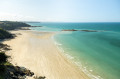
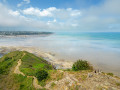
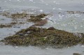
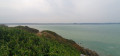
Walk from Martin Beach to La Celle-des-Rosaires via the coastal path. Enjoy the large beach at Les Rosaires or Martin Beach. Superb panoramic views overlooking the sea.

Details

n°35001048
Creation:
Last update:
Last review:
  • Walking
    Activity: Walking
  • ↔
    Distance: 4.30 mi
  • ◔
    Average duration: 2h 20 
  • ▲
    Difficulty: Easy

  • ⚐
    Back to start: Yes
  • ↗
    Ascent: + 427 ft
  • ↘
    Descent: - 423 ft

  • ▲
    Highest point: 256 ft
  • ▼
    Lowest point: 10 ft
  • ⚐ Country: France
  • ⚐ City: Plérin (22190)
  • ⚑
    Start/End: N 48.556359° / W 2.72642°
  • ❏
    IGN map(s): Ref. 0916OT
  • Hour-by-hour weather

Photos

Description of the walk

Martin Plage car park, Rue du Port Martin.

(S/E) On leaving the car park, on the beach side, take Rue du Port Martin, the road that climbs, following the red and white GR® markings. Continue to the junction at the top.

(1) Turn right into the housing estate, then left to follow the GR®. Walk past the Pointe des Tablettes and the Rocher Guérinet, then carry on straight ahead to reach Plage des Rosaires. You can either walk along the beach to the Rocher du Poissonnet, located at the far end, or take the Boulevard de Cornouaille.

(2) Once you reach the end, turn round and retrace your steps in the opposite direction to return to the starting car park (S/E).

Waypoints

  1. S/E : mi 0 - alt. 26 ft - Martin Plage car park
  2. 1 : mi 0.23 - alt. 174 ft - Access to the housing estate
  3. 2 : mi 2.11 - alt. 30 ft - Rocher du Poissonnet
  4. S/E : mi 4.3 - alt. 26 ft - Martin Plage car park

Notes

A pleasant little walk that requires no special equipment.
Please follow the route on the Visorando app.

Always be cautious and plan ahead when you're outdoors. Visorando and the author of this route cannot be held responsible for any accidents occurring on this route.

The GR® and PR® markings are the intellectual property of the Fédération Française de Randonnée Pédestre.

Reviews and comments

5 / 5
Based on 1 review

Reliability of the description
5 / 5
Ease of following the route
5 / 5
Route interest
5 / 5
KarLKoX
KarLKoX
• Edited:

Hike completed yesterday.
There were a few climbs and descents, one of which was a bit steep, but apart from that, the route was fairly accessible.
It's worth noting that when I arrived at the beach, I got the impression that it was a naturist beach... or maybe people are just very relaxed around here

Machine-translated

Laurent49450
Laurent49450

Overall rating : 5 / 5

Date of your route : Aug 05, 2024
Reliability of the description : ★★★★★ Very good
Ease of following the route : ★★★★★ Very good
Route interest : ★★★★★ Very good
Very busy route : Yes

Lots of climbs and descents. And beautiful scenery. Well worth a go.

Machine-translated

Other walks in the area

For more walks, use our search engine .

The GPS track and description are the property of this route's author. Please do not copy them without permission.