Country:
 City:
City:


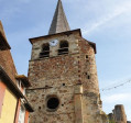
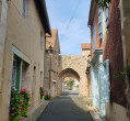
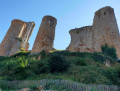
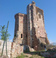
To get to the start, head towards the village of Hérisson. The car park is located on Quai de l’Aumance.
(S/E) With your back to the river, start by heading right towards the north-east, cross the bridge over the Aumance, then turn immediately right into Rue du Calvaire. At the end of the street, head down to the riverbank and follow the riverside path to the left as far as the old communal washhouse. Cross the stream and walk round the pond.
Follow the path which veers sharply to the left, through the municipal park, to the state school.
Cross the Route de Crochepot, then head straight on along the tree-lined path and follow it to Chemin les Coteaux.
(1) You’ll find yourself facing a blue building called ‘Le Cube’. Turn right, follow the tarmac road until you reach the entrance to the path that leads into the woods on the left (marked with yellow signs).
Follow the steep little path running alongside the stream until you reach the Crochepot plain. Continue to follow this stream until you reach the riverside path. Facing the Aumance, turn right and walk alongside the river until you reach the junction with the Crochepot road at the ford.
(2) Turn right to head up the tarmac road to the entrance of the municipal campsite. Turn left to cross the campsite and reach the reception building. From here, turn right towards the municipal park.
At the end of the long tree-lined avenue, turn left to reach the footbridge spanning the Aumance. Cross the river and carry on straight ahead along Avenue Marcellin Simonnet. At the end, veer left to reach the church.
(3) Opposite the church, turn left onto Chemin de la Maison Rouge, following the signs for the Chateloy tourist trail. Walk uphill for about 250 metres, then at the junction, take a sharp right-hand bend heading south-east.
At the first bend, carry on straight ahead, pass a reservoir and continue to the inverted Y-junction. Turn right towards the south-west, onto Rue du Casse Cou. Continue downhill to Rue Cacheloup.
(4) Cross this street and, almost directly opposite, follow the signpost indicating the entrance to the castle. Walk through the park and the ruins, then leave the park via the western exit to find yourself on Rue Fougières de Nicolaï. Turn left.
(5) Cross Rue Gambetta, walk to the left of the tower, then past the medieval inn on Rue Saint-Jean. Head diagonally to the right onto Rue de l’Enfer, where you can see the arched gateway at the end. Before reaching it, turn left to stroll through the narrow little streets and arrive at Rue de l’Abbé Aury.
Turn right until you reach Rue du Quai de l’Aumance, where you’ll find the car park on your right (S/E).

 Visorando Member
 Moderate