Paths through the two villages and forest tracks starting from Meaulne-Vitray

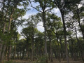
These two villages now form a single municipality. As you make your way from one village to the other, you’ll discover little-known paths that contrast with the wide, straight forest tracks of the Tronçais Forest. Nevertheless, these long forest tracks will surprise you with the varied landscapes offered by the Tronçais Forest at every stage of its management.

Details

3584436
Creation:
Last update:
Last review:
  • Walking
    Activity: Walking
  • ↔
    Distance: 9.44 mi
  • ◔
    Average duration: 4h 45 
  • ▲
    Difficulty: Moderate

  • ⚐
    Back to start: Yes
  • ↗
    Ascent: + 469 ft
  • ↘
    Descent: - 449 ft

  • ▲
    Highest point: 1,020 ft
  • ▼
    Lowest point: 584 ft
  • ⚐ Country: France
  • ⚐ City: Meaulne (03360)
  • ⚑
    Start/End: N 46.599178° / E 2.639278°
  • ❏
    IGN map(s): Ref. 2426SB, 2427SB
  • Hour-by-hour weather

Photos

Description of the walk

Park at the forest car park, on the way out of the hamlet of Dagouret.

(S/E) Head due north along theGR®303towards the Roman camp: Le Thureau De Châtelus. Continue along theGR® until you reach the hamlet of Dagouret.

(1) Leave theGR® and stay on the path on the right. At the ‘Stop’ sign, cross the road and the bridge, then turn right, following the GR® again.

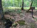
(2) At the three-way junction, take the path on your right and follow it until you reach the crossroads by a fountain.

(3) Head back down the village road towards the hamlet of Les Aulmes, heading for Vitray. After crossing the Fay stream, you’ll reach another junction; continue left onto the road.

(4) Turn left onto the path, which is barely visible from the road but well-maintained. Cross the Fay stream again and arrive at the hamlet of Les Arpents at the junction with the D247.

(5) Turn left here and follow this road for about a hundred metres until you reach the Route Forestière du Pont-Cassé, which you follow to the right. You’ll reach the junction with the Ligne de la Galèze.

(6) Here, let theGR® head off to the left and carry on straight ahead along the Route Forestière du Pont-Cassé until you reach a five-way junction.

(7) Take thesecond pathon the right, situated between plots 380 and 381, and follow the Ligne du Haut du Parc, which you take for about a hundred metres to the right.

(8) Take the path heading left towards plot 377 and join the Route forestière de la Bouteille. Turn right and pass close to the Cerfs observatory on the Palonnière; continue for a few hundred metres more and you will reach the Rond de la Croix de Vitray (elevation 288). Cross the road and continue straight ahead along the Route forestière de la Bouteille to the Rond de Vitray.

(9) Turn right onto the ‘Voie Forestière du Ris-Sangliers’ and you’ll come out onto a local road.

(10) Cross it, heading uphill to the left. A few dozen metres further on, take another forest track on the right. You’ll reach the D312 (elevation 296). Head downhill to the right until you reach the hamlet of Le Bouchant. Turn right onto theGR®303to quickly reach the car park at the forest car park (S/E).

Waypoints

  1. S/E : mi 0 - alt. 833 ft - Place Forestière car park
  2. 1 : mi 0.72 - alt. 712 ft - Chemin de Dagouret
  3. 2 : mi 1.31 - alt. 604 ft - Three-way junction
  4. 3 : mi 1.92 - alt. 669 ft - Return to the local road
  5. 4 : mi 2.29 - alt. 676 ft - Path on the left
  6. 5 : mi 2.93 - alt. 791 ft - Croisement des Arpents
  7. 6 : mi 3.76 - alt. 866 ft - Ligne de la Galèze crossroads
  8. 7 : mi 4.74 - alt. 830 ft - Path between plots 380–381
  9. 8 : mi 5.25 - alt. 856 ft - Path running alongside plot 377
  10. 9 : mi 7.11 - alt. 1,020 ft - Rond de Vitray
  11. 10 : mi 8.36 - alt. 965 ft - Junction of the local road and the forest track
  12. S/E : mi 9.44 - alt. 833 ft - Place Forestière car park

Worth a visit

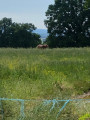
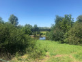
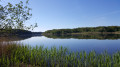
(1) You may spot a few roe deer by the pond.
With a short detour, you can visit the Châtelus Thureau and the deer observatory in Palonnière.

Always be cautious and plan ahead when you're outdoors. Visorando and the author of this route cannot be held responsible for any accidents occurring on this route.

The GR® and PR® markings are the intellectual property of the Fédération Française de Randonnée Pédestre.

Reviews and comments

4.5 / 5
Based on 2 reviews

Reliability of the description
5 / 5
Ease of following the route
5 / 5
Route interest
3.5 / 5
lamaignere
lamaignere

Overall rating : 4.3 / 5

Date of your route : Jul 14, 2025
Reliability of the description : ★★★★★ Very good
Ease of following the route : ★★★★★ Very good
Route interest : ★★★☆☆ Average
Very busy route : No

Many straight forest roads, rather boring.

Machine-translated

saacha007
saacha007

Hello, I live in the mid-range mountains and love forests and hiking at altitude. I'm spending a few days' holiday in the Allier and am interested in visiting the forest, but on looking into it, I realise it would be difficult for me to enjoy it if there are only wide, busy, straight paths. My research gives me the impression of a forest that is criss-crossed and heavily controlled by humans. Am I wrong? If so, could you please recommend parts of this large forest with non-linear, fairly narrow, uncrowded trails? I can walk up to 7 hours a day. Thank you in advance!

Machine-translated

pierre huraux
pierre huraux

Overall rating : 4.7 / 5

Date of your route : May 30, 2025
Reliability of the description : ★★★★★ Very good
Ease of following the route : ★★★★★ Very good
Route interest : ★★★★☆ Good
Very busy route : No

Hello everyone, fellow walkers! We completed this route in lovely weather: the forest paths are, for the most part, wide and the forest is relatively open, so there’s plenty of sunshine for much of the walk, particularly after Les Arpents: avoid this route in very hot weather and make sure you take plenty of water with you. Just at the entrance to Les Arpents, on the GR 303, after crossing the Foy stream, there is a ‘No Trespassing – Private Property’ sign which has no place there, as it is situated on a local footpath and the GR: I have reported this to Meaulne Town Hall. In the meantime, you can carry on your walk without any worries. At point 8, we decided to visit the little village of Vitray: a lovely place, but be warned, the St Eloi fountain is a pool of stagnant water, of no interest and offering no chance to cool off. To rejoin the route, it was impossible to reach the Boulée forest track directly from the village (the path and track are unmaintained, with tall nettles and ferns); we had to take the D145 for nearly 1 km, then take a clearly visible path on the right, after point 276 and before the Vitray cross roundabout, then join the ‘Route forestière de la Boulée’ and follow it to the left to rejoin the original route after point 9 (the Vitray roundabout). In summary, a lovely 18.5 km walk, taking 6 hours, allowing for the detours needed to rejoin the original route after Vitray. Best avoided in very hot weather, and make sure to take plenty of water. The landscape is quite varied up to Les Arpents. After that, the forest isn’t particularly remarkable and offers no shade along the wide forest tracks. Enjoy the walk, everyone. Best regards, Pierre.

Machine-translated

Other walks in the area

For more walks, use our search engine .

The GPS track and description are the property of this route's author. Please do not copy them without permission.