


Refine your search for walks in Aumance (rivière) - Affluent du Cher
Aumance (rivière) - Affluent du Cher walks


 Around Hérisson via the church of Chateloy
 Visorando Member
 2.44 mi
 +226 ft
 -220 ft
 1h 20
1h 20
 Easy
Easy
 Departure from Hérisson (Allier)
A short route starting in the pretty village of Hérisson at the foot of its castle ruins.
Circular Hérisson via La Maugarnie
 8.37 mi
+571 ft
-568 ft
4h 20
8.37 mi
+571 ft
-568 ft
4h 20
 Moderate
Departure from Hérisson (Allier)
Moderate
Departure from Hérisson (Allier)
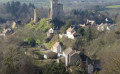
This route will take you from the heights of the Croix de l'Ours to the Soulongis National Forest. Views overlooking the medieval village of Hérisson and numerous heritage sites punctuate this route.
In the Dreuille Forest in search of the Stone of the Four Priests
 5.65 mi
+157 ft
-154 ft
2h 45
Easy
Departure from Cosne-d'Allier (Allier)
5.65 mi
+157 ft
-154 ft
2h 45
Easy
Departure from Cosne-d'Allier (Allier)
A flat walk along unpaved forest tracks (known as ‘roads’), winding through hedgerows and state-owned woodland (oak forest).
Louis Bignon Park and Fortress Park in the village of Hérisson
 2.61 mi
+207 ft
-207 ft
1h 25
Easy
Departure from Hérisson (Allier)
2.61 mi
+207 ft
-207 ft
1h 25
Easy
Departure from Hérisson (Allier)
The diversity of tree species is what gives Louis Bignon Park its charm: oaks, medlars, yews, spruces, cedars, maples, willows, alders, acacias, mahonias, Japanese cornelian cherries, birches, etc.
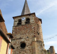
The remains of the fortress, perched on a rock, rise above the rooftops, overlooking the River Aumance, whose course naturally protects the fortified promontory.