In the Dreuille Forest in search of the Stone of the Four Priests

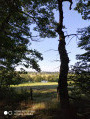
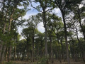
A flat walk along unpaved forest tracks (known as ‘roads’), winding through hedgerows and state-owned woodland (oak forest).

Details

4175837
Creation:
Last update:
Last review:
  • Walking
    Activity: Walking
  • ↔
    Distance: 5.65 mi
  • ◔
    Average duration: 2h 45 
  • ▲
    Difficulty: Easy

  • ⚐
    Back to start: Yes
  • ↗
    Ascent: + 157 ft
  • ↘
    Descent: - 154 ft

  • ▲
    Highest point: 912 ft
  • ▼
    Lowest point: 748 ft

Photos

Description of the walk

Start at a place called La Rible. Parking is available on the hard shoulder of the eastern bypass around Cosne-d’Allier, which is a heavy goods vehicle diversion.

(S/E) Take the dirt track (heading east) towards the ford on the Aumance, which you will cross via the footbridge a few metres upstream. Turn right (south-east) and continue straight on, leaving the tarmac road on your right. Pass the riding centre and arrive at Pisseloup, at the edge of the forest.

(1) Turn right onto the forest road of the same name (heading south-east).

(2) At the first junction, take the track on the left (heading north-east), which will lead you to the Rond de la Demi-Lune.

(3) Cross the RD 22 and follow it to the left towards Cosne for about ten metres. Look for the marked bridle path and take it to the right until you reach the Buxière forest track (unpaved), which you should follow to the right as far as the Rond de la Plantonnée.

(4) Take the forest track on the right (unpaved).

(5) Cross the RD 22 again at the Rond-Point des Tourneaux and continue in the same direction along the same forest track until you reach the edge of the forest and the end of the track.

(6) There is a bench here where you can rest if you’re feeling a bit tired. Turn right (west) onto the yellow-marked bridle path which runs along the edge of the forest and leads to the Rond du Puits Mathieu, where you’ll rejoin the Pisseloup forest track.

(7) Head straight ahead, first westwards then north-westwards.

(2) Continue straight on.

(1) Turn left onto the same path as on the way out to reach the Aumance and then the Rible (S/E).


Waypoints

  1. S/E : mi 0 - alt. 755 ft - La Rible. Cross the - Aumance (rivière) - Affluent du Cher
  2. 1 : mi 0.78 - alt. 843 ft - Pisseloup
  3. 2 : mi 1.11 - alt. 863 ft - Junction
  4. 3 : mi 1.83 - alt. 866 ft - Rond de la Demi-lune
  5. 4 : mi 2.31 - alt. 876 ft - Rond de la Plantonnée
  6. 5 : mi 2.69 - alt. 899 ft - Rond des Tourneaux
  7. 6 : mi 3.24 - alt. 912 ft - End of the forest track
  8. 7 : mi 3.95 - alt. 873 ft - Rond du Puits Mathieu
  9. S/E : mi 5.65 - alt. 758 ft - La Rible

Worth a visit

(1) In season, one can hear birds typical of lowland forests such as the wood warbler, the grey-headed woodpecker, the black woodpecker, etc.

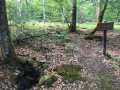
You can try to find the ‘Pierre des Quatre Curés’ (at the boundary of the four parishes), where, it is said, on 13 July 1789 the parish priests of Cosne, Tortezais, Buxières and Vieure gathered “at the stone of the four parishes, at midday, to dine together and cement the union of four good and loyal colleagues” (source: *Le patrimoine des communes de l’Allier*, published by Flohic). Did they foresee what would happen the following day?
Coordinates: N 46°28'16.2"
E 02°52'44.8"

Reviews and comments

4.6 / 5
Based on 3 reviews

Reliability of the description
4.3 / 5
Ease of following the route
4.7 / 5
Route interest
4.7 / 5
caroline.mayaudon@gmail.com

Overall rating : 4.7 / 5

Date of your route : Mar 31, 2024
Reliability of the description : ★★★★☆ Good
Ease of following the route : ★★★★★ Very good
Route interest : ★★★★★ Very good
Very busy route : No

A very pleasant walk through the forest. We rose to the challenge and found THE ‘Stone of the Four Priests’ 😁 It’s clearly marked by a post, though unfortunately the text has worn away.
A little tip for anyone wanting to take up the challenge: check the boundaries of the four local authorities on a map and head to the point where they meet. From there, focus on your surroundings: the stones, the remains of paths that were probably well-travelled in 1789… and explore the area! I’m sure you’ll find it 😊 Good luck on your adventure!

Machine-translated

NLEV
NLEV

Overall rating : 4 / 5

Date of your route : Sep 27, 2022
Reliability of the description : ★★★★☆ Good
Ease of following the route : ★★★★☆ Good
Route interest : ★★★★☆ Good
Very busy route : No

Hike not completed in full.
Should the supposed location of the ‘Stone of the Four Priests’ be better signposted? Even though there’s nothing there now, this spot should be marked as a point of interest, whereas it isn’t at present.

Machine-translated

les trois sœurs +
les trois sœurs +

Overall rating : 5 / 5

Date of your route : Jul 19, 2021
Reliability of the description : ★★★★★ Very good
Ease of following the route : ★★★★★ Very good
Route interest : ★★★★★ Very good
Very busy route : No

just right for us

Machine-translated

Other walks in the area

For more walks, use our search engine .

The GPS track and description are the property of this route's author. Please do not copy them without permission.