


jdelettrez

 Visorando Member
 Premium user
 - Location: Dio-et-Valquières (34650)
- Gender: man
Sign up:
Published route(s)
 The local road from Lieude to Causse de Carlencas
 5.12 mi
 +719 ft
 -715 ft
 3h 00
3h 00
 Moderate
 Departure from Mérifons (Hérault)
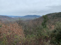
Having found traces of this local road No. 13 on the 1827 land registry, I went in search of it. It starts at La Lieude and climbs up through the Las Moles valley.
This hike is reserved for experienced hikers who are familiar with the terrain and enjoy getting off the beaten track.
The path is not always easy to follow in the ruffes (red earth).
Return via Mas Bousquet and Mas Valos le Vieux and Valos le Bas.
No markings - GPS very useful.
Circular route between Vernazoubres and Brenas
3.32 mi
+646 ft
-636 ft
2h 05
 Easy
Departure from Dio-et-Valquières (Hérault)
Easy
Departure from Dio-et-Valquières (Hérault)
Walk between the hamlet of Vernazoubres and Brenas. Passes close to Mont Caussil and returns via the Reboul traverse and the Col de la Croix de Vernazoubres.
An easy walk; all the paths are almost suitable for vehicles.
Montagne de la Boutine and the Saint-Fulcran Chapel
 4.36 mi
+643 ft
-643 ft
2h 35
Easy
Departure from Mérifons (Hérault)
4.36 mi
+643 ft
-643 ft
2h 35
Easy
Departure from Mérifons (Hérault)
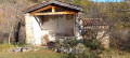
This easy walk takes you to the Chapel of Saint-Fulcran, where tradition holds that Saint-Fulcran – Bishop of Lodève from 949 to 1006 – was born in the vicinity. You then climb along an old path to Mas de Pradels. The return journey takes you to the Montagne de la Boutine, from where you descend via a winding track.
The dolmen and the Fossé des Yeux from Tressan
5.06 mi
+436 ft
-433 ft
2h 40
Easy
Departure from Tressan (Hérault)
This route follows the Dolmen and Fossé des Yeux hike, but starts from Tressan. It is slightly shorter and parking is easier.
The Map of Ceressou in Fontès
3.83 mi
+551 ft
-535 ft
2h 15
Easy
Departure from Fontès (Hérault)
A modified version of aPR® of the same name with an easier start for parking and a crossing of the River Boyne via the bridge on the D174. ThePR® ford before Ceressou is very often impassable. Otherwise, the rest of the route is identical.
Le Plan du Ceressou is an ancient volcano. Curiously, its name has changed in recent years from Ceressou to Celessou on IGN maps.