Around Bailly Bec

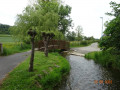
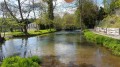
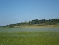
A short walk around the River Bailly Bec. This will allow us to discover the charm of Saint-Ouen-sous-Bailly, with its little bridges and beautiful houses.
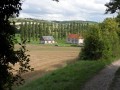
The route takes us through the Bois du Farival and the hamlet of Huppy.
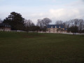
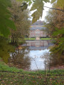
Explore Montigny Castle and the surrounding countryside, then return via Bailly-en-Rivière.

Details

22200966
Creation:
Last update:
Last review:
  • Walking
    Activity: Walking
  • ↔
    Distance: 9.12 mi
  • ◔
    Average duration: 4h 50 
  • ▲
    Difficulty: Moderate

  • ⚐
    Back to start: Yes
  • ↗
    Ascent: + 784 ft
  • ↘
    Descent: - 778 ft

  • ▲
    Highest point: 561 ft
  • ▼
    Lowest point: 174 ft

Photos

Description of the walk

Car park by the playground; the car park is open until 8.00 pm. Start at the picnic area near the playground in Saint-Ouen-sur-Bailly.

(S/E) Facing the river, head to the right. Cross the footbridge over the river and continue straight on, keeping the river on your left. At the three-way junction, take the sharp right-hand bend and leave Rue du Gué on your right.
Ignore the first path on the left; take the second one 200 metres further on, on the left, after passing Rue du Farival.

(1) Follow the path as it climbs gently towards the Bois de Farival. Continue until you reach a side path.

(2) At the end of the track, in the forest, turn left. Carry on straight ahead until you reach the access track to the hamlet of Huppy on the left.

(3) Carry on straight ahead until you reach the junction with the D58. Cross the road and follow the path almost directly opposite, slightly to the left.

(4) At the junction, turn left and follow the main track for 1.2 km, passing through the Bois de Montigny to reach the D117.

(5) Take the path going uphill opposite.

(6) Pass the Château de Montigny on your left, then carry on straight ahead along the path that climbs to the left to reach the plateau. After the bend to the left, pass under a power line and follow the path straight ahead, which descends towards Rue de la Cavée.

(7) At the junction with the D58, turn right towards the town centre. Go through the crossroads, following the road straight ahead towards Sept Meules (Route de Taillemesnil).

(8) Turn left onto Route de la Clapauderie and, at the junction with Route de la Gare, turn right. After 70 metres, in the left-hand bend, take the path leading uphill on the right. Go to the end of the path and turn left onto the tarmac road (D117).

(9) At the left-hand bend on this road, take the path leading uphill on the right. Follow this path along the edge of the Bois de Brétigny. Cross a railway line and you’ll reach a road.

(10) Take the road to the left and, after 30 metres, turn onto the track on the left. Follow this track until you reach the tarmac. At the tarmac road, you’ll see the wind turbines. Turn left and follow the road downhill to the railway line.

(11) Follow the railway line to the right and keep well to the right of it until you reach a bridge.

(12) Cross the bridge and immediately head downhill to join the path below. Follow this path as it descends towards Saint-Ouen-sous-Bailly. Cross the D159 and take the small road opposite.

(13) After 20 metres, turn left and follow Rue du Bailly Bec to the picnic area (S/E).

Waypoints

  1. S/E : mi 0 - alt. 184 ft - Picnic area – children’s playground
  2. 1 : mi 0.48 - alt. 220 ft - Fork in the path
  3. 2 : mi 1.47 - alt. 486 ft - Turn left at the end of the path
  4. 3 : mi 2.16 - alt. 551 ft - Path to the hamlet of Huppy
  5. 4 : mi 3.12 - alt. 554 ft - Junction
  6. 5 : mi 3.94 - alt. 400 ft - D117
  7. 6 : mi 4.06 - alt. 410 ft - Montigny Castle
  8. 7 : mi 5.86 - alt. 253 ft - Junction with the D58
  9. 8 : mi 6.09 - alt. 246 ft - Rue de la Clapauderie
  10. 9 : mi 6.49 - alt. 318 ft - Junction on the path leading uphill
  11. 10 : mi 6.88 - alt. 453 ft - Tarmac road
  12. 11 : mi 8.02 - alt. 351 ft - Railway line
  13. 12 : mi 8.41 - alt. 312 ft - Railway bridge
  14. 13 : mi 8.85 - alt. 177 ft - On the left, Rue du Bailly Bec
  15. S/E : mi 9.12 - alt. 184 ft - Picnic area – children’s playground

Notes

No special equipment required apart from walking boots.
Please note that some paths can be very slippery in wet weather.

Worth a visit

The Arques Forest and the Varenne Ponds.
The church at Envermeu, which is a listed building.

Reviews and comments

5 / 5
Based on 2 reviews

Reliability of the description
5 / 5
Ease of following the route
5 / 5
Route interest
5 / 5
C.Aubin
C.Aubin

Overall rating : 5 / 5

Date of your route : Jun 23, 2022
Reliability of the description : ★★★★★ Very good
Ease of following the route : ★★★★★ Very good
Route interest : ★★★★★ Very good
Very busy route : No

We went for a walk today with six friends – the weather turned out to be lovely after all, despite the forecast.
The scenery is magnificent, with fields in every shade of green imaginable this June.
There were several manor houses and castles built of brick and flint, typical of the Pays de Bray region, though sadly they weren’t open to visitors.
One downside, however, was the lack of maintenance on some of the paths. Tall grass, brambles and stinging nettles made it difficult to get through at times, especially when wearing shorts!
CF

Machine-translated

Michèle Ha
Michèle Ha

Overall rating : 5 / 5

Date of your route : Jun 19, 2022
Reliability of the description : ★★★★★ Very good
Ease of following the route : ★★★★★ Very good
Route interest : ★★★★★ Very good
Very busy route : No

A really lovely, varied route :-) with a clear and reliable description. Thank you very much.

Machine-translated

Other walks in the area

For more walks, use our search engine .

The GPS track and description are the property of this route's author. Please do not copy them without permission.