Mont Gédry

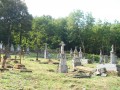
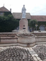
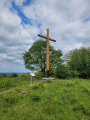
Set off to discover the legend of the Virgin of Mont Gédry and the statue of Notre-Dame. According to legend, the summit of the hill was crowned by a beautiful, gentle clearing of wild grasses. There stood a mysterious pink sandstone rock: La Tounôle. The hill offers a magnificent view of the first foothills of the Vosges Mountains.

Details

9406200
Creation:
Last update:
Last review:
  • Walking
    Activity: Walking
  • ↔
    Distance: 1.39 mi
  • ◔
    Average duration: 0h 55 
  • ▲
    Difficulty: Easy

  • ⚐
    Back to start: Yes
  • ↗
    Ascent: + 338 ft
  • ↘
    Descent: - 338 ft

  • ▲
    Highest point: 1,348 ft
  • ▼
    Lowest point: 997 ft
  • ⚐ Country: France
  • ⚐ City: Arpenans (70200)
  • ⚑
    Start/End: N 47.61546° / E 6.404917°
  • ❏
    IGN map(s): Ref. 3421E
  • Hour-by-hour weather

Description of the walk

Park in the car park by the church.

(S/E) With your back to the church, head towards the town hall via Rue Saint-Valère, then take the first street on the right. Next, take the road on the right, following the hike information board and the signposts. At the end of the road, continue along the path.

(1) Keep to the right, following the blue markers: first viewpoint over the mountain ranges. If you take the path to the left, you’ll reach Oricourt Castle.

(2) Turn right again and continue the climb to the summit of Mont Gédry. You have reached the highest point. Take in the view and admire the statue. An orientation board is available to help you find your bearings. To your right, you’ll be able to see crosses and wells.

(3) Then begin the descent to reach Rue de Montjustin. Turn right and stay on this street, ignoring the three other streets coming from the left as you go. You’ll reach the car park (S/E).

Waypoints

  1. S/E : mi 0 - alt. 1,010 ft - Car park - Eglise d'Arpenans
  2. 1 : mi 0.27 - alt. 1,073 ft - Oricourt Castle junction
  3. 2 : mi 0.53 - alt. 1,214 ft - Three-way junction
  4. 3 : mi 0.87 - alt. 1,316 ft - Vierge du Mont Gédry
  5. S/E : mi 1.39 - alt. 1,010 ft - Car park - Eglise d'Arpenans

Reviews and comments

4.4 / 5
Based on 3 reviews

Reliability of the description
4.7 / 5
Ease of following the route
4.3 / 5
Route interest
4.3 / 5
randonneur 70
randonneur 70

Overall rating : 5 / 5

Date of your route : Nov 24, 2025
Reliability of the description : ★★★★★ Very good
Ease of following the route : ★★★★★ Very good
Route interest : ★★★★★ Very good
Very busy route : Yes

What a beautiful view once you reach the top of Mount Gédry. The place is well maintained and the statue is magnificent.
The path can be difficult to walk down due to mud.

Machine-translated

Kieber
Kieber

Overall rating : 3.3 / 5

Date of your route : Dec 30, 2024
Reliability of the description : ★★★★☆ Good
Ease of following the route : ★★★☆☆ Average
Route interest : ★★★☆☆ Average
Very busy route : No

Very muddy path
Impassable for 400 metres

Machine-translated

Popa
Popa

Overall rating : 5 / 5

Date of your route : Jan 21, 2024
Reliability of the description : ★★★★★ Very good
Ease of following the route : ★★★★★ Very good
Route interest : ★★★★★ Very good
Very busy route : No

A very easy walk with superb views of the Vosges.
The descent to the village of Arpenans is a bit steep, and the path is very wet and a bit icy at this time of year.
Best done in winter, walking in the opposite direction.
There are some beautiful houses in the village of Arpenans, including the château, a former dairy that has been converted into a guesthouse.

Machine-translated

Other walks in the area

For more walks, use our search engine .

The GPS track and description are the property of this route's author. Please do not copy them without permission.