Walk starting from Saint-Sulpice

This walk, which presents no particular difficulty, is suitable for families. It offers the chance to explore the valleys of Haute-Saône and catch a glimpse of the Vosges.

Details

68141738
Creation:
Last update:
Last review:
  • Walking
    Activity: Walking
  • ↔
    Distance: 3.66 mi
  • ◔
    Average duration: 1h 50 
  • ▲
    Difficulty: Easy

  • ⚐
    Back to start: Yes
  • ↗
    Ascent: + 138 ft
  • ↘
    Descent: - 138 ft

  • ▲
    Highest point: 1,020 ft
  • ▼
    Lowest point: 899 ft

Photos

Description of the walk

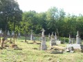
Park in the car park at Saint-Sulpice cemetery.

(S/E) With your back to the cemetery, take the forest path on the right (north-east). After about 150 m, at a three-way junction in the path, turn right. Continue along this path, heading north-east, for about 2 km, first alternating between the edge of the woods and crossing small copses, then through the fields. You’ll come back onto the tarmac and pass the Villafans cemetery.

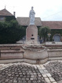
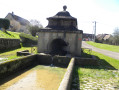
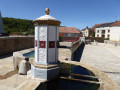
(1) At the junction at the entrance to the village (cross), turn right, then immediately left onto the main road (D4). Head towards the village centre, passing the war memorial and the town hall, until you reach a crossroads with a pretty wash house.

(2) Continue left onto the D92, Rue du Bouchot, towards Gouheunans. “Although there is very little traffic, you may encounter a few vehicles, so please be careful! ” Follow this road uphill, ignoring the side roads. Leave the village and join the cycle path linking Lure to Villersexel (a former railway line).

(3) Take the hairpin bend to the left and join the cycle path. Pass the old gatekeeper’s house and continue gently downhill along this path.

(4) Cross a small road and continue along the cycle path. Cross the bridge over a small road. Further on, cross a small bridge under which an unpaved local track runs.

(5) Immediately after the bridge, go down the steps leading to the local track. Follow this to the right, passing under the bridge again, then head up to the road.

(6) Carry on to the right and follow the road with care (traffic is fairly light) until you reach the Saint-Sulpice cemetery (S/E).

Waypoints

  1. S/E : mi 0 - alt. 928 ft - Saint-Sulpice Cemetery
  2. 1 : mi 1.23 - alt. 912 ft - Intersection – Villafans
  3. 2 : mi 1.37 - alt. 909 ft - Junction – Rue du Bouchot (D92)
  4. 3 : mi 1.99 - alt. 1,020 ft - Cycle path
  5. 4 : mi 2.54 - alt. 978 ft - Crossing a minor road
  6. 5 : mi 3.23 - alt. 919 ft - Small bridge and steps
  7. 6 : mi 3.38 - alt. 938 ft - Route
  8. S/E : mi 3.66 - alt. 928 ft - Saint-Sulpice Cemetery

Notes

Alternative route:
(5) Continue along the Voie Verte for about 500 m. At the three-way junction, turn left to head back towards the village of Saint-Sulpice. After about 700 m, when you reach the three-way junction, turn left towards Longevelle and follow the road up to the cemetery.

You can start the walk from the centre of Villafans or from its cemetery.

This route follows a forest track on the way out and returns via the Voie Verte (cycle path). However, it does involve two sections on departmental roads with very little traffic, but caution is still advised, especially with children.

A good pair of trainers is all you need for this walk.

Worth a visit

View of the Vosges.

Reviews and comments

4.4 / 5
Based on 3 reviews

Reliability of the description
4.7 / 5
Ease of following the route
4.7 / 5
Route interest
4 / 5
gras stephane
gras stephane

Yes, that’s right – it’s a route you can do even in winter. A lovely route.

Machine-translated

le saut de bonneille

Overall rating : 4.7 / 5

Date of your route : May 25, 2025
Reliability of the description : ★★★★★ Very good
Ease of following the route : ★★★★★ Very good
Route interest : ★★★★☆ Good
Very busy route : No

A short, easy ride
We only came across a few cyclists on the cycle path
This route is best done during the hunting season, as there is nothing to cause any friction between walkers and hunters

Machine-translated

gras stephane
gras stephane

Overall rating : 4 / 5

Date of your route : Mar 10, 2025
Reliability of the description : ★★★★☆ Good
Ease of following the route : ★★★★☆ Good
Route interest : ★★★★☆ Good
Very busy route : No

It’s easy and very pleasant in autumn

Machine-translated

les bubus
les bubus

Overall rating : 4.7 / 5

Date of your route : Feb 16, 2025
Reliability of the description : ★★★★★ Very good
Ease of following the route : ★★★★★ Very good
Route interest : ★★★★☆ Good
Very busy route : No

A lovely little walk, not at all difficult; we chose the route including the St SULPICE detour, which is 7 km… It was a lovely little Sunday outing. A M

Machine-translated

Other walks in the area

For more walks, use our search engine .

The GPS track and description are the property of this route's author. Please do not copy them without permission.