Double circular loop starting from Cerre-les-Noroy

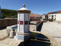
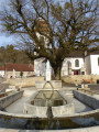
A walk along beautiful woodland paths or an old railway line, alternating between woodland and meadows. The church at Cerre-les-Noroy is notable for its murals; there are several washhouses in the village and a beautiful lime tree at the foot of the church.
There are several options for taking shortcuts, as the route forms a figure of 8.

Details

n°2861332
Creation:
Last update:
Last review:
  • Walking
    Activity: Walking
  • ↔
    Distance: 12.49 mi
  • ◔
    Average duration: 6h 35 
  • ▲
    Difficulty: Moderate

  • ⚐
    Back to start: Yes
  • ↗
    Ascent: + 951 ft
  • ↘
    Descent: - 951 ft

  • ▲
    Highest point: 1,378 ft
  • ▼
    Lowest point: 988 ft

Photos

Description of the walk

Park near the church in Cerre-lès-Noroy, by the washhouse and fountain; there are parking spaces in the vicinity.

(S/E) Take the Grande Rue downhill to quickly reach the Y-junction with the Route d’Autrey.

(1) Turn right onto the winding path leading to the farm. Follow the old railway line; it’s a lovely gravel path. You’ll come to a four-way junction.

(2) Stay on the main track and carry on straight ahead. Cross a wood and follow the edge of a new copse until you reach a road junction.

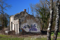
(3) When you reach the road, cross it and carry on straight ahead; do the same at the next road. After the bend, walk straight up the slope to the old station, walk past it and join the district road by walking alongside the private property. Join the district road.

(4) Turn right, follow the departmental road for about a hundred metres and take the first tarmac track on the right, which climbs steeply. Follow the wide forest track until you reach the Y-junction.

(5) Turn slightly right, continue uphill and, at the top, turn left, staying on the main track.

(6) At the junction of two lovely tracks, turn left and continue down the slope.

(7) At the end of the long straight stretch, at the T-junction, turn right onto the long forest track straight ahead until you reach the road.

(8) When you reach the road, turn right for 10 metres, then left onto the only path available. It’s stony at first but turns to dirt as it climbs. Stay on the main path: a long climb followed by a gentle descent to the road.

(9) At the cross just before the road, turn right and walk alongside the road for 200 metres (watch out for traffic).
Take the path on the right below and follow the main stony path, which turns into a dirt track. Keep going alongside the woodland across the meadow, following the path. You’ll reach the crossroads you passed on the way out.
Once you’ve rejoined the path a little further up, carry on until you reach the old railway line.

(2) Cross over and take the path opposite.

(10) Join the path, turn left for 5 m, then turn right onto the path. It is easier to continue walking across the succession of meadows than to join the path through the woodland (crossing the boundary by eye).

(11) At the far end of the last meadow, a path appears; simply follow it through the woodland until it reaches a green waste disposal site and then a tarmac road. Continue on to Autrey-les-Cerre.

(12) In Autrey, take the first path on the left as you head downhill. It runs straight along the edge of the woodland and offers a good, unobstructed view towards the bell tower at Cerre. You’ll pass by a pond.

(13) Join the D81 and follow it to the first junction.

(1) Turn right and head back up into Cerre-les-Noroy to the starting point (S/E).

Waypoints

  1. S/E : mi 0 - alt. 1,079 ft - Church of Cerre-les-Noroy
  2. 1 : mi 0.27 - alt. 1,050 ft - Junction of the D81 and the old railway track
  3. 2 : mi 0.86 - alt. 1,102 ft - Four-way junction
  4. 3 : mi 2.08 - alt. 1,037 ft - Crossing a country road
  5. 4 : mi 3.17 - alt. 1,135 ft - Junction with the D80
  6. 5 : mi 4.34 - alt. 1,240 ft - Y-junction
  7. 6 : mi 6 - alt. 1,171 ft - Y-junction
  8. 7 : mi 6.63 - alt. 1,020 ft - T-junction
  9. 8 : mi 7.12 - alt. 988 ft - Crossing a country road
  10. 9 : mi 8.36 - alt. 1,037 ft - Junction with the D26
  11. 10 : mi 9.66 - alt. 1,129 ft - Crossroads where two paths meet
  12. 11 : mi 10.1 - alt. 1,188 ft - Crossing from the meadow into the forest
  13. 12 : mi 10.82 - alt. 1,191 ft - Entrance to Autrey-les-Cerre
  14. 13 : mi 11.73 - alt. 1,073 ft - Join the D81
  15. S/E : mi 12.49 - alt. 1,079 ft - Church of Cerre-les-Noroy

Notes

(1) Remarkable washhouse, water for refreshment, not drinkable.

If you’re feeling tired, you can return directly to Cerre-les-Noroy by following the old railway line (S)

Worth a visit

(S) Remarkable church interior, exceptional wall paintings + washhouse fountain

(1) Second washhouse fountain (and drinking trough)

Reviews and comments

4.2 / 5
Based on 2 reviews

Reliability of the description
4 / 5
Ease of following the route
4 / 5
Route interest
4.5 / 5
Romu70
Romu70

Overall rating : 4.3 / 5

Date of your route : Aug 11, 2023
Reliability of the description : ★★★★☆ Good
Ease of following the route : ★★★★☆ Good
Route interest : ★★★★★ Very good
Very busy route : Yes

A really nice route – there are just two or three spots where it isn’t signposted if you’re not using the app.
Otherwise, it’s a good route for a walk or a mountain bike ride – it works well for both.

Machine-translated

Marilou
Marilou
• Edited:

Overall rating : 4 / 5

Date of your route : Jan 13, 2020
Reliability of the description : ★★★★☆ Good
Ease of following the route : ★★★★☆ Good
Route interest : ★★★★☆ Good

A lovely walk, with no particular difficulties. The description is accurate.

Machine-translated

Other walks in the area

For more walks, use our search engine .

The GPS track and description are the property of this route's author. Please do not copy them without permission.