Country:

 City:
City:


The Thiéry car park is situated near the village inn.
(S/E) From the car park, head towards the nearby Saint-Roch Chapel, take the track on the left (marked with signpost no. 86) and follow the signs for “Villa Souberre”. Shortly afterwards, this pleasant track enters a wooded area of fir trees and, much further on, reaches a fork in the road at a sharp bend.
(1) Marker 94: continue to the right along the track, following signs for “Thiéry via the Piste des Blaches”. Water from the nearby Roudiquiéry spring provides a chance to cool off in summer. Continue along the track for approximately 1.1 km until you reach a wide left-hand bend.
(2) At the cairn, turn right onto the steep, wooded path and continue to the Villa Souberre crossroads; do not look for a villa-style building, as this is the name of the locality. If you miss the cairn, don’t worry – the track also leads to this spot.
(3) Marker no. 83 and a fountain. Turn left onto the track (DFCI Piste de Briu), then immediately veer right onto this track and continue to where it ends.
(4) Carry on straight ahead in the same direction, off the track. Keep to the right, at the edge of the forest, where the ground allows for easy walking for about 200 m, on level ground, until you reach the ridge at the edge of the woods.
(5) Climb to the right; the area is clear of vegetation. Progress is easy but the slope is steep. Follow the ridge, which lies slightly to the left, and join the curve of the Crête des Gardettes at elevation 1582.
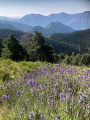
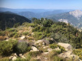
(6) Follow this ridge line to the summit of Mont Fracha, at an elevation of 1,776 metres, in an area that was once a lavender field.
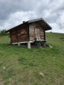
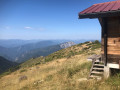
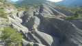
(7) From here, the slope is less steep. Take in the rocky surroundings. Note the shepherd’s hut, situated just a few metres below Mont Fracha, sheltered from the northerly winds.
Take a break by this hut to look out over Mont Vial and Villa Souberre below. Continue south-east along the Crête de Briu, which eventually becomes wooded. You’ll reach an elevation of 1,784 metres.
(8) At the cairn, leave the ridge and descend into the woods, heading roughly north to the Baisse du Brec crossroads. If you cannot find the path, follow the ridge line, which will join the signposted path further down.
(9) Marker 217 at an elevation of 1,688, rejoin a signposted path and head due north towards “Brec d’Ilonse”, across a grassy area. There is no defined path, but there are a few cairns to guide you to the Brec d’Ilonse, which overlooks the valley.
(10) Turn back and head for the Baisse du Brec crossroads.
(9) Turn left towards the south through a beautiful pine forest to reach the Col de Courbaisse.
(11) Signpost 216, elevation 1,629, follow the sign for “La Madone-Thiéry” to the right until you reach a fork in the path.
(12) Marker 84: carry on straight ahead towards “La Madone-Thiéry”. You’ll reach the Villa Souberre crossroads.
(3) Carry on straight ahead towards “La Madone-Thiéry” until you reach the next Y-junction.
(13) Signpost no. 82: turn left, still heading towards “La Madone-Thiéry”, and continue along the descending, wooded path, flanked by old terraced walls, to the Col de la Madone (alt. 1,183 m). Cross the road and head towards the chapel wall.
(14) Marker 81: follow the sign for “Thiéry”. Walk alongside the wall and past the entrance to the chapel; the path turns right, passing old houses, and heads into the wooded valley towards the village of Thiéry. Continue to the junction with another path.
(15) Signpost no. 95: turn right towards “Thiéry”, walk alongside the old aqueduct, then past the kennels to reach the road.
(16) Cross the road and take the old irrigation channel opposite, slightly to the left, which follows the contour line and serves as a path. You’ll come to an access road leading to the village.
(17) Continue left along this road for approximately 400 m until you reach the car park (S/E).


 Visorando Member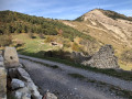
 Easy
Easy 
 Moderate
 Association / Club / Walk leader