The Blaches de Thiéry ridge

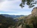
A very pleasant walk through woodland, made unique by its varied route where nature delights us at every turn. Another way to enjoy the surroundings of this superb village in the Nice hinterland, home to the ‘Tubans’, as the locals are known.

Details

n°28507089
Creation:
Last update:
Last review:
  • Walking
    Activity: Walking
  • ↔
    Distance: 3.56 mi
  • ◔
    Average duration: 2h 40 
  • ▲
    Difficulty: Moderate

  • ⚐
    Back to start: Yes
  • ↗
    Ascent: + 1,135 ft
  • ↘
    Descent: - 1,135 ft

  • ▲
    Highest point: 4,475 ft
  • ▼
    Lowest point: 3,412 ft

Photos

Description of the walk

Park at the Auberge de Thiéry car park.

(S/E) Head towards the nearby Saint-Roch Chapel at the far end of the car park and take the road on the right towards the Madone de Thiéry for about 200 metres.

(1) Leave the tarmac road at the start of the crash barrier and keep to the right of it. The path follows the road for a while before beginning a gentle descent. When you reach a tarmac road, cross it and continue straight on along the path which passes close to marker no. 86. Continue past a kennel and an old village water pipe

(2) At this junction, marked by signpost no. 95, turn right, pass under the water pipe, then continue along the steeply ascending path which starts on the left. Halfway up the slope, there is a junction. Stay on the left-hand path until you reach the track suitable for vehicles.

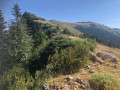
(3) Cross the track, continue along the path which soon curves sharply to the left, and you’ll immediately reach another path junction. Carry on straight ahead (north-east). The path passes a spring where the ground is very damp, then turns into a magnificent path through the woodland. The path disappears at a meadow: head straight on towards the copse of fir trees opposite. From here, you can see, below, the hamlet of La Madone, your next destination. Pass to the right of the chapel and head for the nearby Col de la Madone.

(4) Cross the road, follow the field to the right – look out for marker no. 81 – and continue along the path, heading due north, towards Villa Souberre

(5) At the crossroads of paths marked by a cairn, turn left and follow the path through the woodland. The path disappears into the meadows, but carry on due west until you reach the track known as the Piste de la Villa Souberre. Once on the track, turn right.
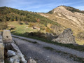
At the cairn, turn left onto a stony, ascending track, which bends to the left at the two enormous piles of stones. Just past the ruins of the house, turn right. Once behind the house, cross the meadow towards the woodland, heading north-west.

(6) At the entrance to the wooded area with a cairn, follow a long, uphill woodland path which then descends back towards the village, leading to the water tower. Continue straight on to return to the car park at the Auberge de Thiéry (S/E).


Waypoints

  1. S/E : mi 0 - alt. 3,412 ft - Car park at the Auberge de Thiéry
  2. 1 : mi 0.19 - alt. 3,458 ft - Start of the safety barrier
  3. 2 : mi 0.69 - alt. 3,494 ft - Marker 95: crossroads of trails
  4. 3 : mi 0.91 - alt. 3,707 ft - Crossing a track
  5. 4 : mi 1.65 - alt. 3,812 ft - Col de la Madone
  6. 5 : mi 1.95 - alt. 4,029 ft - Trail junction
  7. 6 : mi 2.32 - alt. 4,242 ft - Start of the path and the wooded area.
  8. S/E : mi 3.56 - alt. 3,412 ft - Car park at the Auberge de Thiéry

Notes

A few minor technical challenges. You’ll need to use a compass on three occasions, and the app will be a useful aid.
No water along the route.
Make sure you’re wearing suitable footwear, but walking poles aren’t essential.

Worth a visit

Visit the village of Thiéry.

Reviews and comments

4 / 5
Based on 2 reviews

Reliability of the description
3.5 / 5
Ease of following the route
4 / 5
Route interest
4.5 / 5
bernard bb
bernard bb

Thank you, alloallo, for this review, which is very well summarised
Best regards, b.

Machine-translated

alloallo
alloallo

Overall rating : 5 / 5

Date of your route : Oct 26, 2025
Reliability of the description : ★★★★★ Very good
Ease of following the route : ★★★★★ Very good
Route interest : ★★★★★ Very good
Very busy route : No

There are numerous trails and paths around Thiery, not all of which are marked on the various maps, so it is best to also have a compass and/or GPS. However, the directions in the description are very precise and even though the downhill trail is not very well marked, we had no trouble following it.
The hike is very pretty and pleasant, with the colours and freshness of autumn. It offers varied landscapes and beautiful views in three different directions. And how peaceful it is!
To avoid a hunting area, we went straight between points 2 and 4, without passing point 3.
From point 6 onwards, the uphill section of the trail has been widened to the size of a track (jackhammer and mini-digger still on site...), which is perhaps less pleasant, but offers beautiful views on the left.
Before heading back down, don't hesitate to venture a little off the beaten track towards the deforested ridge to enjoy a beautiful view towards Lieuche!
We stayed at the Thiery inn, where we received a warm welcome, comfortable beds and delicious meals. What more could you ask for?
Thank you for this route!

Machine-translated

bernard bb
bernard bb
• Edited:

Good morning. Thank you for your feedback. If you follow the route on the online app, there is no dense vegetation, but the slope is quite steep and the scenery is magnificent. Kind regards, B.

Machine-translated

ianwhite88
ianwhite88

Overall rating : 3 / 5

Date of your route : Aug 26, 2023
Reliability of the description : ★★☆☆☆ Disappointing
Ease of following the route : ★★★☆☆ Average
Route interest : ★★★★☆ Good
Very busy route : No

The descent from the ridge is unclear and was overgrown and rough.
For that reason, I would not recommend this walk.
Date of walk: 17 August 2023

Machine-translated

Other walks in the area

For more walks, use our search engine .

The GPS track and description are the property of this route's author. Please do not copy them without permission.