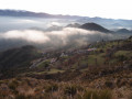
Mont Brune via the 3 Baisses

I consider this hike to be very difficult due to its length and significant elevation gain, with some exposed sections that can be slippery.

Details

n°20731824
Creation:
Last update:
Last review:
  • Walking
    Activity: Walking
  • ↔
    Distance: 12.56 mi
  • ◔
    Duration according to the author: 10 hrs 
  • ▲
    Difficulty: Very difficult

  • ⚐
    Back to start: Yes
  • ↗
    Ascent: + 4,744 ft
  • ↘
    Descent: - 4,744 ft

  • ▲
    Highest point: 4,967 ft
  • ▼
    Lowest point: 814 ft

Photos

Description of the walk

Start from the car park beside the D6202, near Sainte-Pétronille in Villars-sur-Var, railway station.

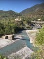
(S/E) At Sainte-Pétronille, from marker 21, head for the bridge over the Var and cross it.

(1) At marker 22, turn right towards Ascros. Proceed with caution along the approximately 200 metres of tricky terrain, which is sloping and overlooks the Var. The path is well marked. Follow it to the Baraquin junction, marker 2.

(2) Turn onto the path on the left and join a track at La Baisse d’Ascros, marker 303.

(3) Follow the DFCI track to the left for about 2 km.

(4) At the end of this track, continue along the path that follows the ridge to Mont Brune.

(5) Enjoy the 360° view of the Mercantour, the Var plain, the sea and the Cheiron, then continue along the path that descends along the ridge. Reach the Baisse du Mont Brune, marker 93.

(6) Follow the path to the left, towards Toudon, until you reach the Baisse des Collettes, marker 91.

(7) Continue to the left and, via a very long descent towards Villars-sur-Var (visible almost the whole time), reach the junction at Bau de Mars, marker 20.

(8) Turn left onto what is initially a very narrow path that may be slippery. After a series of wide hairpin bends, with lovely views of the Var Valley in places, descend until you reach the Adous via a track running alongside the Var, marker 17.

(9) Continue to the left along the path that passes a few houses, heading upstream. Then carry on along a undulating path past the last private property. Follow the Var to the Sainte-Pétronille Bridge.

(1) Cross the bridge over the Var and head to the car park near Sainte-Pétronille (S/E).

Waypoints

  1. S/E : mi 0 - alt. 981 ft - Marker 21, Sainte-Pétronille
  2. 1 : mi 0.25 - alt. 915 ft - Marker 22, Sainte-Pétronille Bridge - Var (fleuve)
  3. 2 : mi 1.95 - alt. 2,877 ft - Marker 29, Baraquin
  4. 3 : mi 3.31 - alt. 3,921 ft - Marker 303, Baisse d’Ascros
  5. 4 : mi 4.46 - alt. 4,252 ft - End of the DFCI track
  6. 5 : mi 5.75 - alt. 4,967 ft - Mont Brune
  7. 6 : mi 6.02 - alt. 4,577 ft - Marker 93, Descent from Mont Brune
  8. 7 : mi 6.99 - alt. 4,173 ft - Marker 91, Baisse des Collettes
  9. 8 : mi 7.92 - alt. 3,481 ft - Marker 20, Bau de Mars
  10. 9 : mi 10.62 - alt. 866 ft - Marker 17, the Adous
  11. S/E : mi 12.56 - alt. 988 ft - Marker 21, Sainte-Pétronille

Notes

There are no drinking water sources; please bring your own, especially in summer.
Given the length of the walk and the rocky sections, please wear suitable footwear.

Worth a visit

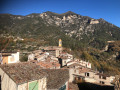
Panoramic views of the villages of the Var Valley, the Mercantour, the Cheiron and the sea on a clear day.

Reviews and comments

5 / 5
Based on 1 review

Reliability of the description
5 / 5
Ease of following the route
5 / 5
Route interest
5 / 5
Angelo6
Angelo6

Overall rating : 5 / 5

Date of your route : Apr 04, 2025
Reliability of the description : ★★★★★ Very good
Ease of following the route : ★★★★★ Very good
Route interest : ★★★★★ Very good
Very busy route : No

A superb walk with varied landscapes and scenery, though it is really aimed at walkers with some experience; you’re in for a truly lovely day’s walking (8 am to 5 pm in my case, with two 30-minute breaks)! In my view, it can be a great way to ‘take your hiking to the next level’ if you’re aiming to cover around 20 km and tackle over 1,000 metres of elevation gain.

Most of the elevation gain and the ascent to the summit take place during the first half of the route, and you’ll need to have plenty left in the tank to tackle the several hours of descent that lie ahead – though a few stretches of flat ground and gentle climbs make it very manageable. If you fancy a bite to eat or a break before reaching the summit, there’s a lovely spot by the water reservoir at the end of the DFCI track.

You may come across herds of sheep and mountain dogs, which gave me a bit of a scare on the way up but weren’t aggressive – just a bit of barking. The path is occasionally a bit damaged by fallen trees and/or rocks, but it remains passable for the time being.

It’s easy to stay on the right route thanks to the app’s map, the route description and the regular signposts.

A big thank you to the creator for sharing it!

Machine-translated

gerard06440
gerard06440

Not yet used.

Machine-translated

Other walks in the area

For more walks, use our search engine .

The GPS track and description are the property of this route's author. Please do not copy them without permission.