Country:

 City:
City:


Access is from Queige, at the entrance to the Beaufortain, by taking the road to the hamlet of Molliessoulaz and continuing on it to Les Chappes. Leave your car in front of the forest chalet.
(S/E) Walk back down the road for a few hundred metres and take the path on the right, which climbs (signpostedGRP® Tour du Beaufortain). Continue to the Chappes chalets.
(1) Follow the wide track opposite, which climbs gently across the mountain pasture and passes close to the Mozes chalets; carry on straight ahead, then past the Chalet du Haut Pré (where goat’s cheese is sold).
(2) At the Chalet du Haut Pré, leave the track and take a slightly steeper path that climbs due south to a lovely flat area known as the Petit Pré.
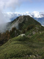
(3) Take the path on the left which climbs north-eastwards and joins the Roche Pourrie ridge. It leads to the summit via a few sections with cables, which are easy to navigate. Caution! Just a few metres below the summit marker, do not follow the yellow markings, which lead to a rather steep slab; instead, step over the ridge to go round it on the left and reach the summit, marked by a stele surrounded by an orientation table.
(4) Leaving the summit, take the yellow-marked path which descends just over 200 m towards Les Challières. There is no point looking for the south-eastern route along the ridge that would avoid the descent because, although shown as a dotted line on the IGN map , its start has been obliterated by rockfalls from the aptly named “Roche Pourrie”.
(5) Once you reach Les Challières, follow theGRP® Tour du Beaufortain to the right, which climbs along a very pleasant path that makes you forget the extra 200 m of elevation gain. Then ignore a path on the left. Once you reach the ridge, leave theGRP® – which descends towards the Aulp de Tours – and take the path on the left that continues along the ridge to the Pointe Saint-Jean (2,254 m).
(6) Continue along the ridge to the Pas de l’Âne, which marks the access point to Mont Mirantin when approaching from Arêche.
(7) Head onto the ridge that leads directly to the summit of Mont Mirantin
(8) At the summit, there is a magnificent 360° view. The return journey follows the same route as the ascent to Les Challières.
(5) Continue the descent along theGRP® to the Chalets des Chappes, taking care to keep to the right once you’ve rejoined the route you took on the way up.
(1) Continue the descent along the unpaved road to the forest chalet, which avoids the final climb (S/E).

 Visorando Member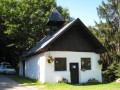
 Easy
Easy 
 Moderate