


 Country:

 City:


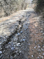
Access from Les Orres is via a stony road leading to the forest car park. The route is then very well signposted towards Le Méale with yellow signposts.
(S/E) From the car park, take the north-east-facing path which enters the woodland and leads to a junction.
(1) Turn right at the hairpin bend and continue steadily uphill through the woodland.
(2) Take the left-hand hairpin bend and follow the path as it winds through several wide bends.
(3) Turn right and carry on until you reach another fork.
(4) Turn left and begin the climb towards Le Méale.
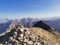
(5) Carry on straight ahead, leaving the downhill path on your left. Reach the summit.
(6) Begin the descent to the fork you passed on the way up.
(5) Turn right and reach the start of the Méale path.
(4) Continue left along the path, which winds several times before heading firmly westwards until you reach a junction.
(7) Keep to the right to reach the paragliding launch site.
(8) Turn back.
(7) Turn right and follow the path, ignoring the offshoots on either side, to reach the nature trail.
(9) Follow it straight on: there is a single information board about the flora at the foot of a cross. The path is more like a balcony overlooking Les Orres. There may be patous (mountain herding dogs) present: we had to go round the enclosure to keep a safe distance. Return to the access road to the car park.
(10) Follow it to the right until you reach the start (S/E).

 Visorando Member
 Moderate


 Easy

 Very difficult

