Country:
 City:



Start at the Place du Foirail.
(S/E) Head west-south-west and turn right for about 60 metres. Turn left again, then right at the end of the lane; cross the Guyoult Bridge to reach the Pont des Tendières on Rue de Dinan.
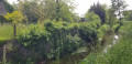
(1) Cross the street and take the path opposite, keeping to the left of the bridge. Follow the path alongside the stream as it joins the main course of the Guyoult. Continue along the riverbank.
(2) At the footbridge, stay on the riverbank and carry on straight ahead. The path forms an S-shape. Turn right to pass under the N176 bridge. Then turn right and follow the path which goes round the buildings on the left.
(3) After the Bégaudière manor house, turn left and follow the path. At the first junction, turn left. The path heads west before branching northwards and becoming a track.
(4) At a place called Chanteloup, take the path on the left. Follow it and cross the bridge over the Cardequin. Continue to the right and walk alongside the stream for about 1,700 metres.
(5) Cross the D78 and walk straight ahead for 800 metres to the bridge.
(6) Take the path that branches off to the south, on the left, for about 1,300 metres. It leads to a bridge over the Biez du Milieu.
(7) Continue to the left, cross the D78 and go straight on for 1,300 metres to reach the Cardequin.
(8) Turn right, heading south, towards the bridge over the four-lane road. Cross the bridge and carry on to the next junction.
(9) At the junction, take the road on the left, pass the hamlet of Cardequin and take the path on the left again. Carry on for about 400 metres and turn right onto the dirt track. After a circular bend, pass the farm at the hamlet of Launay Bégasse and join a cross-road.
(10) Continue left along the road, leaving La Morlaix on your left and carrying on straight ahead, passing Rue Pierre de Coubertin. Follow the road opposite, Rue de Montplaisir, until you reach Rue de Dinan. Turn right onto this street.
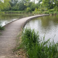
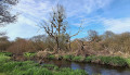
(11) At the junction, take the road on the left towards the Abbaye residential complex. After about 250 m, turn right onto the second dirt track. After about 150 m, take the track on the left and head towards the edge of the pond.
(12) Do not cross the footbridge but continue to the left until you reach a second footbridge, then cross it. Join the gravel path, follow it and take the road opposite; continue straight on to return to the starting point (S/E).
 Visorando Member

 Association / Club / Walk leader

 Easy