A circular walk from Dol to Chateloup and Mont-Dol

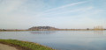
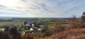
A route that takes in the Marais Noir and the Marais Blanc. The two marshes are separated, roughly speaking, by the D4. It offers the chance to explore Mont-Dol, a granite massif overlooking the ‘twin’ marsh of the one on which Mont-St-Michel stands, to the east, and the village of Lillemer to the west. A leisurely route, the highlight of which is the climb up Mont-Dol, offering a 360° panoramic view. Do take the time to climb the tower for a breath of fresh air, and visit the Moulin du Tertre, which is well worth a visit when it is open.

Details

n°111403898
Creation:
Last update:
Last review:
–
  • Walking
    Activity: Walking
  • ↔
    Distance: 7.19 mi
  • ◔
    Average duration: 3h 30 
  • ▲
    Difficulty: Moderate

  • ⚐
    Back to start: Yes
  • ↗
    Ascent: + 207 ft
  • ↘
    Descent: - 226 ft

  • ▲
    Highest point: 210 ft
  • ▼
    Lowest point: 10 ft

Photos

Description of the walk

Start from the Chalet car park, near Dol-de-Bretagne station.

(S/E) Walk down from the car park and take the pedestrian passageway in the wall on the right. Continue straight ahead along the path opposite, join Rue de Légeard, follow it to the right, pass the cinema, and head left to reach the fairground. Go round it on the right, turning right onto Allée de la Ville Nicault. Pass the social housing blocks and turn right.

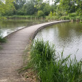
(1) When you reach the street, turn right and take the path that runs alongside the playground. Pass the gazebo and, via a gateway, join Rue des Ponts. Take the Passage des Ylouzes, keeping slightly to the left. This leads onto Rue des Tanneries. Continue to the left until you reach the two bridges; cross them and follow the Guyoult downstream, keeping to the right.

(2) Leave the footbridge on your right and carry on straight ahead. Continue along the road and then the dirt track which turns to the left.

(3) At the junction, turn right, go under the road bridge, then turn right and follow the path. Walk alongside the buildings and turn left after passing the Manoir de la Bégaudière. Follow the stony path.

(4) At the junction, carry on to the left and straight ahead until you reach the hamlet of Chanteloup.

(5) Cross the D4 and carry on straight ahead. Cross the bridge over the Guyoult, take the D155 to the left for about ten metres, then cross it to join the road heading right towards Mont Dol. Continue keeping to the left and pass the first houses.

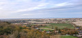
(6) Turn right at the Place du Marché, then right again. Take the gently sloping path that runs alongside the cemetery. Follow the path to the left, which climbs and joins the road. Continue uphill and turn right onto the path. Pass the chestnut tree planted in the 17th century on your right to reach the tower topped by a statue of Notre-Dame de l’Espérance (a lovely view of the marsh and the Bay of Mont-Saint-Michel).

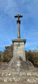
(7) Carry on towards the small pond. Then cross the road and visit the calvary. Return to the road, turn left and walk past the houses. You can make a detour to see or visit the Moulin du Tertre by continuing straight on.

(8) Take the path on the left and head back down towards the foot of the hill, passing by the “vineyard”. Reach the town hall and turn left. At the church, go down the steps on the right and pass back through the junction you came from on the way there.

(6) Follow the route you took on the way there, keeping to the right, but further on, turn left onto the path heading due south (paved road). Pass under the railway bridge, then the one under the N176. At Rue des Murets, continue to the right.

(9) On the left, take the Passage Louis Maufrais. In front of the cathedral, turn left to go round it on the left, then take Rue Ceinte on the left, followed by Rue des Perrons on the right. At Grande Rue des Stuarts, turn left, then take the passage between the café and the town hall.

(10) Cross the square, then the boulevard. At the roundabout, head towards Épiniac, Combourg and the station by taking the exit opposite. Return to the starting car park (S/E).

Waypoints

  1. S/E : mi 0 - alt. 75 ft - Chalet car park - Gare de Dol-de-bretagne
  2. 1 : mi 0.49 - alt. 23 ft - Street
  3. 2 : mi 1.01 - alt. 23 ft - Footbridge - Guyoult (fleuve)
  4. 3 : mi 1.39 - alt. 10 ft - Junction leading to the bridge
  5. 4 : mi 2.14 - alt. 13 ft - Junction
  6. 5 : mi 3.39 - alt. 16 ft - Crossing the D4
  7. 6 : mi 4.21 - alt. 13 ft - Market Square
  8. 7 : mi 4.62 - alt. 207 ft - Tower
  9. 8 : mi 4.89 - alt. 200 ft - Mill
  10. 9 : mi 6.69 - alt. 36 ft - Rue des Murets and passageway
  11. 10 : mi 6.95 - alt. 52 ft - Town Hall Square
  12. S/E : mi 7.19 - alt. 75 ft - Chalet car park

Notes

Toilets are available near the car park, on the Tertre de Mont-Dol by the last house, and on the Place de la Mairie in Dol-de-Bretagne (10).
The Mont-Dol hilltop tower and chapel are open to the public; the chapel is sometimes closed.
You can also walk down from the hill by taking the road leading to the hill’s car park; it leads directly to the front of the church but is very steep. The descent towards the town hall is steep and consists of uneven steps.
The station is 300 metres from the chalet car park.

Worth a visit

On Le Tertre
Two19th-century windmills dominate the landscape. One of them, purchased by the local council, has been restored: it is the only windmill in the bay to have retained its internal mechanism (open in season).

The Notre-Dame de l’Espérance Tower
Built in 1857, it offers a breathtaking view of the polders, the marshes (Blanc and Noir), Dol-de-Bretagne Cathedral, the Bay of Mont-Saint-Michel and, on a clear day, Mont-Saint-Michel, the Chausey Islands archipelago and the Herpin Lighthouse.

The Chapel of Notre-Dame-de-l’Espérance
Built on the foundations of a former Chappe aerial telegraph (which itself stood on the site of an ancient pagan temple and later a priory attached to Mont-Saint-Michel Abbey).

Calvary on the hillock
Erected in 1891 in memory of a religious mission that took place in November of that same year. Inscription: O Crux Ave.

St Peter’s Church
The small church of St Peter at Mont-Dol was built at the end of the12th century and was altered in the15th,16th and19th centuries. During the Revolution, the church does not appear to have suffered any damage, as Mont-Dol was a stronghold of the Chouans. The murals were restored in 1972 and are the artistic jewel of St Peter’s Church.

In Dol-de-Bretagne
Saint-Samson’s Cathedral, a jewel of Breton Gothic architecture, and the old houses on the Grande-Rue-des-Stuarts; the Maison des Petits Palets, dating fromthe 12th century, is one of the oldest in Brittany; the moat; the Rue des Perrons and the Rue Ceinte; the Champ Dolent menhir; etc.

Other walks in the area

For more walks, use our search engine .

The GPS track and description are the property of this route's author. Please do not copy them without permission.