


Refine your search for walks in Le Langon
Le Langon walks


 The Langon Marshes
 Association / Club / Walk leader

 6.62 mi
 +23 ft
 -23 ft
 3h 05
 Moderate
 Departure from Le Langon (Vendée)
A circular walk between the plains and the marshes, following paths and small roads, some lined with tall hedgerows and cultivated fields, others running alongside the wide canals of the drained marshland, teeming with birds and herds grazing in vast wet meadows.
Massigny circular route via the Auzay marshes and Les Gazettes
 Visorando Member5.54 mi
+13 ft
-13 ft
2h 35
 Easy
Departure from Le Poiré-sur-Velluire (Vendée)
A circular route partly along the Vendée river, passing through the Marais d’Auzay: a mix of flatlands and marshland!
Around Auchay-sur-Vendée
 7.19 mi
+92 ft
-92 ft
3h 25
Moderate
Departure from Auzay (Vendée)
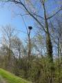
Starting from the Eiffel-style bridge linking Auzay to Chaix (now merged into the commune of Auchay-sur-Vendée).
This route through lush countryside (steep, wooded hillsides, vast fields and meadows) will take you to the Moulin de la Boissière (in the commune of Velluire-sur-Vendée) before reaching the banks of the Vendée at the Massigny Dam.
Montreuil Marsh Trail
 Tourism professional
 5.57 mi
+7 ft
-10 ft
2h 35
Easy
Departure from Montreuil (Vendée) (Vendée)
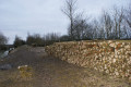
Montreuil, in the 85 department, situated between the plains and the marshes, was once located on the shores of the Gulf of Pictons, hence its name Montreuil-sur-Mer until 1945. The commune consists of a market town and four hamlets. Thefirst part of this trail follows small roads and runs alongside three old ports where there are small jetties that once provided access by boat to the cultivated plots: these are the ports of Baude (the most visible), Écoué and, finally, Fraigneau.
The trail is marked in yellow.
Circular route around the Étier du Marais d’Écoué, starting from Baude
 5.89 mi
+7 ft
-10 ft
2h 45
Easy
Departure from Montreuil (Vendée) (Vendée)
Starting from the Baude de Montreuil municipal trail, the walk leads into the commune of Vix. The outward and return journeys follow the embankment between the drained marshes of Vix and the wet marshes of Baude. Part of the route follows the path that crosses the drained marshes, protected by the Écoué dyke or embankment
Discovering Montreuil’s heritage
 4.77 mi
+56 ft
-52 ft
2h 15
Easy
Departure from Montreuil (Vendée) (Vendée)
Montreuil has preserved some traces of its past, including its Romanesque church, the courtyard gate, the Écoué porch, the homes of local dignitaries, wells, and so on. Its landscape of plains and marshes invites you to explore. The town was known as Montreuil-sur-mer until 1945, due to its former location on the edge of the Gulf of Pictons. The former gulf is now occupied by the Marais Poitevin, hence this woodcarving of a heron taking flight, the bird emblematic of wetlands. It is accompanied by the names of the hamlets within the commune: Écoué, Baude, Fraigneau.
From Hermenault to the Bois de Saint-Maixent
 4.88 mi
+279 ft
-253 ft
2h 30
Moderate
Departure from L'Hermenault (Vendée)
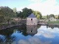
A very pleasant walk in the Hermenault countryside, offering a variety of landscapes ranging from plains to undergrowth and bocage.
Urban circular in Fontenay le Comte
 6.93 mi
+112 ft
-131 ft
3h 15
Moderate
Departure from Fontenay-le-Comte (Vendée)
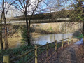
A superb hike that allows you to discover some of the town centre's attractions and trails, mostly along the Vendée, before returning along a small stream and then an old railway line. There is little elevation gain, making it a very easy route.
Circular path in the wet marshes of Doix-lès-Fontaines
 7.03 mi
+16 ft
-16 ft
3h 15
Easy
Departure from Doix (Vendée)
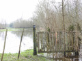
An easy hike that takes you along the levees created four centuries ago by man to protect the drained marshes from river flooding. You will walk through a landscape entirely created by man, with plantations of pollarded or topped ash trees and rows of trees (poplars) lining the canals.We are in the wet marsh: the route may be impassable in late autumn and winter on a small section. (see practical information).
Circular route around Le Fougeray
3.96 mi
+292 ft
-318 ft
2h 05
Easy
Departure from Pissotte (Vendée)
A circular walk around the hamlet of Le Fougeray, passing through the Mervent woodland, then skirting the Vendée river, and returning via an old disused railway line. A relatively easy walk.
Around Pissotte
 6.83 mi
+413 ft
-410 ft
3h 30
Moderate
Departure from Pissotte (Vendée)
A relatively easy hike with an initial open section along the Vendée towards Fontenay-le-Comte, then back along an old disused railway line. The second section begins with a crossing of vineyards, then immediately enters the forest with paths and trails.
From Orbrie along the Vendée
 6.96 mi
+577 ft
-597 ft
3h 40
Moderate
Departure from L'Orbrie (Vendée)
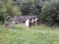
A lovely circular walk along the River Vendée and through the Mervent Forest. This circular walk will take you to the Mervent Dam, following part of the Mélusine GRP®.
The Père de Montfort Cave in the Mervent Forest
 6.25 mi
+554 ft
-558 ft
3h 20
Moderate
Departure from Pissotte (Vendée)
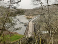
From the Saint-Luc roundabout, you will walk along long forest paths to a trail overlooking the Vergnes stream and leading to the Pierre Brune dam. You will then climb stone steps to the Grotte du Père de Montfort and finish the ascent via a wooden staircase. You will then walk along the Mère to the Diet Bridge and join theGR® de Pays de Mélusine, which will take you back to your starting point.
In the Mervent forest along the Vendée
 9.89 mi
+643 ft
-617 ft
5h 05
Moderate
Departure from Pissotte (Vendée)
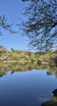
After exploring the Mervent National Forest, a lesser-known but slightly wilder route along the Mervent dam reservoir. Let's set off to explore the banks of the Vendée, passing by the Fontaine à l'Ermite, the Balingue and the Sauvaget site. Quite a programme.
Discovering the Mervent State Forest
 10.23 mi
+883 ft
-883 ft
5h 30
Moderate
Departure from Pissotte (Vendée)
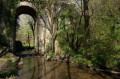
A superb hike through the largest forest in the Vendée. The terrain is varied but not particularly difficult, making it a hiker's paradise. Beautiful paths, a dam lake, a climbing site, a leisure park, a hidden cave, remarkable bridges and trees, and a forest that has been explored for many years: this is what I invite you to discover.
Marans Maritime Canal
7.95 mi
+10 ft
-10 ft
3h 40
Moderate
Departure from Charron (Charente-Maritime)
Walk along the navigable canal from the Sèvre Niortaise estuary to the Port of Marans. Western part of the Marais Poitevin where you can observe many species of seabirds, varying according to the seasons.
Pierre Brune and Pierre Blanche
 6.39 mi
+509 ft
-486 ft
3h 25
Moderate
Departure from Vouvant (Vendée)
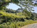
A hike best enjoyed in the warmer months on shaded trails in the heart of the Mervent Forest.After a steep climb up the Rocher de Pierre Brune, you’ll reach the viewpoint overlooking the Pierre Blanche climbing site via forest paths and a short stretch of road. You will then descend to the banks of the river known as the Mère, before following the course of the Ruisseau des Verreries to reach the Maison Forestière of the same name. You will discover the Cinq Jumeaux before reaching the Pierre Brune Dam by following part ofthe GRP® Tour du Pays de Mélusine.
The Croix des Marys and the Bazoin locks
 4.73 mi
+10 ft
-10 ft
2h 10
Easy
Departure from La Ronde (Charente-Maritime)
This is a short loop in the Marais Poitevin, starting at the Croix des Marys and following the Mignon canal before returning along the Sèvre Niortaise.Please note: read the comments in the Practical Information section