Country:

 City:


Park in one of the two car parks on Rue d’Ermensbach in Rimbach-Près-Masevaux.
(S/E) Head right towards Rue Principale and turn right, leaving Rimbach and following the road towards Oberbruck until thefirst junction.
(1) Turn right onto Chemin du Gresson, marked with a Yellow Ring, and continue straight on until you reach the junction with Rue du Château.
(2) Carry on straight ahead, following the sign for “Gresson – Neuweiher”. About 200 metres further on, leave the wide signposted path, ignore the path on the right and carry on straight ahead. Stay on this path until you reach a large junction of signposted paths.
(3) At the junction, leave the main path and follow the track on the left signposted “Gresson” and marked with a Blue Cross. Continue along the track across the hill, heading west, then turn right towards Gresson Farm.
(4) Walk past the Gresson farmhouse inn, then take the path on the left heading northwards up towards the forest, signposted with a Blue Rectangle (GR®531). Whilst walking through the forest, follow the signs for “Neuweiher”.
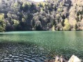
(5) When you reach the Grand Neuweiher Lakes, cross the dam following the Red Ring and Blue Rectangle markings, pass between the rocks and follow the path signposted ‘tour du lac’. This joins the path coming from the Petit Neuweiher; continue to the next junction.
(6) Turn left towards “tour du lac – Seppi-weg”, signposted with a Red Ring, which quickly leads to the Haute-Bers path just after crossing a small bridge.
(7) Take this path to the right and follow the “Haute-Bers” sign, marked with a Blue Rectangle and a White Rectangle. During the ascent, after climbing several hairpin bends, keep to the right and arrive at a clearing; head towards the beautiful Haute-Bers chalet shelter.
(8) Continue along the path to the right; at the junction, leave the Blue Rectangle and White Rectangle markings and follow the sign for “Col des Perches” on theGR®5, marked with a Red Rectangle. The path skirts the Lac des Perches below on the right and reaches the large junction at the Col des Perches.
(9) Head down towards Lac des Perches to the right on theGR®531(Blue Rectangle). The descent is steep but well secured.
(10) At Lac des Perches, leave theGR® and follow the “Basse-Bers / Rimbach” path, marked with Red Triangles. It leads to the Basse-Bers farm.
(11) At the farm, follow the sign for “Rimbach via the Rieswald farmhouse inn”, marked with a Yellow Ring, heading to the left. On reaching the Riesenwald, join the Blue Triangle markings of the path coming from the left.
(12) Continue keeping to the right until you reach the entrance to the village of Rimbach, on Rue du Sternsee. Walk down the street to the crossroads and the small square in front of the “Auberge du Tourisme”.
(13) Turn right just before the inn and take the path signposted “towards Ermensbach”, marked with a Yellow Saltire sign. Walk behind the church, continue straight on and follow the signs “towards Neuweiher”. At each junction, continue straight on “towards Ermensbach”, following the Yellow Saltire signs.
(14) When you reach the little chapel in Ermensbach, turn left to continue the route on the left-hand side of the road and head for the car park (S/E).

 Tourist office
 Easy

 Visorando Member
 Moderate