Circular route around the Pont des Aniers

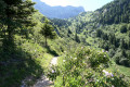
A short walk around the hamlet of Les Aniers, on the border between Lans-en-Vercors and Villard-de-Lans. An easy route, though demanding at the start with a steep climb of over 15%, followed by a plateau and then a gentle descent. The route takes in a variety of paths, ranging from narrow tracks tonon-GR® paths, with short tarmac sections of a few metres at the start and end of the route.

Details

n°49060261
Creation:
Last update:
–
Last review:
  • Walking
    Activity: Walking
  • ↔
    Distance: 2.34 mi
  • ◔
    Average duration: 1h 50 
  • ▲
    Difficulty: Moderate

  • ⚐
    Back to start: Yes
  • ↗
    Ascent: + 869 ft
  • ↘
    Descent: - 869 ft

  • ▲
    Highest point: 4,088 ft
  • ▼
    Lowest point: 3,202 ft

Photos

Description of the walk

Park at the entrance to the tram line.

(S/E) Follow the departmental road for 150 m towards Villard-de-Lans, using the cycle path running parallel to it. When the cycle path turns left, cross the departmental road carefully to reach the path opposite. Cross the bridge over the Bourne and continue to the bend.

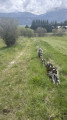
(1) Turn left onto the ascending path: there is a less steep alternative through the field just before this point, but the field is sometimes closed (*). Continue straight on, first along the edge of the field and then along the path, climbing up the valley.

(2) At this point, do not continue down the valley but take the steep climb on the left for about thirty metres. Once at the top, turn right and continue climbing straight on until you reach the new forest track.

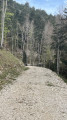
(3) Turn right and follow this stony forest track for 600 metres.

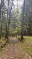
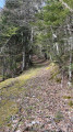
(4) Turn right and begin the descent through the forest along various paths. At the Fork in the road, veer left onto the sunken path and follow it until you reach the farms and houses of the hamlet of Traffé. Take the tarmac road.

(5) Continue to the right to join the departmental road. Cross it to take the path marked by slate slabs and cross the Bourne via the wooden bridge. Join the tram track and then turn right to return to the car park (S/E).


Waypoints

  1. S/E : mi 0 - alt. 3,219 ft - Car park
  2. 1 : mi 0.25 - alt. 3,232 ft - Start of the steep path
  3. 2 : mi 0.52 - alt. 3,570 ft - Crossing to the other side of the valley
  4. 3 : mi 0.7 - alt. 3,907 ft - Forest track
  5. 4 : mi 1.07 - alt. 4,088 ft - Start of descent
  6. 5 : mi 1.89 - alt. 3,310 ft - Turn right at the fork
  7. S/E : mi 2.34 - alt. 3,219 ft - Car park

Notes

Please note that in autumn and spring, the plain after you cross the departmental road may be flooded. In this case, make your way back to the car park by walking along the departmental road.

Worth a visit

(*) If you take the bypass, you can reach the Grotte des Aniers by walking across the fields. Then return to point (2) to continue the walk.

Always be cautious and plan ahead when you're outdoors. Visorando and the author of this route cannot be held responsible for any accidents occurring on this route.

The GR® and PR® markings are the intellectual property of the Fédération Française de Randonnée Pédestre.

Reviews and comments

4.2 / 5
Based on 2 reviews

Reliability of the description
4.5 / 5
Ease of following the route
4.5 / 5
Route interest
3.5 / 5
Ange Heureux
Ange Heureux
• Edited:

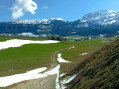
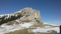
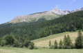
The idea is, in fact, to explore this little-used hillside and, on the way back, to enjoy the view of the row of peaks in the eastern Vercors.

Machine-translated

AUJAMES Denis
AUJAMES Denis

Overall rating : 4.3 / 5

Date of your route : Jul 15, 2026
Reliability of the description : ★★★★★ Very good
Ease of following the route : ★★★★★ Very good
Route interest : ★★★☆☆ Average
Very busy route : No

The route is very steep right from the start, so take your time as the gradient is around 15 per cent. Once you reach the top, it’s just a gentle stroll through the woods. You only get to see the view right at the very end of the route. This walk is best done as a training session to maintain your fitness. Not particularly interesting.

Machine-translated

Mot laid
Mot laid

Overall rating : 4 / 5

Date of your route : Jul 11, 2025
Reliability of the description : ★★★★☆ Good
Ease of following the route : ★★★★☆ Good
Route interest : ★★★★☆ Good
Very busy route : No

hike completed on 11/07.
Departure from the hamlet of Les Bruyères, the starting point of the Pont des Aniers bridge, reached via the cycle path.
Between points 1 and 2, climb up through the meadow (make sure you close the electric fences behind you).
The climb from the meadow to point 3 is very steep.
When you leave the forest road at point 4, the start is not at all obvious: you need to look for a red "private property" sign stuck in a tree stump below the road. A small, fairly obvious path then leads down into the woods. After the big left turn, the trail disappears into some scrubland, but a path (marked as a straight dotted line on the map) allows you to continue; you will find the path again further down.
The descent from point 4 is very pleasant.
At the hamlet of Traffé, I turned left to reach the D531 road and return to the hamlet of Les Bruyères (approx. 300 m on a very busy road).
Total time from Les Bruyères: 1 hour 40 minutes.
In summary: beautiful forest setting, ideal for training on steep slopes. Some beautiful views at the end of the descent, towards Traffé.
Please note: there are no signposts along the route, but the description is sufficient.

Machine-translated

Other walks in the area

For more walks, use our search engine .

The GPS track and description are the property of this route's author. Please do not copy them without permission.