Country:
 City:
City:



Start from La Batarelle at the terminus of bus route no. 37.
(S/E) Walk up Rue du Capelan and head up into the hills via a stone staircase.
(1) Take the path opposite, running alongside the Vallon Dol reservoir facilities. This path joins a tarmac road.
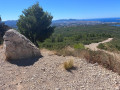
(2) When the road begins to descend, turn right onto a path that climbs. Head towards a large, clearly visible concrete marker on the left. Walk past this marker, turn left and you’ll reach the tarmac road at Vallon Dol. Cross the road, go through the barrier and join a wide track (large rock and bench). Turn left.
You’ll come to fire hydrant no. 401. Go round to the right of this hydrant and carry on.
You’ll reach a crossroads. Turn left.
(3) Take the shortcut on the right which cuts across the track. Join the track and continue to the right.
(4) Take the shortcut on the right, cross the track and take the small path opposite, which then veers off the track to the left. The path rejoins the track further on at a bend. Turn left.
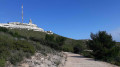
(5) At the junction of the tracks (elevation 525), turn left. Ignore the paths to the left and right leading towards the antennas.
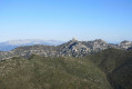
(6) After a sharp bend to the right, take thefirst path on the left. Admire the panoramic view of Marseille and the Côte Bleue to your right.
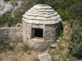
After a bend to the left, take the path that passes above the Jo Monier
hut and the Puits des Diables
. Continue along the path as it descends gradually, with a magnificent view of Marseille’s northern districts throughout.
(7) Turn right and carry on. You’ll come close to the landfill site. You’ll then reach the tarmac road, with an underground cistern on your left. Cross the road.
(8) Go through the gate, then turn left onto a wide path that winds down through the pine trees.
(9) Turn right onto a narrower track. You’ll see a track on the right heading south; you need to join this.
(10) Turn right at a crossroads. Follow the circular track, then turn left onto this long track which runs straight ahead and is actually a gas pipeline corridor marked with yellow boundary posts.
(11) Keep to the left, following the yellow markers.
(12) Just after a marker, turn left onto a small path that descends into the valley, then turn right and rejoin the gas pipeline track further down. Please note that the start of this path is difficult to find, as the vegetation is dense. The markings are yellow and red, part ofthe GR® 2013 route.
(13) Turn left; the markings remain yellow and red. As before, the start of this path is difficult to find.
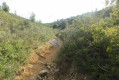
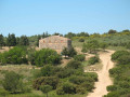
This path winds its way into the valley. The vegetation is dense but not overgrown, as it is regularly maintained. After a short but steep climb, the path leads onto a wide track. On the right is an old bastide to visit. Approach the bastide from the right.
(14) Walk past the bastide and turn right onto a path that leads into the forest. Keep to the left. You’ll emerge on the hillside with a magnificent view of Marseille to your right.
(15) Turn left to reach the other side of the Bastide. Take the opportunity to admire the vast olive grove. Walk past some benches. At a crossroads, turn right at a red sign. You’ll come to fire hydrant no. 400 and a commemorative plaque on a rock.
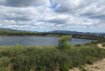
(16) Turn left at the tank to reach the Vallon Dol reservoir. Follow this track downhill, skirting the reservoir and then passing it. After a tarmac section, you’ll come to another tank (No. 550). At the bottom, take the sharp left-hand bend. The path winds its way uphill towards the houses at La Batarelle.
Walk round the houses to find the access to Rue du Capelan on the right (S/E).

 Visorando Member


 Easy
Easy