Between Étoiles and Sanguins

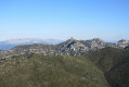
An unusual walk on the northern and southern slopes of the Étoile massif, passing by radio and TV transmission sites and radio masts. Stunning views over Marseille and its harbour, the Côte Bleue and, further afield, Marignane and the Étang de Berre.

Details

n°14246764
Creation:
Last update:
–
Last review:
  • Walking
    Activity: Walking
  • ↔
    Distance: 8.45 mi
  • ◔
    Average duration: 5h 30 
  • ▲
    Difficulty: Moderate

  • ⚐
    Back to start: Yes
  • ↗
    Ascent: + 1,818 ft
  • ↘
    Descent: - 1,801 ft

  • ▲
    Highest point: 1,841 ft
  • ▼
    Lowest point: 761 ft
  • ⚐ Country: France
  • ⚐ City: Marseille (13000)
  • ⚑
    Start/End: N 43.355761° / E 5.40823°
  • ❏
    IGN map(s): Ref. 3145ET
  • Hour-by-hour weather

Photos

Description of the walk

Start from La Batarelle at the terminus of bus route no. 37.

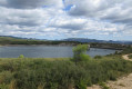
(S/E) Walk up Rue du Capelan and head up into the hills via a stone staircase. Take the path opposite, running alongside the Vallon Dol reservoir facilities. This path joins a tarmac road.

(1) When the road begins to descend, turn right onto a path that climbs. Head towards a large, clearly visible concrete marker on the left. Turn left at the marker and you’ll reach the tarmac road at Vallon Dol.
Cross the road, go through the barrier and join a wide track (large rock and bench). Turn left. Turn right at cistern 401, then left at the T-junction.

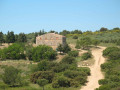
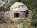
(2) Turn right towards the Ravin de la Baume. In the valley, look out for a well (or old lime kiln). Climb up the other side, then turn left towards the Grande Étoile.

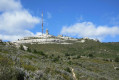
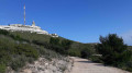
(3) At cistern 402, head straight on along the steep, rugged path leading to the Grande Étoile viewpoint. Go round this large rock on the left, then rejoin the narrow path that runs alongside the TDF installations and which then forms a circular loop to the left to join the DFCI track. Turn left onto this track.

(4) Turn right onto the DFCI track, which descends steadily down the northern slope of the massif. Take a short detour to see the ruins of the Jas de Féraud, then continue along the route, passing by fire tank 604. Turn left onto the track, heading west.

(5) Turn left again onto the gas pipeline path, marked by yellow posts.

(6) In the valley hollow, turn left onto the clearly marked path that leads into the forest. Keep to the right. The path widens and leads to a fenced-off area used for hunting. Continue straight on, skirting this area on the right, heading south. The path becomes steeper. Keep to the right at a fork in the road. There are a few rocks to climb over and a steep slope before you reach the track leading to the Grand Sanguin.

(7) Cross the track and take the path opposite, which climbs steeply and then very steeply to a rocky outcrop next to the Petite Étoile. Head towards the mast and you’ll arrive near the fence surrounding the facilities. Walk past the masts on the left and join the access track. Ignore the track on the right leading to the Petit Sanguin and continue down to a junction with a DFCI track. Turn right at the Fork in the road.

(8) At a bend below the Petit Sanguin antennas, turn left onto the path that descends southwards towards the Vallon Dol basin. You’ll reach a tarmac road; follow it to the left. Pass through the barrier, then stay on the left-hand road.

(9) Look out for a cast-iron plaque on the ground and turn left. The pleasant path joins a tarmac road at the bottom of a valley. Turn left and, 25 metres further down, rejoin the path on the right. At a junction, turn right and join the tarmac road to Vallon Dol.

(10) Turn left and follow the road which runs alongside the Vallon Dol facilities. Pass through a gate. The road turns left then descends to a junction.

(11) Keep to the right, go through a gate and follow the road.

(1) Follow the same route back as on the way there to return to the car park (S/E).

Waypoints

  1. S/E : mi 0 - alt. 764 ft - Rue du Capelan
  2. 1 : mi 0.42 - alt. 837 ft - Turn right at the fork
  3. 2 : mi 1.5 - alt. 1,066 ft - T-junction, turn right
  4. 3 : mi 2.2 - alt. 1,476 ft - Opposite, towards the Grande Étoile
  5. 4 : mi 2.9 - alt. 1,722 ft - Turn right onto the DFCI track
  6. 5 : mi 4.32 - alt. 1,165 ft - Turn left onto the path marked with yellow posts
  7. 6 : mi 4.43 - alt. 1,112 ft - Turn left into the valley hollow
  8. 7 : mi 5.29 - alt. 1,699 ft - Crossing the track
  9. 8 : mi 5.82 - alt. 1,624 ft - Path on the left
  10. 9 : mi 6.71 - alt. 1,020 ft - Cast-iron sign, on the left
  11. 10 : mi 7.2 - alt. 932 ft - Vallon Dol tarmac road, on the left
  12. 11 : mi 7.93 - alt. 794 ft - Crossroads, turn right
  13. S/E : mi 8.45 - alt. 764 ft - Rue du Capelan

Notes

For reference: the author’s time for this route was 4 hours 15 minutes (excluding a lunch break)

Reviews and comments

3.8 / 5
Based on 2 reviews

Reliability of the description
3.5 / 5
Ease of following the route
3.5 / 5
Route interest
4.5 / 5
NITRITE
NITRITE

Overall rating : 3.3 / 5

Date of your route : Nov 05, 2022
Reliability of the description : ★★★☆☆ Average
Ease of following the route : ★★★☆☆ Average
Route interest : ★★★★☆ Good
Very busy route : No

We followed the route description as we couldn’t get the GPS to work at the start; we took a wrong turn between points 1 and 2, but then, thanks to the GPS, we were able to find point 3 via a lovely little path. A lovely walk despite the strong wind!

Machine-translated

phildaix
phildaix

Overall rating : 4.3 / 5

Date of your route : Dec 01, 2021
Reliability of the description : ★★★★☆ Good
Ease of following the route : ★★★★☆ Good
Route interest : ★★★★★ Very good
Very busy route : No

The views along the walk – or almost the entire walk – are absolutely splendid. A must-do.

The route description was fine – we just veered too far to the right after the hunting enclosure past WP6. Once we reached the ridge, we found the track again, but then couldn’t locate the little path that was supposed to take us to the rocky outcrop (WP7); so we took a slight detour by following the track further – no big deal.
Otherwise, compared to usual, the estimated duration of the walk seems a bit on the long side to me.

Machine-translated

Other walks in the area

For more walks, use our search engine .

The GPS track and description are the property of this route's author. Please do not copy them without permission.