Les Monts des Buis

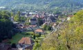
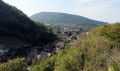
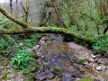
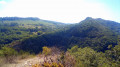
Starting from the small chapel overlooking the Citadel and the Besançon circular route, you will follow a stream through the cool little valley of Les Mercureaux where, it is said, a temple dedicated to the god Mercury stood in ancient times. Then you will return at a more brisk pace along the old Roman road to Fort des Buis, stopping at the many viewpoints over the Doubs valley.

Details

384445
Creation:
Last update:
Last review:
  • Walking
    Activity: Walking
  • ↔
    Distance: 5.06 mi
  • ◔
    Average duration: 3h 05 
  • ▲
    Difficulty: Easy

  • ⚐
    Back to start: Yes
  • ↗
    Ascent: + 840 ft
  • ↘
    Descent: - 830 ft

  • ▲
    Highest point: 1,611 ft
  • ▼
    Lowest point: 902 ft
  • ⚐ Country: France
  • ⚐ City: Besançon (25000)
  • ⚑
    Start/End: N 47.218179° / E 6.045858°
  • ❏
    IGN map(s): Ref. 3323ET
  • Hour-by-hour weather

Photos

Description of the walk

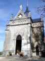
Parking is available at La Chapelle-des-Buis, in front of the chapel, which you can visit.
Yellow and blue markings.

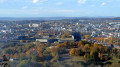
(S/E) Upon arrival, you will be treated to a superb view of the Citadel and Besançon. Walk a few metres back towards the signpost and take the path downhill on the left. On the house opposite, you will see a striking lion figure. Descend to the right onto the small tarmac road.

(1) After the farm, ignore the first path on the right and take the second one (green sign for Mercureau - Maillot). Follow the stream, pass under the motorway bridge, wade across the stream, then descend through the cool little Mercureaux valley.

(2) At the hamlet of Maillot, ignore the first path on the right, then three others on the left, staying on Chemin de Maillot which descends towards Beure. Opposite the last house in the hamlet, ignore the hiking trail descending to the left towards the Bout du Monde waterfall. Continue for another 200 metres until you reach a telephone pole and a sign inviting you to climb to the right.

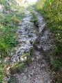
(3) Shortly after a bench on the right, at the corner of the wall, turn right onto the Sert stone path. Climb up the old Roman road with its ruts carved into the stone (towards Bois de Peu). Shortly after the Roman road, take a sharp left turn. At a large stone with markers, turn left again and continue climbing through the box trees, then carefully along the ledge to the meadows and the viewpoint over the Doubs valley, where there is a bench.

(4) The marked path starts again from the bench and crosses the length of the pasture, but for now, continue straight along the edge of the trees bordering the cliffs and, after about fifteen metres, you will find a small, discreet path on your left that continues to follow the cliffs and leads you to Baume Martin (a baume, from the Gallic word balma, is a rock shelter). Turn back to the bench, turn your back on it and head straight across the meadow to reach a fork. Take the grassy path slightly downhill to the right.

(5) You will arrive at a hunting car park. Continue straight ahead along this well-paved path, ignoring the forest paths that come from the right and left. The path gradually curves to the right and climbs, crossing a beautiful fir forest, and arrives at the foot of a marker post. Climb to the right (towards Chapelle des Buis via Chemin des Crêtes).

(6) Soon you will come to another signpost at a crossroads. Go straight down, ignoring the crosses, to reach the viewpoint, leaving the first path that descends to the left.

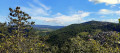
(7) After 300 metres, look for a small opening in the trees on the left, where a path leads to the viewpoint over the Mercureaux valley, the Arguel valley and its jagged rocks. Turn back to the crossroads.

(6) Climb up to the right along the Chemin des Crêtes, following the markings and crosses that will prevent you from taking certain paths.

(8) Pass the ruins of Fort de l'Ouest des Buis and shortly afterwards, at the fork marked by a signpost, climb to the right and then quickly to the left, still following the Chemin des Crêtes, which will take you back to the Chapelle des Buis (S/E).

Waypoints

  1. S/E : mi 0 - alt. 1,480 ft - Car park at La Chapelle-des-Buis
  2. 1 : mi 0.42 - alt. 1,293 ft - The Mercureaux Valley
  3. 2 : mi 1.88 - alt. 1,020 ft - T-shirt
  4. 3 : mi 2.24 - alt. 902 ft - Roman road
  5. 4 : mi 2.59 - alt. 1,371 ft - Baume Martin
  6. 5 : mi 2.9 - alt. 1,368 ft - Chasse du Bois de Peu car park
  7. 6 : mi 3.5 - alt. 1,476 ft - Chemin des Crêtes
  8. 7 : mi 3.63 - alt. 1,381 ft - Belvédère des Mercureaux
  9. 8 : mi 4.21 - alt. 1,522 ft - Fort de l'Ouest des Buis
  10. S/E : mi 5.06 - alt. 1,480 ft - Car park at La Chapelle-des-Buis

Notes

The route includes ledge paths and unsecured viewpoints. The paths are rocky and slippery in places. Sturdy footwear is essential and walking sticks are recommended.



Reviews and comments

4.6 / 5
Based on 6 reviews

Reliability of the description
4.8 / 5
Ease of following the route
4.8 / 5
Route interest
4.2 / 5
croc-trotteuse
croc-trotteuse
• Edited:

Overall rating : 4 / 5

Date of your route : Jan 13, 2024
Reliability of the description : ★★★★☆ Good
Ease of following the route : ★★★★☆ Good
Route interest : ★★★★☆ Good
Very busy route : No

A very pleasant hike, a little challenging when you reach the Bout du Monde waterfall and climb back up above it. Otherwise, the route is perfectly clear. Be careful, however, as some viewpoints are not secured, and at point 6, the viewpoint barrier was down, so be careful not to get too close.
Walking sticks are recommended. I did it in foggy conditions, so visibility wasn't great at the viewpoints, but it was a very pretty walk. The last ridge trail to the chapel is really nice. The Liberation Monument is also a great find, with a crypt at the bottom that you can visit.

Machine-translated

paluch roi
paluch roi

Overall rating : 4.7 / 5

Date of your route : Feb 24, 2022
Reliability of the description : ★★★★★ Very good
Ease of following the route : ★★★★★ Very good
Route interest : ★★★★☆ Good
Very busy route : Yes

A pleasant route, best enjoyed in good weather. Beautiful views. Please note that the markings in the village do not correspond exactly to the hiking map. In fact, the green and yellow markings lead to the Bout du Monde waterfall, which is not on the map (it's a short detour).
The GPS tracking works well.

Machine-translated

GORMOND
GORMOND

Overall rating : 5 / 5

Date of your route : May 20, 2020
Reliability of the description : ★★★★★ Very good
Ease of following the route : ★★★★★ Very good
Route interest : ★★★★★ Very good
Very busy route : No

Very beautiful route. We chose to start from Beure and climb up the Roman road first. It was a good climb on the narrow path and then over the rocks. Superb view. The little cave is worth a visit, but the path to it is a bit difficult to find. We arrived without difficulty at the Chapelle des Buis, and then all we had to do was descend via the Chemin de Maillot. Everything is well marked. Despite the lifting of lockdown restrictions, we only encountered two people along the way, even though the weather was superb... Perfect!

Machine-translated

gazok54
gazok54 ★

Thank you, florent25310, but Visorando has no control over the markup.

Machine-translated

florent25310
florent25310

Overall rating : 4.7 / 5

Date of your route : Oct 14, 2017
Reliability of the description : ★★★★★ Very good
Ease of following the route : ★★★★★ Very good
Route interest : ★★★★☆ Good

Great hike with beautiful views at the end. Be careful not to take the wrong path once you reach the top of the climb. There are many paths leading in all directions. The signposting could be improved in this section.

Machine-translated

Ghyslain
Ghyslain

Great hike! Magnificent scenery, especially at this time of year!
I highly recommend it.

Machine-translated

VisoRandoFlo8807
VisoRandoFlo8807

Overall rating : 4.7 / 5

Date of your route : Aug 20, 2017
Reliability of the description : ★★★★★ Very good
Ease of following the route : ★★★★★ Very good
Route interest : ★★★★☆ Good

Please note that the start of the trail may be hidden by cars parked in front. The hike is described as easy, but there is a steep climb halfway through.

Machine-translated

Franck T.
Franck T.

Overall rating : 4.7 / 5

Date of your route : Nov 03, 2016
Reliability of the description : ★★★★★ Very good
Ease of following the route : ★★★★★ Very good
Route interest : ★★★★☆ Good

The second part of the route (the return journey from the viewpoint above Beurre) is less interesting, entirely through woods on paths that are sometimes stony.

Machine-translated

Other walks in the area

For more walks, use our search engine .

The GPS track and description are the property of this route's author. Please do not copy them without permission.