Country:
 City:
City:



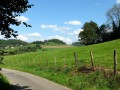
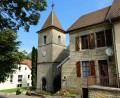
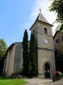
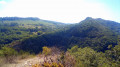
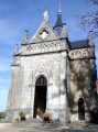
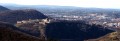
(S) Car park in front of the Notre-Dame-des-Buis Chapel. Yellow-blue and white-red markings. As soon as you get out of the car, you will be treated to a superb panorama of the Citadel overlooking the city of Besançon. Head towards the village (keep an eye out for the Virgin Mary statue on the left and an astonishing lion figure on the right) and after the chapel, turn left to reach Notre Dame de la Libération. Another viewpoint over the circular loop. On the way, you will see the ruins of the powder magazine. Walk around the Virgin Mary statue, then visit the crypt.
(1) Retrace your steps for 200 metres, crossing the small bridge again and turning right down the path that starts with a few wooden steps, heading towards the town centre via Pré au Bœuf.
(2) At the junction with a path marked by a signpost, descend to the left for about 100 metres (towards the town centre). At the next signpost, near the pond, take a sharp right turn (towards Morre via the medieval road). You will come to another signpost and a wider path, which you follow down to the left
.
(3) At the first house on Chemin de la Bro, take a sharp right turn onto the Morre par Maillot footpath.
(4) At the Grand Besançon signpost, take the path on the right despite the signs prohibiting it, to reach the unprotected viewpoint over Montfaucon and the Doubs Valley. Be careful! Return to the fork and descend on the right. The descent to Morre via this winding path can be very slippery in wet weather. Another viewpoint over the valley. Follow the signs. At the bridge, turn left towards the village. In the centre, turn right towards the station. Walk back up to the church. Return, then turn right into Impasse des Clos. After the small tunnel, go straight up the footpath. Before it ends, turn right onto the gravel path.
(5) At the housing estate, pass between numbers 15 and 14, continuing along the footpath. You will arrive at Rue du Lieutenant Vallet and turn right. At number 27, turn left onto Chemin de Valleroche, which runs alongside the fence. At the top of the stairs, turn right until you reach the stop sign. Head towards Fontain.
(6) At the last house in the hamlet, turn right onto the path and follow the markings.
(7) You will cross a wider path that passes through a small gorge between the rocks. Follow the red and white markings that climb to the right. The yellow and blue path branches off to the left. They meet up again, but the uphill path is more pleasant. You will come to a wider path. Go down it to the left for about ten steps and then take the small path on the right, following the yellow-blue markings. Once on this path, ignore the ones that branch off to the right. If you continue a few metres along the main path, you will see the tracks of iron-rimmed wheels from a medieval road.
(8) At the water tower, go down the stairs and take the path opposite the steps.
(9) You will reach the D143, which you should cross carefully (in a bend with poor visibility) and turn left. Viewpoint over the Vallée des Mercureaux. You will find yourself at a three-way junction (not counting the main road). Take the middle path, Chemin du Fort, despite the cross blocking it. Continue along this stony path, ignoring all the paths branching off to the left. At the barrier, turn right again.
(10) At the dead end sign, continue straight ahead. 400 metres further down, turn right onto the small tarmac road to the Buis chapel, leaving the dead end on your right after the bridge, then before the first houses, leave the stony path on your left.
(11) At No. 12, turn left onto the small path that climbs up at the corner of the house. This will take you back to the chapel and the car park.
 The route includes cliff-edge paths and unsecured viewpoints. Good footwear and walking sticks are recommended, as rocky outcrops could cause you to trip.



 Visorando Member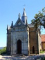
 Easy
Easy