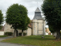
The Pompadour Estate

This family-friendly route takes in the sites associated with Madame de Pompadour, mistress of King Louis XV, who lived in Crécy-Couvé in the 18th century.

Details

23080500
Creation:
Last update:
Last review:
  • Walking
    Activity: Walking
  • ↔
    Distance: 3.98 mi
  • ◔
    Average duration: 2h 00 
  • ▲
    Difficulty: Easy

  • ⚐
    Back to start: Yes
  • ↗
    Ascent: + 217 ft
  • ↘
    Descent: - 217 ft

  • ▲
    Highest point: 541 ft
  • ▼
    Lowest point: 367 ft

Description of the walk

Parking is available in front of Crécy-Couvé Town Hall.

(S/E) Cross the Place des Marronniers. Continue to a junction and take the D20 on the right, towards Dreux.

(1) When the road bends to the left, after about 300 m, carry straight on along the path opposite. At the Fork in the road, turn right.

(2) At the next junction, turn left and continue along this track for 1 km.

(3) Take the path on the right and head down into the woods.

(4) At the bottom, take the path on the right.

(5) At the road, carry on straight ahead. After the isolated house and the bend to the right, take the small path on the right which leads up into the woods. Turn left at the fork, then follow the road to the right. Take thefirst road on the left towards La Bellassière.

(6) At the stop sign, follow the D310 to the right towards Crécy.

(7) Atthe second stop sign, turn right, head towards the church and continue to the town hall (S/E).

Waypoints

  1. S/E : mi 0 - alt. 541 ft - Crécy-Couvé Town Hall
  2. 1 : mi 0.19 - alt. 535 ft - Start of the trail
  3. 2 : mi 0.58 - alt. 525 ft - Crossroads
  4. 3 : mi 1.16 - alt. 502 ft - Trail
  5. 4 : mi 1.46 - alt. 367 ft - Path on the right
  6. 5 : mi 2.04 - alt. 384 ft - D135.5 road
  7. 6 : mi 3.11 - alt. 390 ft - Stop. Near the - Blaise (rivière) - Affluent de l'Eure
  8. 7 : mi 3.51 - alt. 541 ft - Stop
  9. S/E : mi 3.98 - alt. 541 ft - Crécy-Couvé Town Hall

Notes

Route created in collaboration with the Eure-et-Loir Departmental Hiking Committee.
Follow the yellow markings.

Worth a visit

Eating
La Grangette

Reviews and comments

4.3 / 5
Based on 3 reviews

Reliability of the description
4.3 / 5
Ease of following the route
4.3 / 5
Route interest
4.3 / 5
Marco Pagotto
Marco Pagotto

Overall rating : 4.7 / 5

Date of your route : Nov 30, 2025
Reliability of the description : ★★★★★ Very good
Ease of following the route : ★★★★★ Very good
Route interest : ★★★★☆ Good
Very busy route : No

A pleasant hike at the end of a very bright day in late November.

Machine-translated

Le Fèvre61
Le Fèvre61

Overall rating : 5 / 5

Date of your route : Apr 28, 2025
Reliability of the description : ★★★★★ Very good
Ease of following the route : ★★★★★ Very good
Route interest : ★★★★★ Very good
Very busy route : No

An enjoyable and historically enriching route

Machine-translated

Bergeron
Bergeron

Overall rating : 3.3 / 5

Date of your route : Oct 16, 2023
Reliability of the description : ★★★☆☆ Average
Ease of following the route : ★★★☆☆ Average
Route interest : ★★★★☆ Good
Very busy route : No

A very pleasant and very easy walk. The end of point 5 isn’t easy to find. It’s a shame that, to finish, you have to walk along the D310 for too long.

Machine-translated

Other walks in the area

For more walks, use our search engine .

The GPS track and description are the property of this route's author. Please do not copy them without permission.