The Linas Sandstone Dolmen

The main aim of this short walk, which alternates between paths through fields, in woods and along woodland edges, is to discover one of the main dolmens in the Essonne department.

Details

n°621148
Creation:
Last update:
Last review:
  • Walking
    Activity: Walking
  • ↔
    Distance: 2.99 mi
  • ◔
    Average duration: 1h 25 
  • ▲
    Difficulty: Easy

  • ⚐
    Back to start: Yes
  • ↗
    Ascent: + 92 ft
  • ↘
    Descent: - 92 ft

  • ▲
    Highest point: 486 ft
  • ▼
    Lowest point: 390 ft

Photos

Description of the walk

Starting point: the centre of the village of Thionville. Several parking options:
- In the small square at the junction of Rue des Fravilles and Rue des Vignes (marked car park with 3 spaces), which corresponds to the route shown on the map.
- Near the small square, along Rue des Fravilles.
- In the small car park at the cemetery (half a dozen spaces), situated on the outskirts of the village on the road to Chalo-Saint-Mars. In this case, start the walk from the section mentioning the cemetery, shortly before the end of the description.

No signposting

(S/E) With your back to Rue des Vignes (a cul-de-sac), turn right onto Rue des Fravilles. At the junction with Rue du Moulin (with the old water pump on the right opposite), first turn left then right to follow the D160 towards Gaudreville. Leave the village and ignore a path branching off to the left.

(1) After a slight bend to the right, leave the road and take the first track on the left, which heads towards the far end of a wood. Initially tarmac, the track quickly becomes grassy.

(2) At the first junction, just before the woodland, turn left up a slight incline. Follow the edge of the woodland on your right and take two tight bends, first turn right then left. After about a hundred metres, you’ll find the dolmen on the right in the middle of a field.

(3) Retrace your steps back to the previous junction.

(2) Turn left and walk some distance along the edge of the woodland on your left. At the T-junction, take the path on the left and cross through the woodland. Continue due east along the edge of the woodland and then through the fields. Ignore a path on the right (not shown on the map), head downhill and enter the woodland.

Red and white markings

(4) Cross a small road and follow theGR®111straight ahead (signpost about a hundred metres further on). Walk alongside a woodland on your left, then, after a short stretch of open ground, head up into a woodland. At the top of the hill, walk alongside a bushy hedge on your left. At a T-junction (not shown on the map), turn left and come out onto a small road.

No signposting

(5) Follow the road to the left. Climb the road, taking a few bends, then continue along the road towards the village, which is clearly visible. Just after the cemetery, at a three-way junction, turn right. Take the first left, Rue des Fravilles, and return to the starting point (S/E).

Waypoints

  1. S/E : mi 0 - alt. 482 ft - Thionville – Plot on Rue des Fravilles
  2. 1 : mi 0.43 - alt. 476 ft - Start of the path
  3. 2 : mi 0.79 - alt. 449 ft - Crossroads – Access to the dolmen
  4. 3 : mi 0.91 - alt. 469 ft - Dolmen du Grès de Linas
  5. 4 : mi 1.8 - alt. 410 ft - Small road – Junction with the GR111
  6. 5 : mi 2.35 - alt. 397 ft - Small road – Leave the GR111
  7. S/E : mi 2.99 - alt. 482 ft - Thionville – Plot on Rue des Fravilles

Notes

In dry weather, a good pair of trainers is sufficient for this short walk, which follows well-maintained paths and quiet country lanes. In wet weather, the paths between the fields can be muddy.

There is a water point inside the cemetery, at the end of the route. No shops.

A detailed map is essential (at the very least, the one accompanying this description).

Access to the dolmen:
The dolmen is situated within a cultivated field which is private property. There is no access path to the dolmen; only a small uncultivated area has been left around the monument. This may be regrettable, but it is the reality of the situation. Consequently,
- When crops have been sown, do not enter the field, even if the vegetation is still at the seedling stage. Simply view the dolmen from the edge of the field. N.B. As the dolmen is not very tall, visibility is reduced in early summer when cereal crops (wheat or barley) are growing; it is non-existent when taller plants (maize, rapeseed, sunflowers, etc.) are present.
- The only time when the dolmen can be viewed at close quarters is immediately after the harvest and up until the first tillage operations for the next crop. The dates of this period obviously depend on the type of crops in question.

Walk undertaken by the author on 28 June 2017.

Worth a visit

The Grès de Linas Dolmen (3), discovered in 1864, is the main destination of this walk.

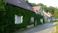
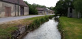
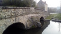
A few pretty houses and an old water pump in the village of Thionville.

Always be cautious and plan ahead when you're outdoors. Visorando and the author of this route cannot be held responsible for any accidents occurring on this route.

The GR® and PR® markings are the intellectual property of the Fédération Française de Randonnée Pédestre.

Reviews and comments

4.7 / 5
Based on 1 review

Reliability of the description
5 / 5
Ease of following the route
5 / 5
Route interest
4 / 5
jp1024
jp1024

Overall rating : 4.7 / 5

Date of your route : Sep 06, 2017
Reliability of the description : ★★★★★ Very good
Ease of following the route : ★★★★★ Very good
Route interest : ★★★★☆ Good

In fact, the D60 towards Gaudreville is simply called: Rue du … dolmen
The dolmen was easily accessible on that day, 6 September
Keep an eye on the weather, as half the route is exposed to the wind.

Machine-translated

Other walks in the area

For more walks, use our search engine .

The GPS track and description are the property of this route's author. Please do not copy them without permission.